


Agricultural News
Latest U.S. Drought Moniitor Map Now Paints Most of Cimarron County in Extreme Drought
Thu, 04 Jun 2020 15:12:43 CDT
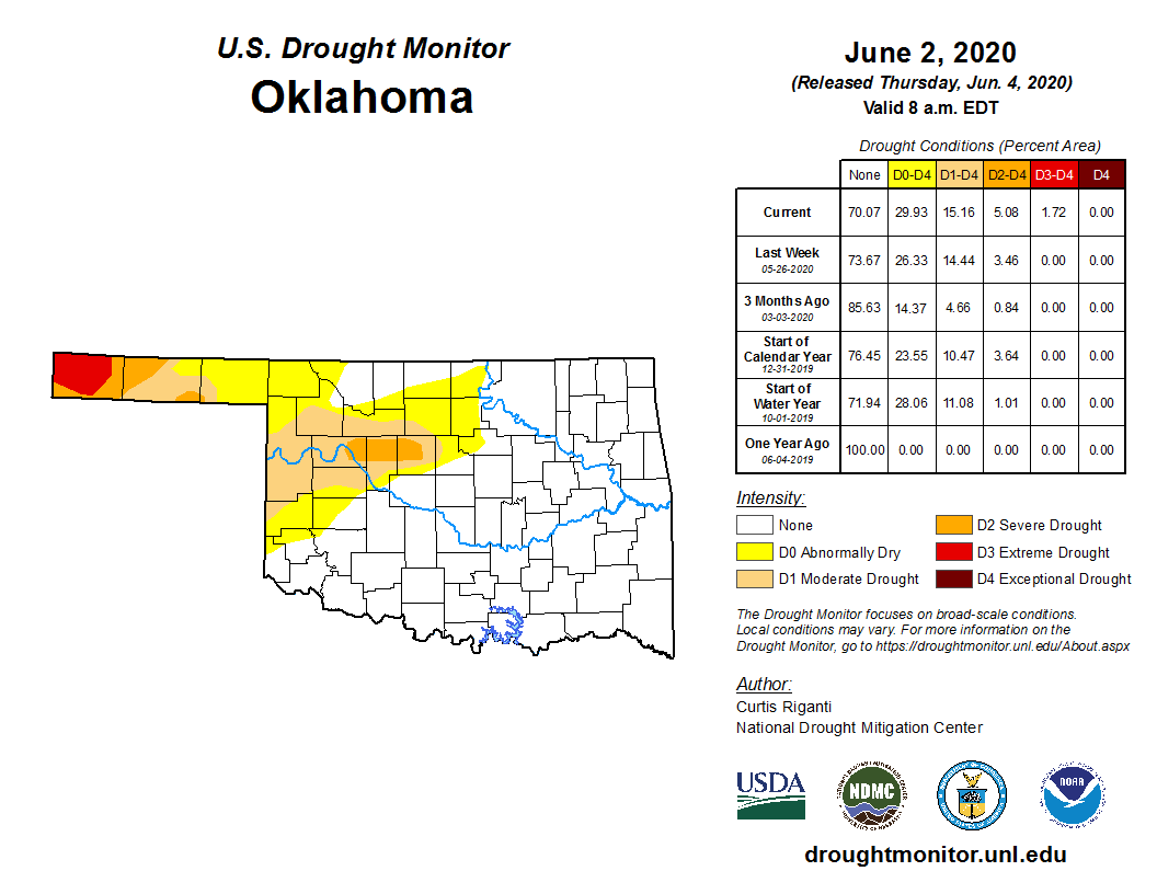
 Cimarron County in the far western Oklahoma Panhandle is now mostly colored red for extreme drought (D-3) according to the latest U.S. Drought Monitor map.
This should come as no surprise as we have been watching the red zone slowly creep out of Colorado into Kansas and now Oklahoma where conditions have become extremely dry as a result of low precipitation and high evaporative demand.
Just as alarming is severe drought creeping into a small area northwest of Oklahoma City where short-term precipitation deficits have worsened in Dewey, Blaine and Kingfisher Counties.
The percentage of Oklahoma covered in abnormally dry or worse now stands at almost 30 percent, about 3 points worse than last week and more than double the amount just three months ago.
This week's Oklahoma drought map stands in stark contrast to one year ago when no areas of the state were experiencing dry conditions.
According to the U.S. Drought Monitor's definition of severe drought, dryland crops are severely reduced and pasture growth is stunted and cattle are stressed. If the D3 Extreme Drought expands, we could see pastures go dormant and the danger of wildfires goes up.
Nationwide, dry conditions continued to dominate parts of the central and southern Great Plains, and in much of the Intermountain West region.
Areas of moderate and severe long-term drought have degraded and expanded in West Texas and adjacent regions.
Severe drought also increased in southwest Colorado while heavy snowpack in parts of the Rockies kept some high mountain roads closed.
Areas in the northwest U.S. are also experiencing drought conditions as parts of northern California and southern Oregon are colored red (D-3).
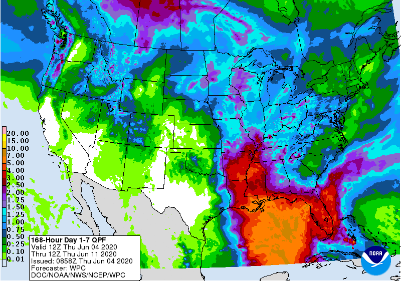
Adding insult to injury for western Oklahoma is the latest precipitation forecast which shows very little relief for drought impacted areas while just a short distance east, across the Oklahoma border into Arkansas, flooding rains are predicted.
The National Weather Service is expecting dry weather to continue over the central and southern Great Plains into next week.
To view the 7-day precipitation forecast, click here.
To view the drought outlook map for June, click here.
To view the Oklahoma drought map, click here.
To view the latest U.S. Drought Monitor map, click here.
The U.S. Drought Monitor Map is developed through a partnership between the National Drought Mitigation Center at the University of Nebraska-Lincoln, the United States Department of Agriculture, and the National Oceanic and Atmospheric Administration.
WebReadyTM Powered by WireReady® NSI
Top Agricultural News
More Headlines...


