

Agricultural News
Latest U.S. Drought Monitor Map Show Dramatic Improvement For Oklahoma
Thu, 30 Jul 2020 14:16:45 CDT
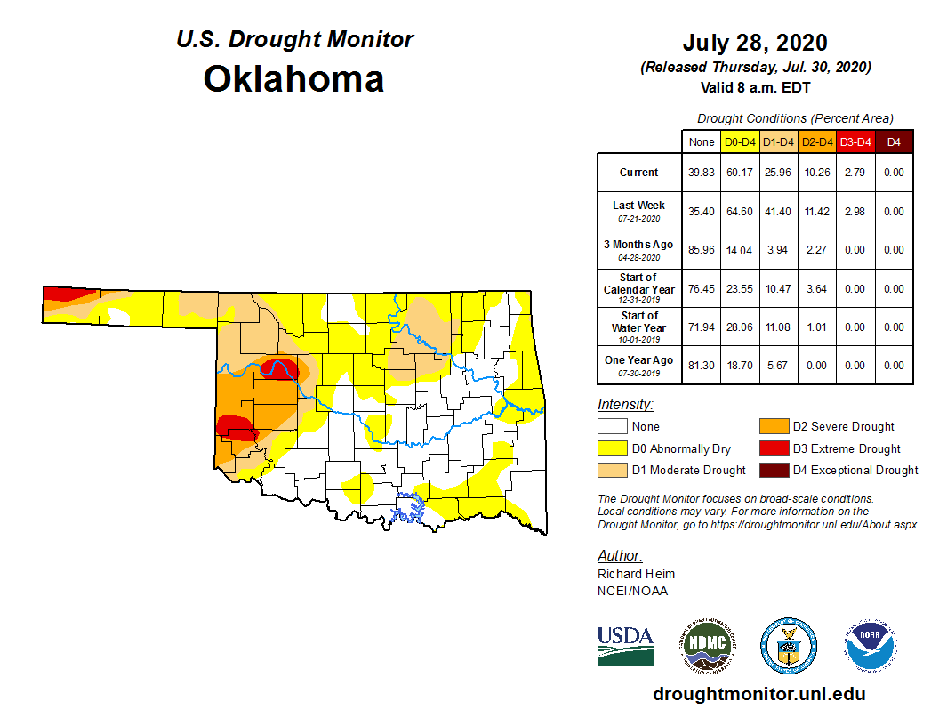 Dramatic improvement in the Oklahoma drought map on the latest U.S. Drought Monitor update was the result of heavy rain in central and northern Oklahoma the past several days.
Abnormal dryness and moderate to extreme drought contracted, especially in central Oklahoma and the Texas Panhandle. Unfortunately, abnormal dryness expanded in parts of eastern Oklahoma.
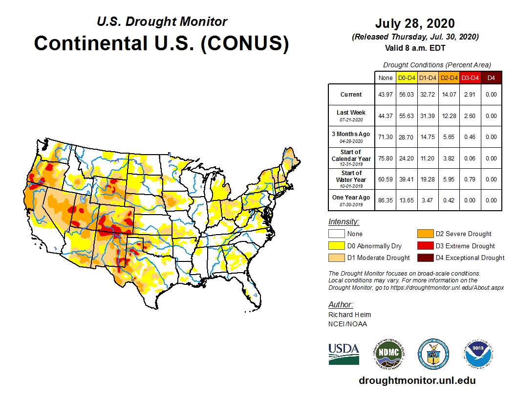
It was also a case of the "haves" and "have nots" for neighboring areas as more than two inches of rain fell over parts of Nebraska and Kansas while parts of Colorado had an inch or more or rain. But little to no rain fell in a few scattered areas of Kansas across Nebraska and Colorado.
The wet weather resulted in contraction of abnormal dryness and moderate to extreme drought across Kansas and parts of Colorado.
For those of you following the weekly crop progress reports, pasture and range conditions across the Rocky Mountains and West have been mostly poor to very poor. The southwest monsoons sparked some showers over New Mexico but most of the West received little to no rain.
Severe to extreme drought expanded in New Mexico.
Today for Oklahoma almost 40 percent of the state is free from any abnormal dryness or drought conditions. This is not as positive as a year ago when more than 81 percent of the state was drought free, but it is almost five points better than last week.
Another way to view the data shows about 26 percent of Oklahoma is covered in moderate or worse drought. Last week that number was 41.40 percent.
There are still three persistent pockets of Extreme Drought (D3) we are continuing to watch in Cimarron, Dewey and Beckham Counties.
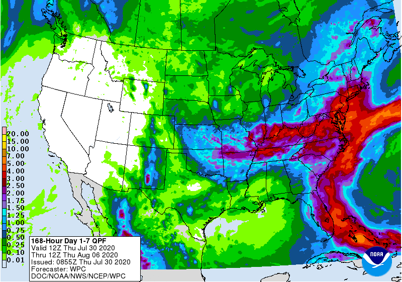
For the week ahead there is some relief as cooler temperatures and additional precipitation are forecast for Oklahoma.
To view the 7-day precipitation outlook, click here.
Unfortunately, little to no rain is expected for the West with half an inch or less across the Rockies and only a couple of inches stretching across the middle of New Mexico.
To view the Oklahoma drought monitor map update, click here.
To view the U.S. Drought Monitor map, click here.
The U.S. Drought Monitor Map is developed through a partnership between the National Drought Mitigation Center at the University of Nebraska-Lincoln, the United States Department of Agriculture, and the National Oceanic and Atmospheric Administration.
WebReadyTM Powered by WireReady® NSI
Top Agricultural News
More Headlines...


