

Agricultural News
Latest U.S. Drought Monitor Map Has Oklahoma Practically Free of Extreme Drought
Thu, 22 Apr 2021 14:56:14 CDT
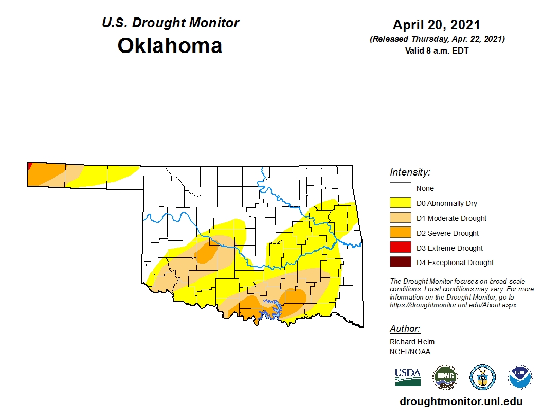 Oklahoma is essentially free of any extreme drought (D3) designations this week as there is only a tiny sliver of northwest Cimarron County still shaded red, according to the latest U.S. Drought Monitor map.
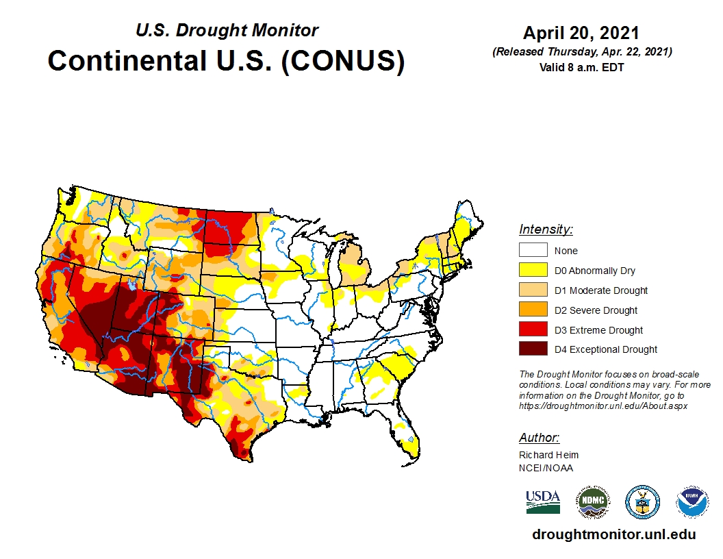
Cold, dry Canadian air funneled into the High Plains, raising freeze damage concerns for the winter wheat.
Snow and rain fell across the northern and central Rockies as well as parts of the northern Plains and upper Midwest.
Sections of the upper corn belt, including east central Indiana, are shaded abnormally dry this week, just as corn planting is getting under way.
Rainfall totals of two inches or more covered most of Louisiana into northeast Texas and parts of Oklahoma.
The rains improved soils across parts of Texas and Oklahoma, but the USDA reports still have 60 percent of Texas and 26 percent of Oklahoma with topsoil moisture short or very short.
To view the U.S. Drought map, click here.
In Oklahoma, the updated drought map shows 50.89 percent of the state is experiencing some type of dryness, which is an improvement over last week's 53 percent.
Interestingly, one year ago, only 10.91 percent of the state was in drought.
To view the Oklahoma drought map, click here.
Looking ahead, normal temperatures are expected with below normal precipitation.
A big concern is the forecast dryness for the Oklahoma Panhandle and most of Kansas.
To view the 6-10-day temperature outlook, click here.
To view the 6-10-day precipitation outlook, click here.
A dry spring is forecast by NOAA in their 3-month (April-June) precipitation outlook. To view this outlook, click here.
Unfortunately, drought conditions will persist into summer for much of the western and southwestern U.S. and is expected to expand. The updated seasonal drought outlook map shows almost half the country will be in drought conditions during the next three months.
To view the latest seasonal drought outlook map, click here.
The U.S. Drought Monitor Map is developed through a partnership between the National Drought Mitigation Center at the University of Nebraska-Lincoln, the United States Department of Agriculture, and the National Oceanic and Atmospheric Administration.
WebReadyTM Powered by WireReady® NSI
Top Agricultural News
More Headlines...

