

Agricultural News
Latest Drought Monitor Map Shows Some Improvement in Northern High Plains And Oklahoma
Thu, 27 May 2021 14:36:38 CDT
 Temperatures below normal across much of the western U.S. accompanied by above normal precipitation in the Cascades, central Great Basin, Montana and northern New Mexico was evident on the latest U.S. Drought Monitor map.
Above normal temperatures were noted for central and northern Plains eastward to the Atlantic Coast.
Heavy rains fell across western portions of the High Plains, warranting minor improvements across the western Dakotas, while the larger improvements were observed from western Nebraska and Kansas westward to Front Ranges.
Rainfall amounts of 1.5 to 3 inches were reported from western North Dakota southward to eastern Colorado and northwestern Kansas. This resulted in reductions in D0 (abnormally dry) and D1 (moderate drought) coverage in western Nebraska and eastern Colorado.
In the Dakotas, where long-term moderate (D1) to exceptional (D4) drought is entrenched, the heavy rainfall was only enough for minor reductions in drought coverage.
To view the U.S. Drought map, click here.
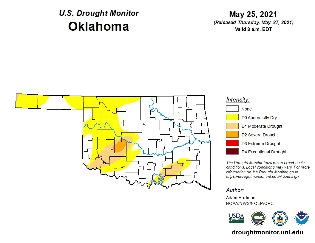
In Oklahoma, we continue to see reductions in drought coverage this week, as 64.15 percent of the state is drought free. This compares to 59.61 percent last week, yet is still below the 69.33 percent coverage just three months ago.
There are no shades of red (D3 extreme drought) on the Oklahoma map this week.
One year ago, that number was 73.67 percent.
To view the Oklahoma drought map, click here.
Looking ahead to next week, below normal temperatures with normal precipitation is expected for Oklahoma.
To view the 6-10-day temperature outlook, click here.
To view the 6-10-day precipitation outlook, click here.
A normal summer, precipitation-wise, is now forecast by NOAA for much of the Oklahoma. To view this outlook, click here.
There is some good news in the latest seasonal drought outlook as NOAA expects drought removal likely in southwest and southern Oklahoma.
Unfortunately, the drought will persist and intensify for much of the western and southwestern U.S.
To view the new seasonal drought outlook map, click here.
The U.S. Drought Monitor Map is developed through a partnership between the National Drought Mitigation Center at the University of Nebraska-Lincoln, the United States Department of Agriculture, and the National Oceanic and Atmospheric Administration.

WebReadyTM Powered by WireReady® NSI
Top Agricultural News
More Headlines...

