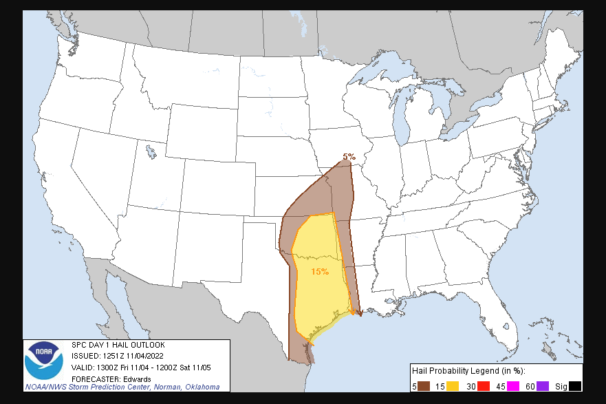
State Climatologist Gary McManus says we could see some severe weather with the front that could include a large hail threat, but he says, “Any storms going up in the warm sector (that area ahead of the cold front) could be more dangerous.”
McManus says that’s expected to occur after the front moves farther into SE OK later this afternoon, but should any storms go up before then (again, in the warm sector ahead of the cold front). He says they’ll need to be tracked carefully since instability is so high (the atmosphere, not me, although I’m very unstable, I can’t produce tornadoes) and there is strong shear in place.
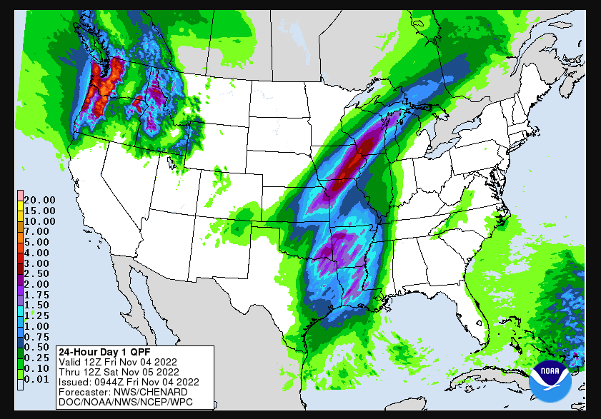
McManus said that doesn’t mean the storms going on behind the front won’t be severe, as he says we’ve had a few Thunderstorm warnings and rain showers across the state already.
Buffalo got an inch of rain, the most rain they’ve received in a single day since March 21, and more rain than they’ve received since July 31, 96 days ago.
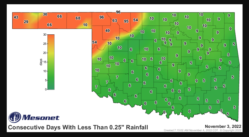
McManus says the state should prepare for severe weather, “Tuning into your local NWS office/ favorite media source for up-to-the-minute weather updates, but ESPECIALLY those down in SE OK, where there is a risk of STRONG (EF2-EF5) tornadoes today.” He says we may not get the rain we need right now, but we’ll take what we can get at this point.