

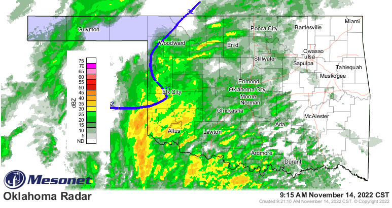
Right now we have a little shortwave moving in from the West and Weaking, according to State Climatologist Gary McManus. He says it will possibly generate enough “lift” to set up extremely heavy snow bands across western into south central Oklahoma. “Temps are still warm, of course, but as we’ve talked about for days (and days), the precipitation falling from above into drier air below should cool things down as it evaporates. That sets us up for rain changing to snow.”
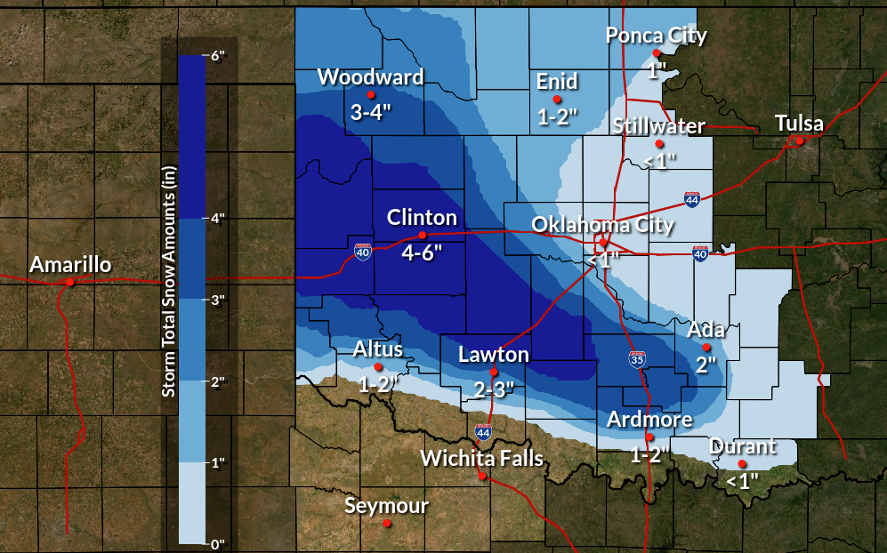
Even though temps are above freezing, they should start to inch down a degree or more after a bit, and with the wind it feels colder than it actually is outside. McManus says, “the gradient between those that receive a LOT of snow, those that receive SOME snow, and those that are left crying, should be fairly tight. Like, your Aunt Mabel in Lindsay gets 4 inches, but your location in NE Norman gets less than an inch.” Places in Western Oklahoma could see anywhere from 4-6″, while the Panhandle could see 3-4″, and other areas around the state might see 1-2″ or less.
McManus says For the snowy areas, yes, the ground temps are above freezing, but “The snow will stick eventually as the precipitation draws that heat away, and in those areas with the heavy snowfall rates, roads WILL become slick. And I’m talking huge white flakes falling so thickly that driving in it will be dangerous alone due to reduced visibility. So the time to be cautious AND hopefully cancel those travel plans is NOW!”
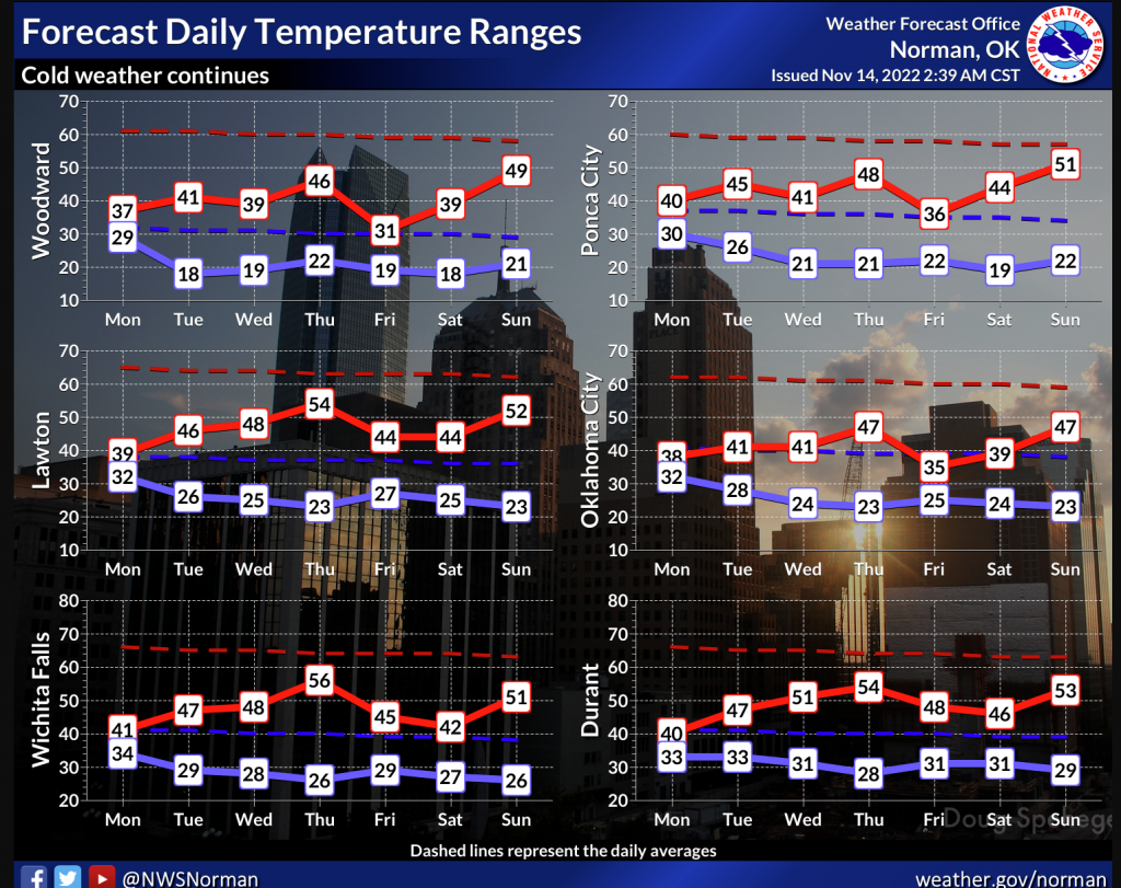
The snow should melt pretty quickly over the next couple of days, but McManus says its going to stay cold until Thanksgiving.
Another big front is moving through this weekend, but it looks mostly dry, according to McManus.
To see Gary McManus’s mesonet ticker, click here:


