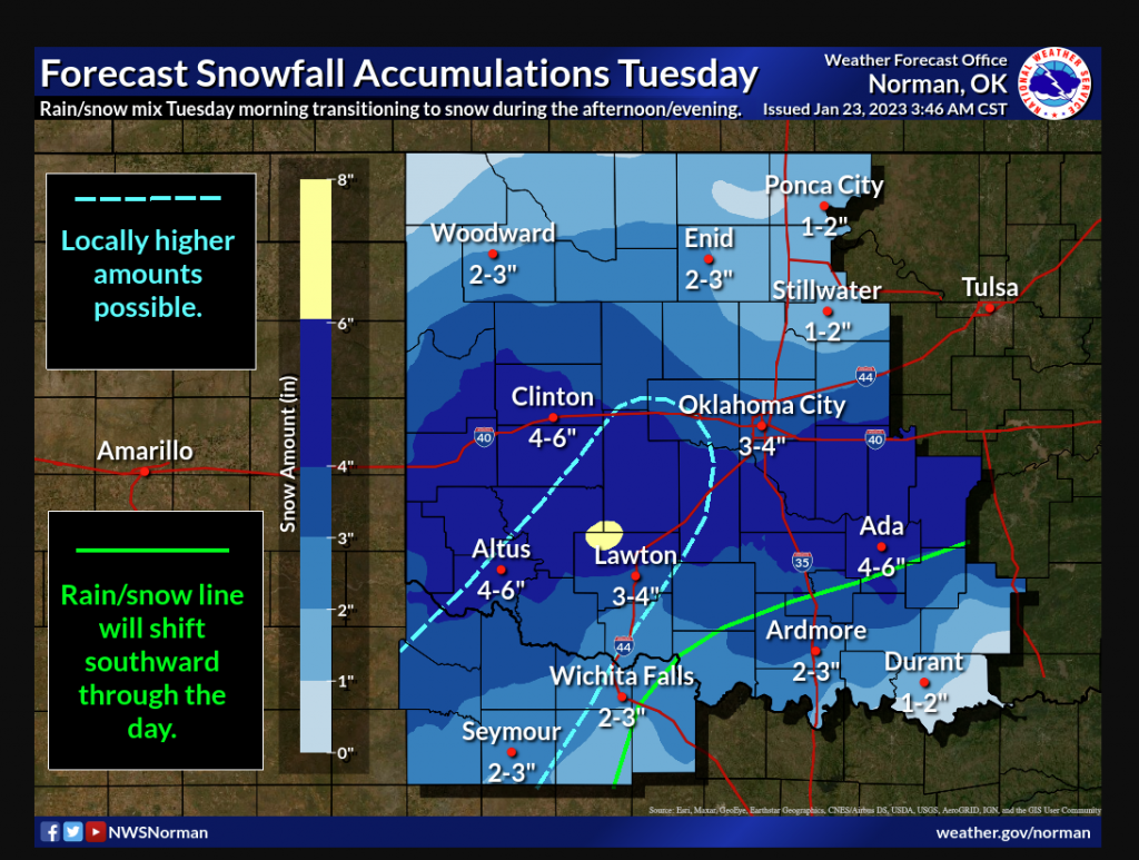
A winter Storm is brewing and could bring some pretty good snow to the state. According to State Climatologist Gary McManus, “Some folks could see a LOT more (or less, obviously) with convective elements within the broader storm possible, meaning thunder-snow. Again, lots has to happen to get all these things working in the same direction, but those areas will have the potential to see greater than 6-8” in localized areas. “
McManus says this storm won’t be bringing super cold temps, so the snow will remain slushy, “Originally, it was thought the roads would remain pretty clear during the event because of the air and ground temperatures, but with the possibility of heavy snow of the large, wet flake variety, those roads could go downhill pretty quickly. Thus the Winter Storm Watch as well as the Winter Weather Advisory.”
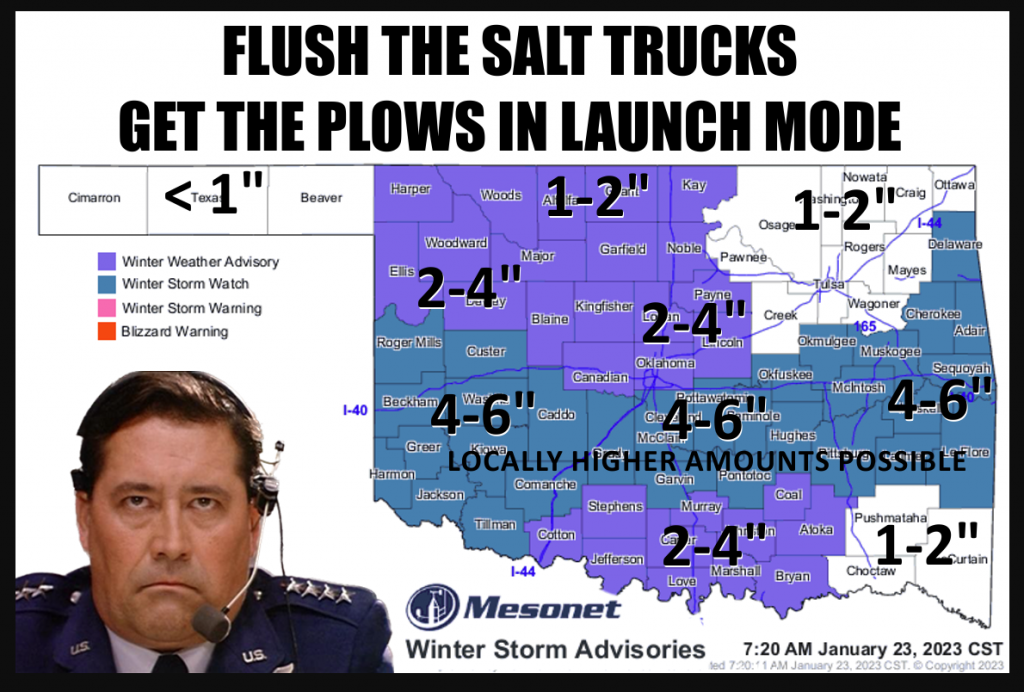
McManus says to Watch for upgrades and downgrades later today to a Winter Storm Warning, as well as some counties coming in and out of both advisories, “There is a lot of moisture available for this storm, so regardless of whether we see lots of snow or just a really really cold rain–or a mix–this will be very beneficial moisture for most of the state, save for the Panhandle and far northern OK.”
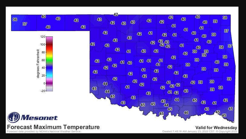
The Snow won’t stick around too long as above freezing temps are expected for Wednesday.
Hopefully, this storm system will drop some much-needed moisture throughout the state. To read more from Gary McManus on his mesonet ticker, click here:


