Thu, 26 Jan 2023 05:56:10 CST
The big flake wet snow storm of this week has seen the liquid rainfall totals rise with temperatures above the freezing mark yesterday as the system moved eastward out of the state.
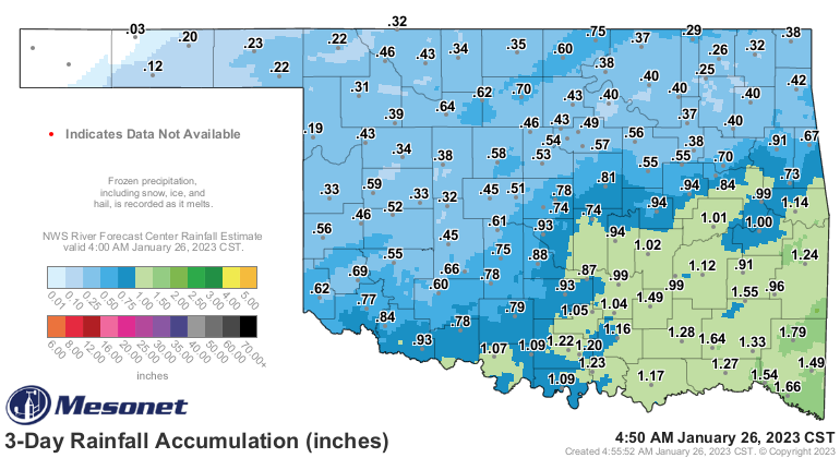
The map above from the Oklahoma Mesonet shows many locations with two tenths to a half inch more “rainfall” compared to the map that we posted on Wednesday morning in our daily email- and that is virtually all from the melting that has been a part of this storm. Click here to see the three day rainfall map from the Mesonet to compare additional melting that may have been happening since the snapshot above.
While this is not a drought busting system- it is the best moisture that we have had since Thanksgiving in much of Oklahoma- and will help the winter wheat as well as pastures with a drink of water ahead of the next winter storm coming- which appears to be more of an artic push with colder temps and the possibility of ice associated with it.
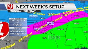
In the graphic below- here’s what Jed Castles with News9 has posted early this morning on Social Media(in this case- Twitter) so get ready!