

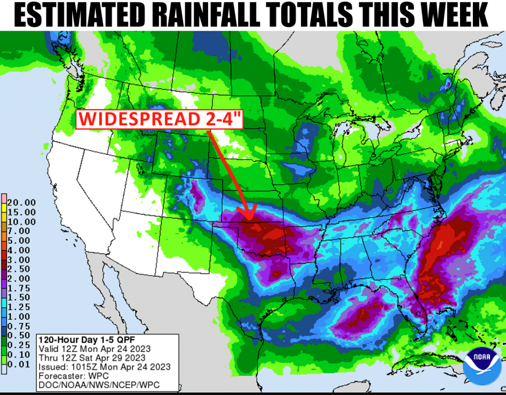
Parts of the driest portions of Oklahoma MIGHT get their chance at rain this week, according to State Climatologist Gary McManus, “The forecast models have been consistently consistent since last week in dumping copious amounts of
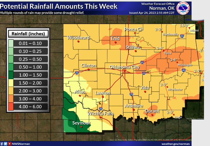
rainfall across drought-plagued north and western Oklahoma, so we’re going to go with the hopeful flow and lean into it. We’re talking the first significant statewide rainfall in well over 6 months, going back to late last summer. I managed to patch together the totals predicted this week from our friends at the Tulsa and Norman NWS offices and came up with this (sorry to Tulsa for obliterating your logo and whatnot), confirming the widespread 2-4 inches being predicted by the national folks in the top graphic above.”
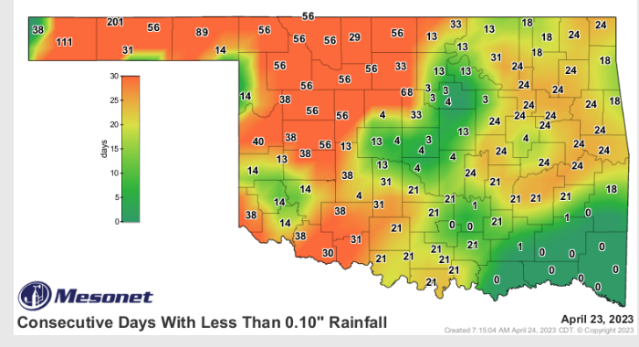
Many parts of the state have seen consecutive days without any considerable rain, so this could be a drought quencher or even possibly a drought ender if this rain does come through.
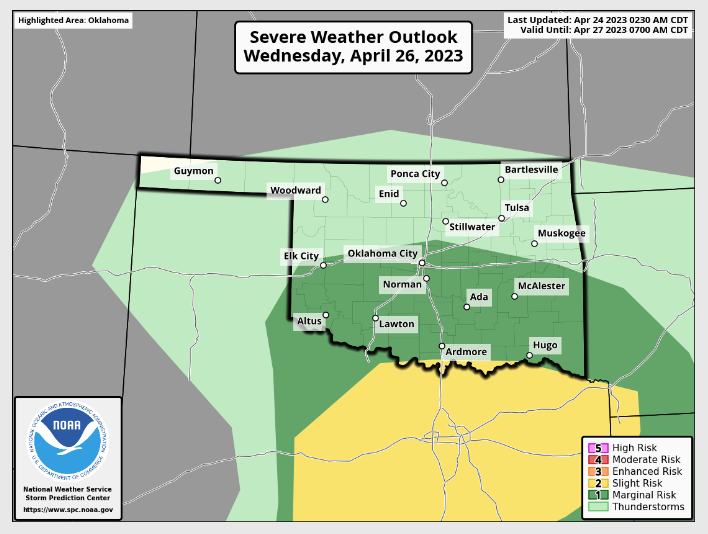
McManus says this could be what the state needs to reset, “As we see several waves of storms over the next few days, keep in mind that flooding will be a concern due to the hard ground, baked into an impenetrable plate by the sun and lack of rainfall over the last 6+ months, which makes it tough for the moisture to soak in. But soak in it will, eventually since we’re talking multiple rounds and not bigtime storms dumping 3 inches in 2 hours type of stuff. There will be hints of
severe weather around, but more typical severe threats in such a cold environment like some hail and wind. Wednesday might be a day to watch for in far southern Oklahoma with a bit more “oomph.”
The good news is this system just looks like Rain according to McManus, but he says it still pays to be weather aware. To read more from McManus in his weekly ticker, click here:


