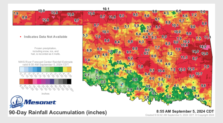
According to State Climatologist Gary McManus, drought continues to intensify across the state, especially in Southwest Oklahoma, where Extreme drought now covers 47% of that area, the highest coverage since October 24th of last year. Conditions have worsened over the last two months, and those changes aren’t confined to just SW OK.”
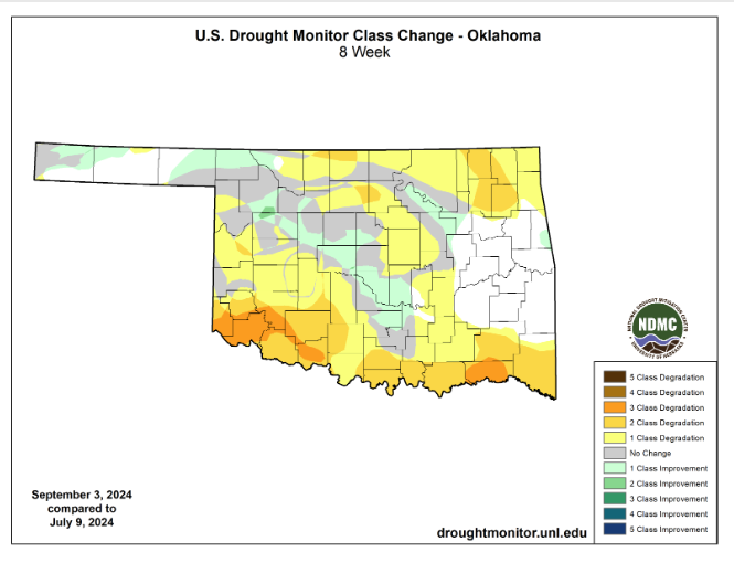
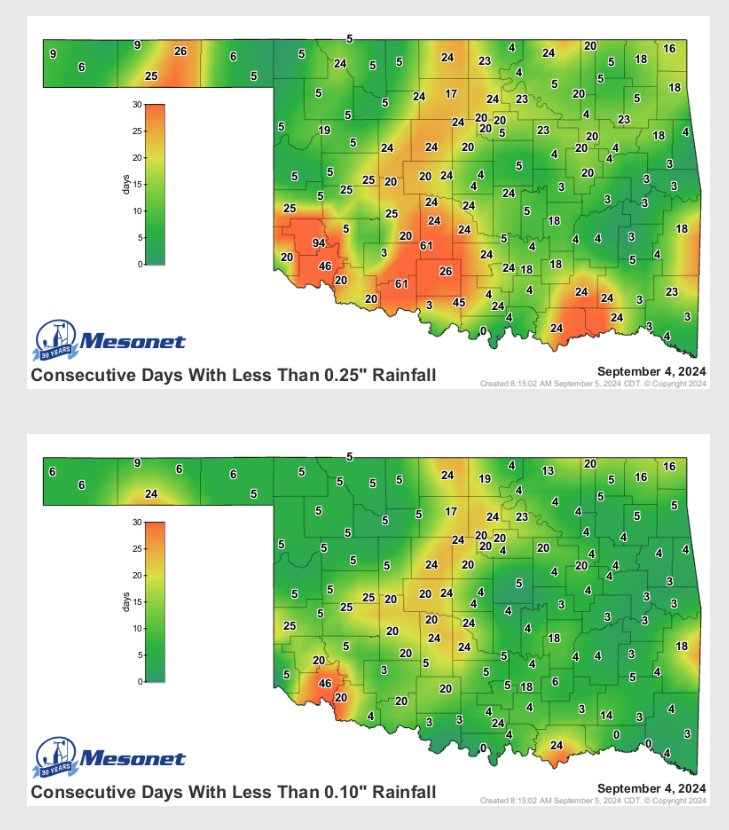
McManus says we have seen some improvements, but those are mainly concentrated in the strips of heavier rainfall that we’ve seen in specific places across the state over the last month or so, ” Mangum has gone 94 consecutive days without at least a quarter-inch of rain in a single day!”
McManus says we are on the cusp of seeing some exceptional drought reintroduced into the state if we don’t see showers pretty soon, “Should we start getting those dry fall cold fronts with the low humidity and strong SW to NW
winds…watch out.”
With hot, dry conditions comes the risk of fire danger, so McManus reminds folks to stay weather aware on those windy days as our vegetation is going backward this year, “Easy to see from OK-FIRE’s relative greenness map that our vegetation is going backward a bit early this year, acting like it’s fall already when the growing season is still going strong.”

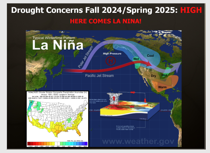
McManus says we still may see t a La Nina pattern possibly in the mix for later this fall and Winter, “that would not be good news either as that ocean-atmospheric coupling phenomenon from the Equatorial Pacific waters off the West Coast of South America tends to bring us drier than normal conditions during the cool season. We should get the latest ENSO forecast next week, so we’ll have a better idea on prospects for that La Nina possibility.”
Until we do see sufficient rain, McManus says to practice conservation techniques and remember the danger of wildfires.
https://ticker.mesonet.org/To read more from State Climatologist Gary McManus on is mesonet ticker, click here: