

After the heavy rainfall of the past week, Farm Director KC Sheperd spoke with Oklahoma State Climatologist Gary McManus about how it affected drought conditions and the future outlook across the state.
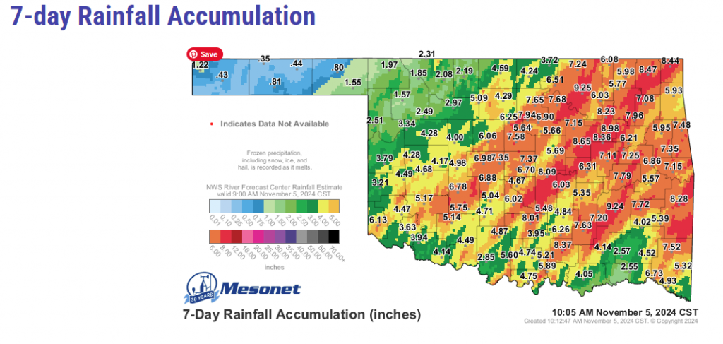
McManus detailed the rainfall amounts in various parts of the state saying that Northwest Oklahoma missed a lot of it, settling for only an inch or two of rain. Central Oklahoma, Northeast Oklahoma, and parts of East Central Oklahoma received 7 to 9 inches of rain.
“We see that a lot over the last thirty or forty years,” McManus said. “When we get a drought of some significance, it does tend to end in extremely heavy rainfall. I don’t think we are completely out of drought, but we have certainly alleviated some of those impacts we were seeing over the last three or four months.”
The concern for wheat farmers, now, is that the seed that was dusted in when it was dry is now washed away. The fields will have to be replanted.
“I know that bad things come with rain like this,” McManus admitted. “We get a lot of erosion, crop damage, flooding, and things of that nature, but we are certainly better off where we are now than we were before these big-time rains.”
McManus and Sheperd attended an Emergency Drought Commission meeting only a week ago, and at that time the deficits were nearing the driest on record from 1985, but after the recent rain, conditions stand within the 15th wettest on record since 1985.
It is still too early to recount impacts to lakes and reservoirs, but farm ponds are visually much improved. “One thing we want to know when we are looking at these drought impacts is how the lower-level soil moisture starting to respond,” McManus explained. “As we are looking at the mesonet data, we are starting to see that response even in the 32-inch soil moisture levels.
“Sometimes when you get these big rains, they run right off, but I think in this case, it is permeating down to those lower levels in the soil at least.”
Another big storm system is forecast to arrive on Thursday and possibly last until Sunday. It is predicted to dump another 2” – 4” inches on Southwest Oklahoma and West Central Oklahoma that also missed the bulk of the most recent system, and the Western Panhandle may see 6” of snow.
“We are in that territory where if we get that cold air combined with these types of storm systems, we will start to see that frozen precipitation,” McManus said.
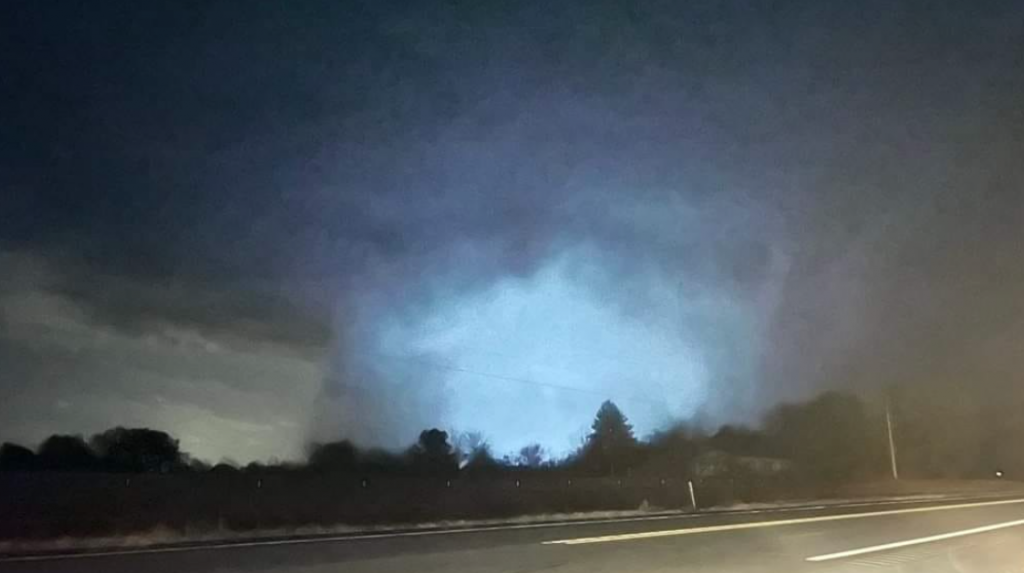
Typical when talking about the weather in Oklahoma, the conversation moved directly from frozen precipitation to tornados. “It looks like we might break the record for the largest number of tornadoes in the month of November,” McManus said. “We are just on day five and we have had five confirmed, but there is probably a dozen more out there waiting to be confirmed by the weather service. The record is twelve from 1958, so we might just blow that record out of the water. We are already at the 15th wettest November on record, and with 25 more days to go… This November is shaping up to be one of the craziest ones we’ve had in quite some time. You just never know in Oklahoma.”
McManus went on to explain why he disagrees with Drought Monitor Reports saying that D4 Exceptional Drought has been absent in Oklahoma since the beginning of the calendar year. Click the soundbar at the top of the page to listen to the whole conversation.
He did urge producers to weigh in on drought impacts on crops, farm ponds, cattle inventories, and forage and water supplementation directly on the Drought Monitor website using a tool called the Condition Monitoring Observer Report or email him directly by using this link.


