

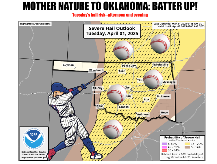
Oklahoma residents are urged to stay vigilant as the state faces the possibility of another round of severe weather this week, just days after a significant hailstorm. State Climatologist Gary McManus warns of potential tornadoes, large hail, and a high fire danger.
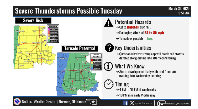
“Fresh off our the hail from Saturday night/Sunday morning, we have another POTENTIAL round of significant severe weather on the line for Tuesday,” McManus states, emphasizing the immediacy of the threat. He highlights the potential for large hail, noting, “Tornadoes? Sure, but the hail’ll could be what gets ya, putting knots on your noggin faster’n you can rub ’em.”
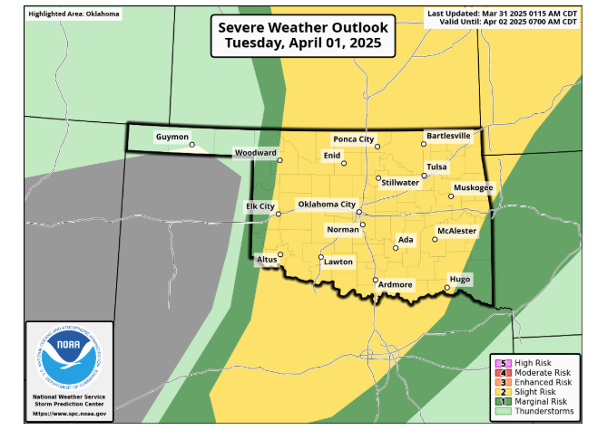
However, the formation of these storms is not guaranteed. “Now obviously storms actually have to form in the first place, and there is an indication a somewhat strong cap, or lid on the atmosphere, will be in place,” McManus explains. This “cap,” a layer of warm air, could inhibit the development of thunderstorms. “This layer of warm air thousands of feet above the surface would act as a dead-stop for that air rising explosively upwards and forming thunderstorms.”
Despite this potential barrier, if sufficient heating occurs, severe weather is likely. “If we get enough heating along and ahead of that dryline that will be in place, however…watch out,” McManus cautions. He also notes that the forecast is subject to change. “This forecast will continue to evolve and shift around a bit, and maybe get a bit better (i.e., less violent). Always remember, though, that it could get worse. Like in far SE OK the following day.”
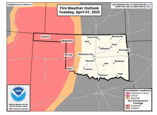
Adding to the concern is the increased fire danger. “And if there’s gonna be a dry line, with all that dead/dormant vegetation out there waiting on some rain to green up, that means there’s gonna be some fire danger. LOTS of fire danger, possibly,” McManus warns.
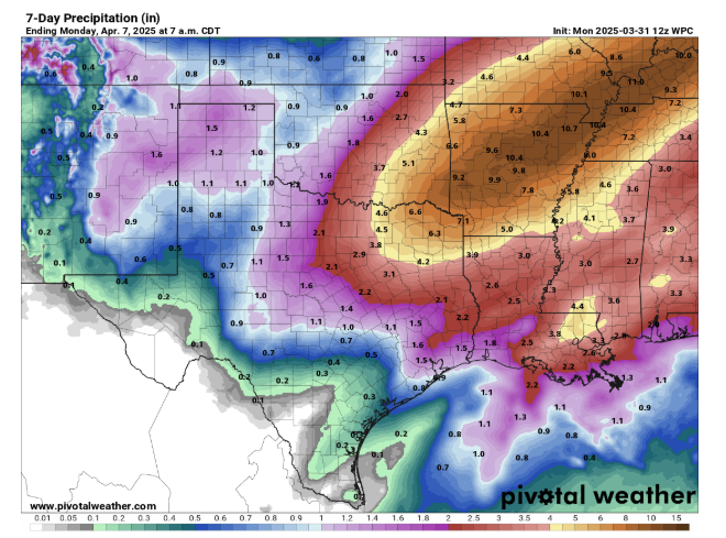
Amidst the potential hazards, there is a silver lining: rain. “I guess the good news with all this is we can at least get some rain. Well, that and I’ll be getting anxious/excited about the weather, which will lead to multiple bouts of Cherry Pop-Tart consumption!” McManus jokes, injecting a bit of levity. “But that rain, along with the storms Tuesday and Wednesday, we should see several consecutive days with good chances of moisture.”
However, the distribution of rainfall will be uneven. “Holy flooding threat, Batman! Those are some major amounts down in southeast OK. Unfortunately, NW OK sees a forecast of Corporal Amounts,” McManus points out, highlighting the stark contrast in projected rainfall across the state.
McManus reminds Oklahoma Residents to stay informed and prepared while acknowledging the potential for significant rainfall, albeit with varying distribution.


