

Oklahoma’s weather is taking a dramatic turn, shifting from severe storms to a late-season winter resurgence. State Climatologist Gary McManus warns of continued turbulent conditions, including tornadoes, freezes, and even snow.
“The Winter streak is back,” McManus declared, highlighting the abrupt change in weather patterns. He detailed the immediate threat: “We’ve had at least two damaging tornadoes overnight up in NE OK, and it would be nice if we could call it a day. Unfortunately, the unpleasantness continues, and will continue for the next couple of days.”
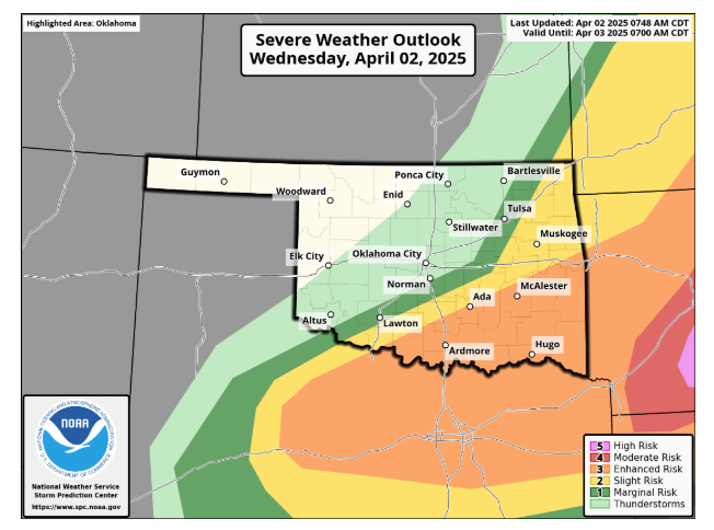
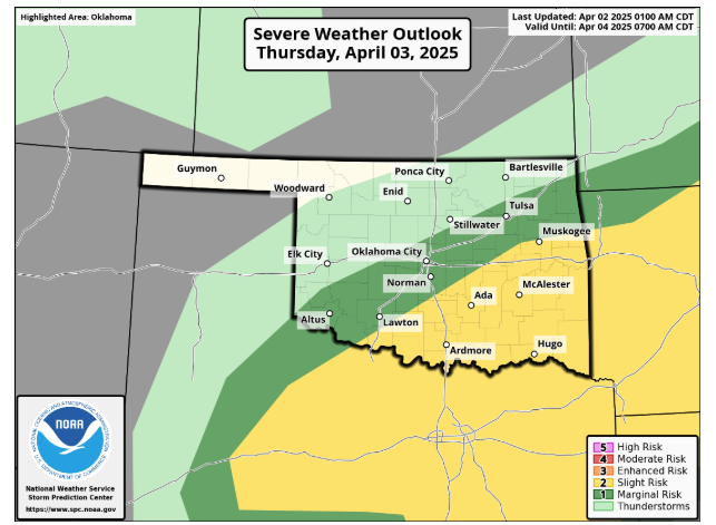
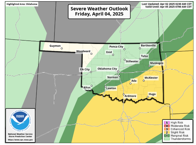
The severe weather isn’t confined to a single region. “And southeastern OK needs to stay weather aware for through Friday,” McManus emphasized, indicating a prolonged period of potential danger.
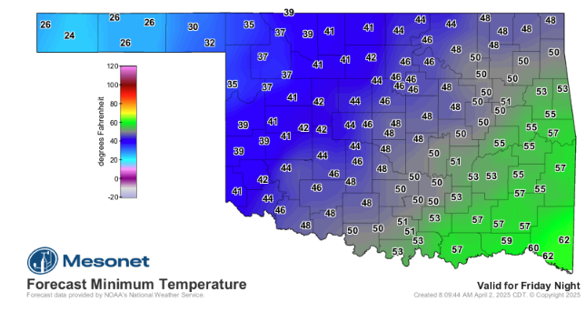
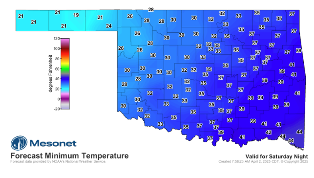
Following the storm threat, a sharp temperature drop is expected. “After that, the NW half or so of the state needs to be FREEZE aware (You shouldn’t have planted those flowers!) this weekend. Monday also has a risk,” McManus cautioned, advising residents to protect sensitive plants.
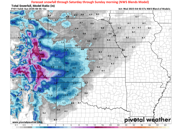
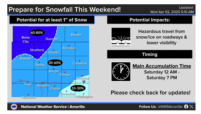
Adding to the unusual weather mix, a snowstorm is forecasted for the Panhandle and far northwestern Oklahoma. “I, for one (actually, I count three because I’M writing this thing), am not ready to go back to winter, but back to winter we will go, regardless, as the Panhandle and far NW OK deal with a snowstorm of some sort,” McManus stated, expressing his own reluctance to embrace the returning winter conditions.
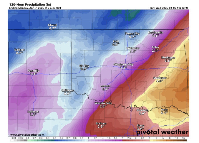
Despite the hazardous conditions, there is a silver lining. “I guess the best part of the coming few days is we will see some more rainfall, or in SE OK, a LOT more rainfall,” McManus noted, acknowledging the much-needed moisture.
However, he also expressed a desire for more benign weather. “It’d be nice to get ‘just rain,’ without the freeze, tornadoes, hail, snow, etc.,” McManus said, highlighting the state’s volatile climate.
To read more from Gary Mcmanus on his daily ticker, click here;


