

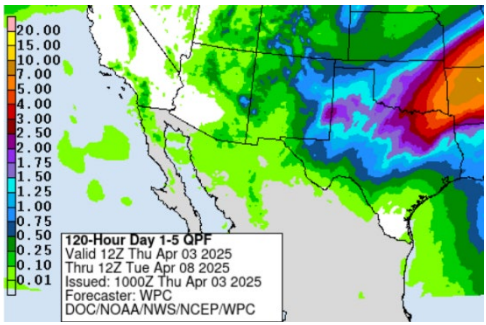
Statewide Discussion: Leading off this morning with the optimism of statewide wetting rainfall as a wet pattern will dominate the forecast through the weekend. Wetting rains will push green-up progression into some of the areas that have not received beneficial amounts since November. Improving soil moisture combined with increasing soil temperature will drive live-herbaceous fuel moisture up as improving the live-to-dead ratio on the landscape ultimately lowering overall fuels availability. Timber fuels will hang on a bit longer, given drying conditions following the weekend, although increasing leaf cover will provide the shading and sheltering effect to hamper fire danger potential in the near future. Obviously, elevated fire weather will not be present today outside of limited potential in the far western reaches of the Oklahoma Panhandle.
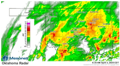
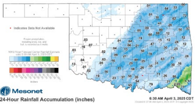
Today: Rain and some storms over the state will persist through the day adding to the rainfall amounts of the last twenty-four hours. While areas of western and northern Oklahoma have not received wetting rains yet, the system is expected to push increasing probabilities through the day and especially overnight. New wildfire occurrence today should exhibit minimal resistance to control offer excellent probability of successful initial attack. OFS resources that have been strategically prepositioned and moved throughout the state will begin demobilizing back to the home dispatch units to begin rehab and repair of equipment in preparation for the next round of wildfire activity. Thank you to the Fire Departments and communities that have hosted these resources regularly and continuously through the last month.
Fire Behavior:
- Oklahoma Panhandle/Northwestern/Western Oklahoma: Rain in some areas combined with much higher surface air moisture will limit fuel receptiveness this morning. Outside of a brief period of possible elevated fire weather in the western Panhandle, limited fire occurrence is expected with greatly reduced new wildfire potential. In the western Panhandle where with temperature around 60°, increasing cloud cover and relative humidity values maybe tapping 22%; 1-hr fuel moisture may touch 5%. South winds 20-25 mph with some gusts approaching 35 mph will support a narrow window of active burning conditions where rangeland fuels exhibit head fire rates of spread +/-140 ft/min and flame lengths +/-9 ft prior to burning conditions rapidly declining.
- Central/Eastern Regions of Oklahoma: Ongoing rainfall that is expected to continue off and on through the weekend will hamper fire danger offering very good probability of successful initial attack.
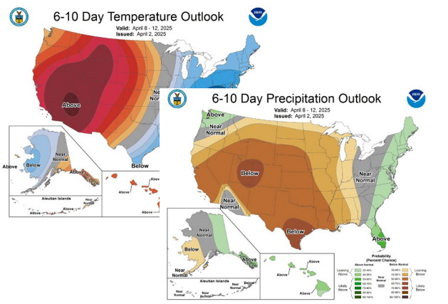
Outlook: Following a wet weekend offering very good opportunity for much needed rainfall, warmer drier conditions return although improving live-to-dead fuel ratios are expected to result in reduced fire behavior potential. The drier than normal expectation extends through the next two weeks based upon current predictive serves products.
County Burn Bans: Click HERE for current burn ban information.


