

Oklahoma is bracing for a “stormy pattern” in the coming days, characterized by the potential for severe weather, particularly strong winds. This follows recent storm activity that brought significant wind gusts.
State Climatologist Gary McManus indicated that summertime storms, while potentially disruptive due to wind, can also offer beneficial rain and the creation of outflow boundaries, leading to cooler, drier air ideal for outdoor activities like mowing. However, winds reaching speeds of 60 mph are a cause for concern.
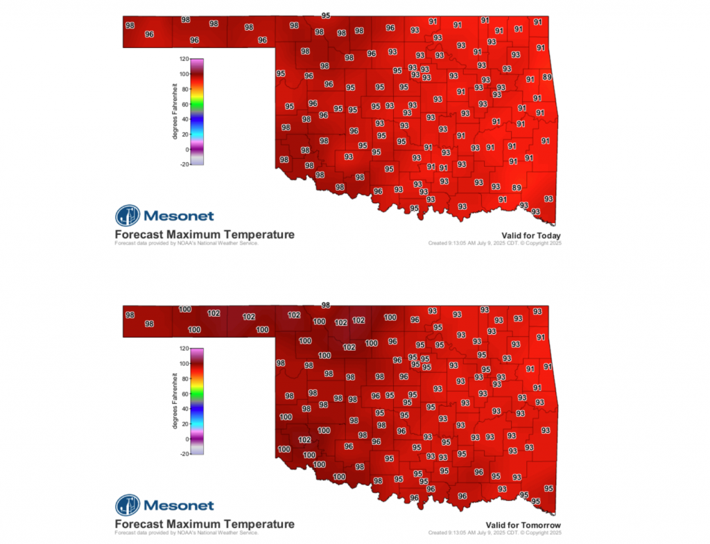
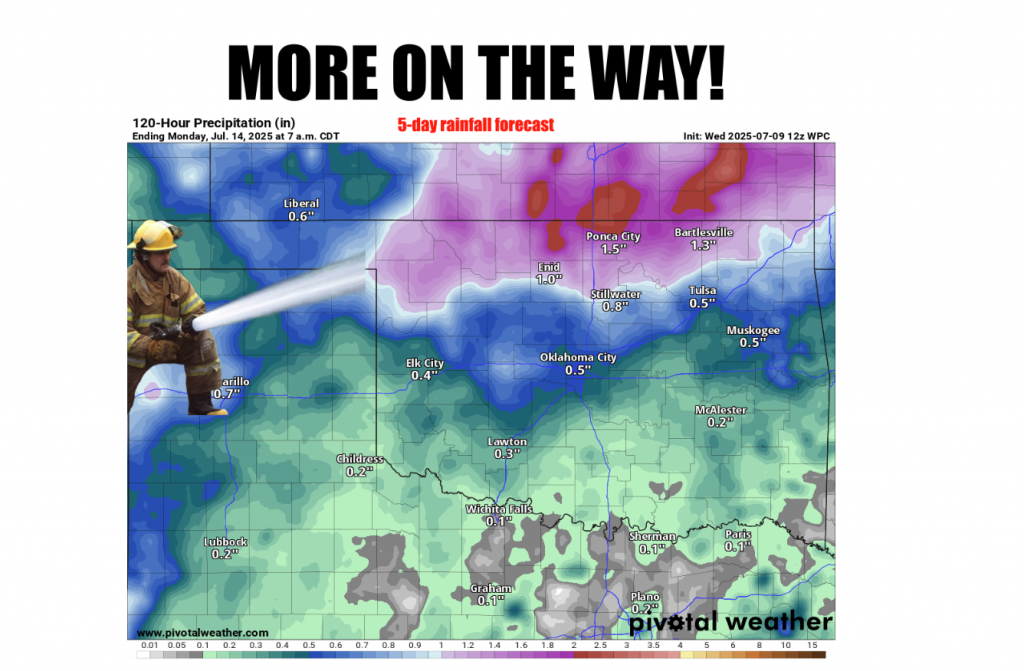
A brief respite from the stormy conditions is expected, with a period of no rain or clouds and temperatures exceeding 100 degrees Fahrenheit. This will be short-lived, as rains are predicted to return by the weekend and potentially continue into next week.
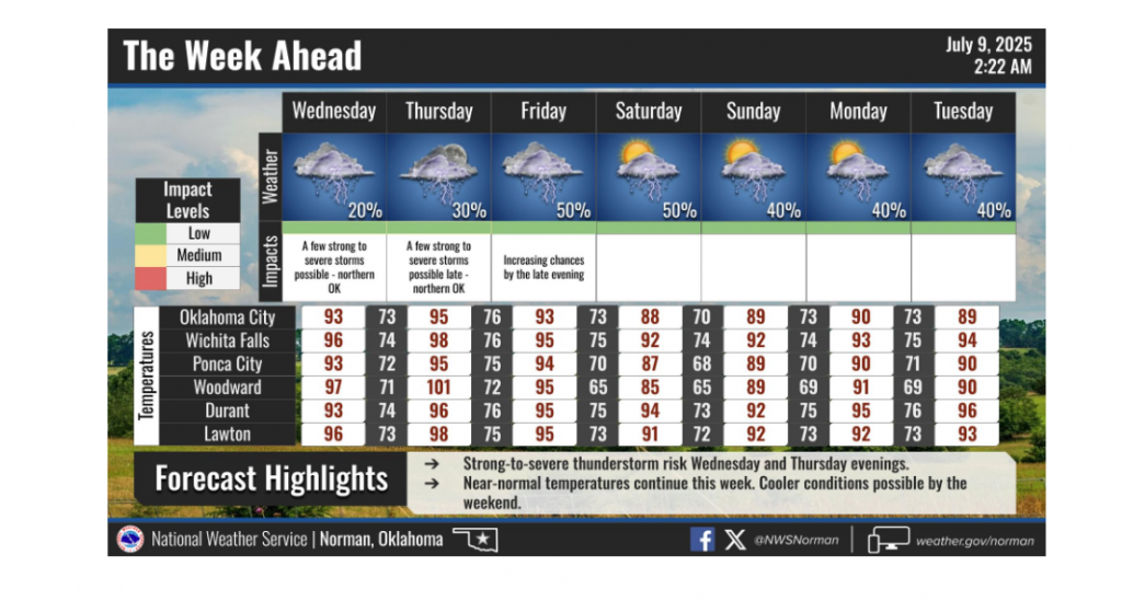
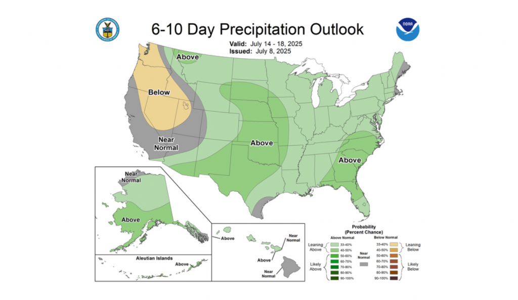
The forecast for next week suggests a likelihood of below-normal temperatures, which, according to McManus, often indicates an increase in rainfall and associated cloud cover during the summer months. Residents should prepare for continued unsettled weather, transitioning from strong winds to high temperatures, and then back to a rainy, cloudy pattern.
To read more from Gary McManus on his Mesonet ticker, click here:


