

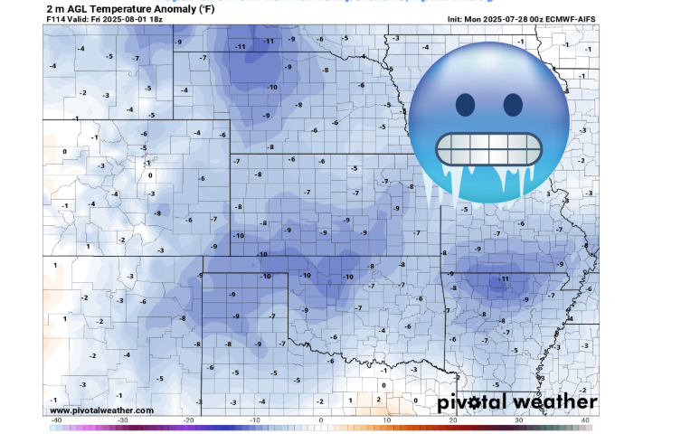
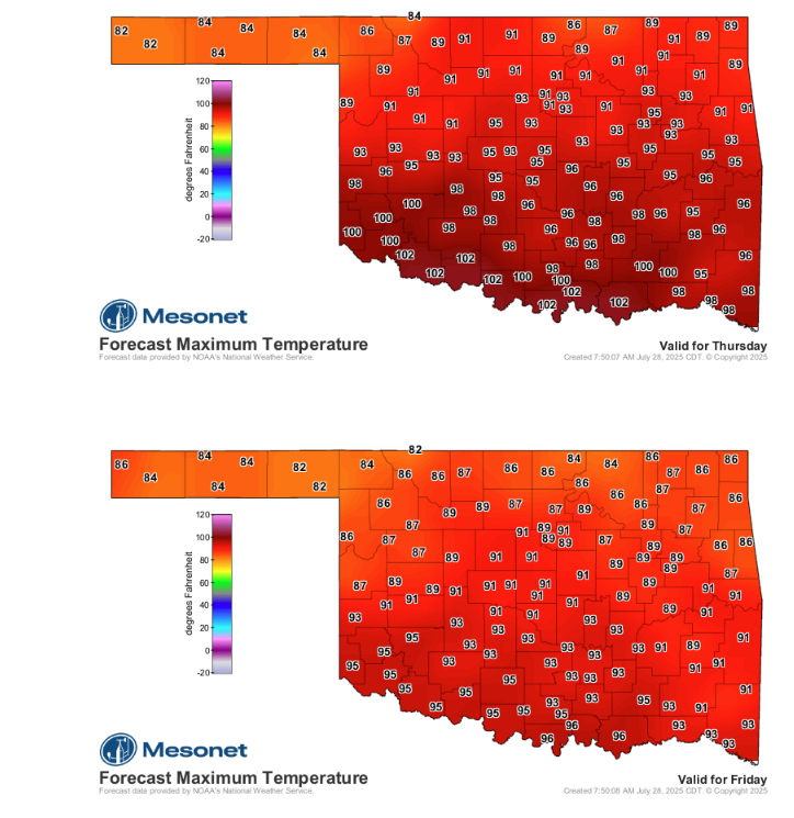
After enduring a prolonged and intense heat wave, Oklahomans can finally look forward to a significant shift in weather patterns later this week. State Climatologist Gary McManus announced today that a “rather strong cold front, given the season,” is set to enter the state on Thursday, bringing with it a welcome reprieve from the scorching temperatures.
“When you have that sudden switch in temperature when the unbearable heat becomes, uhhhhh…bearable. THAT’S the genius of summer,” McManus quipped, describing the anticipated relief.
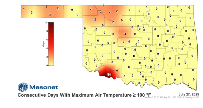
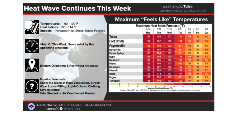
The state has been under the grip of a relentless heat wave, with some areas experiencing extreme conditions. Grandfield, for example, has logged “10 consecutive days at or above 100” degrees. Across much of Oklahoma, heat index values have been consistently in the triple digits for two straight weeks, a trend expected to continue for the next couple of days before Thursday’s much-awaited change.
The incoming cold front promises a dramatic cool-down, just in time for the start of August. “Can you imagine lows in the 60s, and highs in the 80s and low 90s, for 3 or 4 days over the weekend?” McManus enthused, highlighting the stark contrast to the current oppressive conditions.
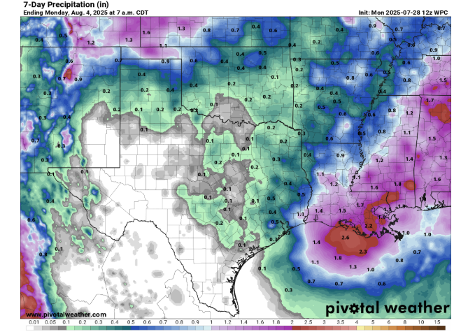
In addition to cooler temperatures, the cold front will also bring increased chances of rain, particularly across northern Oklahoma. This precipitation will be a welcome bonus after an extended period of dry heat, potentially offering some relief to parched soils.
Residents are advised to continue taking precautions against the heat for the next couple of days, staying hydrated and limiting outdoor activities, before enjoying the significantly cooler and potentially wetter conditions expected by Thursday and through the upcoming weekend.
To read more from Gary McManus on his mesonet ticker, click here:


