

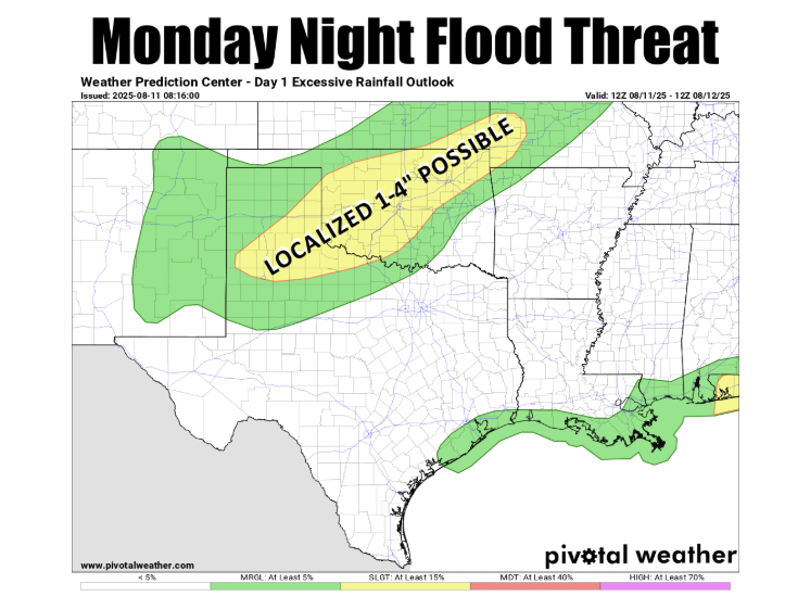
Oklahoma is experiencing what State Climatologist Gary McManus calls a “Bizarro Summer,” with weather patterns more common in spring than mid-August. This has led to a significant threat of flooding, particularly in the northern part of the state, from “training thunderstorms” that have been repeatedly passing over the same areas.
According to McManus, the unusual weather is a stark departure from the typical hot and dry August. “Well of course we’re worried about flooding in mid-August, because we’re in the midst of Bizarro Summer here in Oklahoma!” he stated.
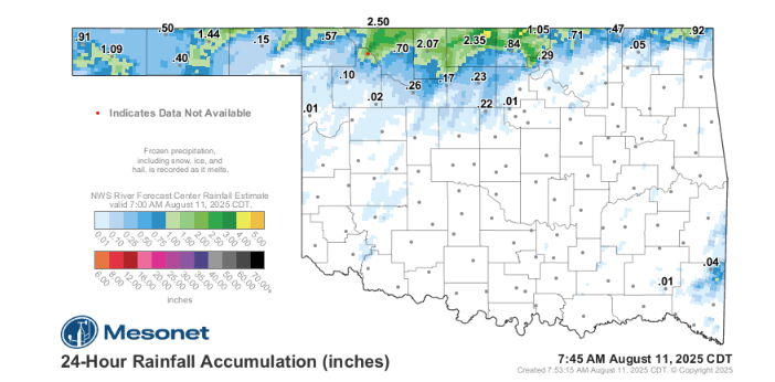
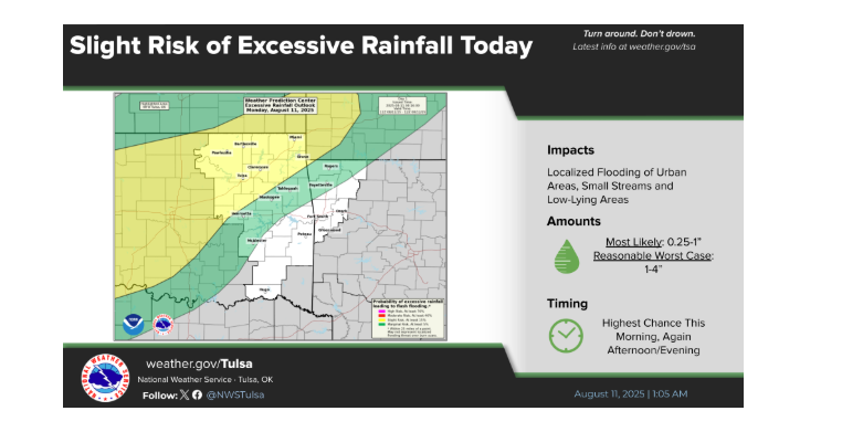
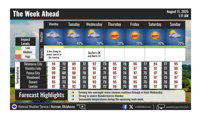
The primary concern is the heavy rainfall from training thunderstorms, a meteorological term for storms that repeatedly develop and move over the same region, much like cars on a train track. This can lead to significant and highly localized flooding. “This isn’t just an ‘everybody gets 2′ of rain’ type of deal…this is one of those where you might get a ton and somebody a county over gets left out, but the potential for some real flooding problems is there,” McManus explained.
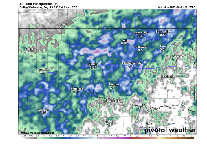
While the storms bring the risk of flooding, wind, and hail, they also offer a temporary break from the intense heat. Milder temperatures are expected to accompany the rain through Wednesday morning, providing a brief respite before the heat returns. McManus warned, “If you’re not liking the rain, well at least come for the milder weather. Because summer hits the fan after that brief interlude. Again.”
To Read more from Gary McManus on his mesonet ticker, click here:


