We have seen triple digit temperatures and high heat indexes the past few weeks, but according to State Climatologist Gary McManus a cold front will be moving through the state this weekend, “The front arrives in NW OK on
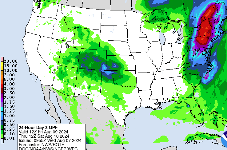
Thursday then overspreads the state over the next 24 hours. Should get some showers and storms forming in the High Plains and then heading our way in the NW flow around the periphery of the heat dome to the west, its meandering that way allowing the cold front to slip through. Pretty nice temps setting up, just like we detailed yesterday, but maybe the rain chances are slipping a bit farther south along with the milder air.”
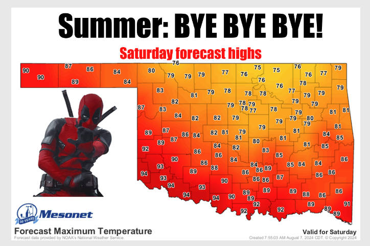
We will still have to suffer through a few more days of hot temps; in fact, a heat advisory is in effect today as the heat and humidity will build up today, pushing the heat index up to dangerous levels.
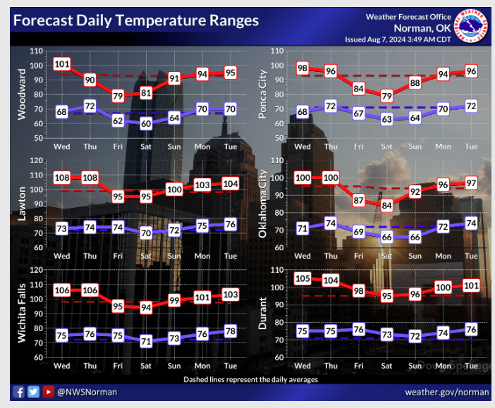
Highs over the weekend include some 80’s and some 70s throughout the state and there’s also a chance of rain in the forecast.
To read more from State Climatologist Gary McManus on his mesonet ticket, click here: