

Oklahoma is experiencing an exceptionally wet period, which is helping to alleviate building drought conditions. In a conversation with Farm Director KC Sheperd, Oklahoma State Climatologist Gary McManus detailed the state’s unusual weather patterns and what they could mean for the coming months.
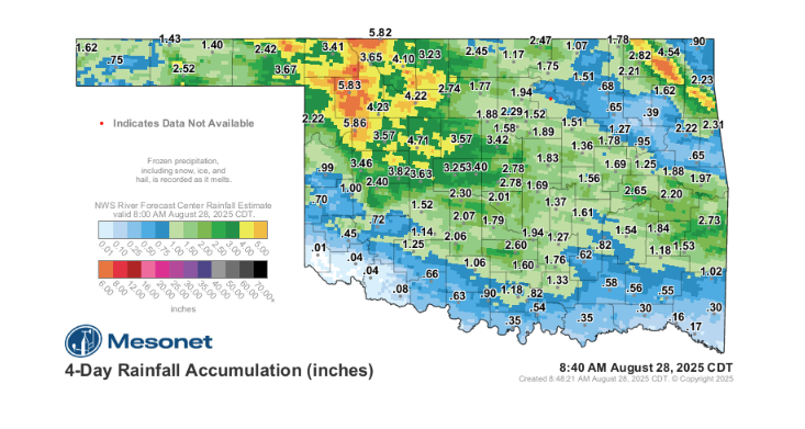
According to McManus, the state has seen an extremely wet year overall, despite a few dry periods. This includes the wettest April on record and generous rains throughout June and much of July. The final week of August has been particularly remarkable, with rainfall totals that could rank among the wettest last weeks of August on record. The last four days alone have been the wettest in a century. This trend of extreme rainfall dates back to the wettest November on record in 2024, contributing to an extended period with minimal drought.
Fall Forecast and Long-Range Outlook
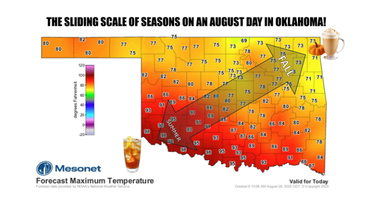
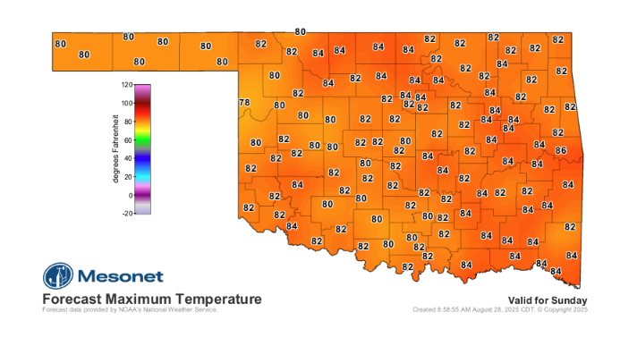
McManus also addressed the prospect of an early end to Oklahoma’s notorious summer heat. While he cautioned that southwestern Oklahoma often has its own unique weather patterns, the rest of the state is seeing a significant disruption of the typical late-August heat dome. With a strong cold front moving through, temperatures are dropping into the 70s and 80s, and this pattern is expected to extend into mid-September. While the possibility of triple-digit temperatures isn’t entirely gone, this break will shorten the time for such extreme heat.
The recent rains have been crucial for replenishing soil moisture, which had started to dwindle over the last few weeks. This timing is especially beneficial as the state heads into the cooler months. As the sun gets lower in the sky and plants begin to go dormant, moisture won’t evaporate as quickly, helping to ward off a return of drought conditions.
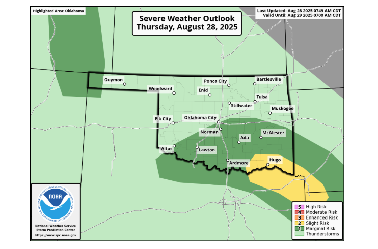
He noted that as the cold front moves through, it can kick up storms, particularly in the warmer, southern parts of the state. Due to the contrasting conditions, there’s a chance of severe weather, including the potential for large hail, high winds, and a low, but not zero, tornado threat. McManus emphasized the need to be “weather aware,” especially in the southeastern and south-central parts of Oklahoma.
Looking ahead to the fall and winter, McManus is watching for a potential return of a La Niña weather pattern. La Niña conditions typically tilt the odds toward a warmer and drier cool season for the Southern Plains. However, the abundant rainfall Oklahoma is currently receiving will help “hedge some of our bets” against a severe drought, even if La Niña fully develops.
To read more from State Climatologist Gary McManus on his ticker, click here:


