

Well, roll out the Pumpkin Spice, as it appears that the changing weather in Oklahoma’s summer temperatures is almost gone for good. According to State Climatologist Gary McManus, a strong cold front is set to move into the state, bringing another taste of fall. The recent trend of highs in the 70s and 80s has replaced the punishing temperatures of earlier in the month, except for a few 90s and triple-digits in southwest Oklahoma.
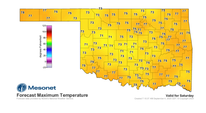
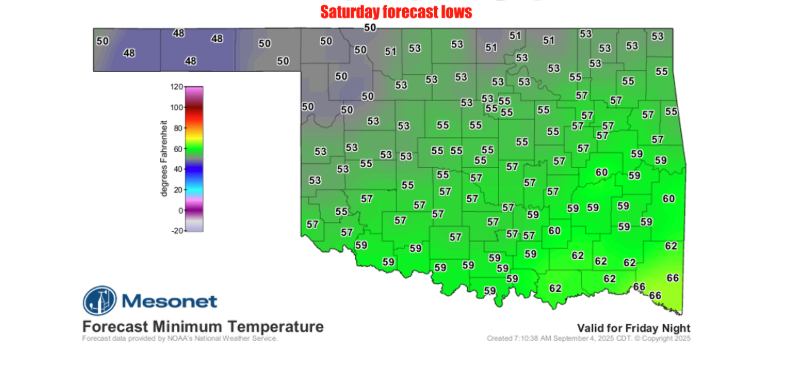
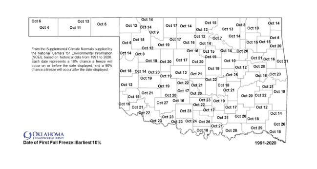
This weekend promises more lovely fall weather, with lots of gray skies and scattered showers. Temperatures are expected to be in the 60s and 70s for most of the state, with some 80s lingering in a few areas. The cold front is so significant that lows could drop into the 40s on Saturday morning, which would be the first time since Eva saw a low of 43°F back on June 4. While 40s often suggest 30s are not far behind, McManus reminds us that we are still about a month away from the earliest fall freeze probabilities for the state.
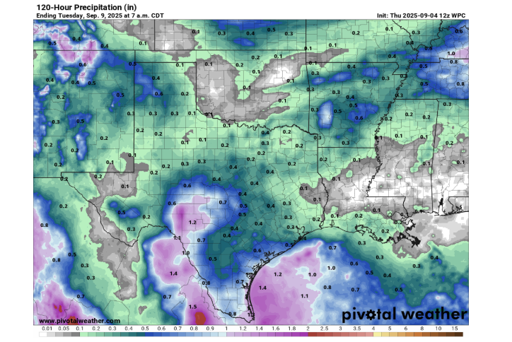
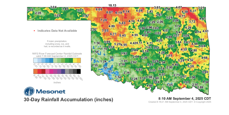
One major difference with this new front is the lack of moisture. Unlike the fronts that ended August’s summer heat with plenty of rain, this one is not expected to bring a lot of precipitation. This is of particular concern for southwest Oklahoma, which has largely missed out on the recent heavy rains. As a result, the U.S. Drought Monitor has introduced “D0,” or abnormally dry conditions, in the region, a precursor to potential drought if rain doesn’t arrive soon.
While a few marginally severe storms are possible with the frontal passage, a major severe weather event is not likely
To Read more from Gary McManus on his Mesonet ticker, click here:


