

Oklahomans could be forgiven for checking their calendars this past weekend, as “summer” made an aggressive and record-shattering return in the middle of November.
“Why are we having mid-90s in Oklahoma in mid-November?” asked a bewildered State Climatologist Gary McManus in his recent report, channeling the thoughts of many residents.
This wasn’t just unseasonably warm; it was historic.
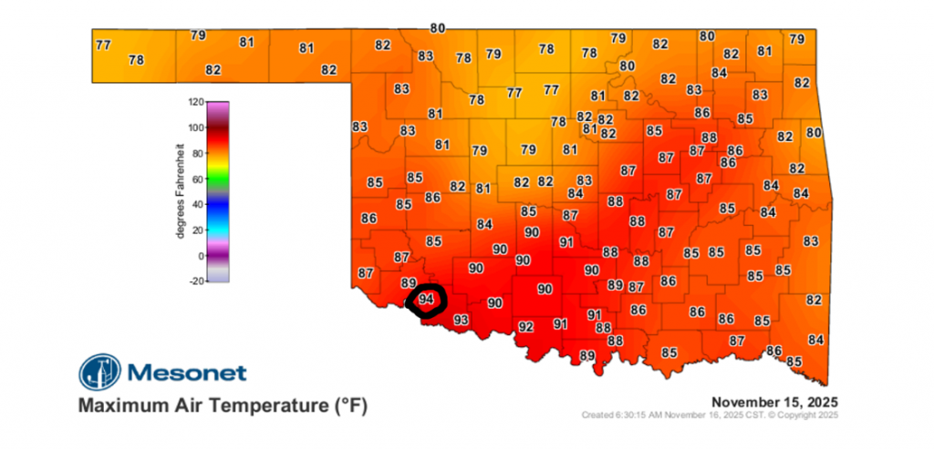
The heat, which peaked over the weekend and is forecast to linger through Tuesday, broke not just daily records but, in many cases, monthly records for entire stations. The most stunning reading came from Tipton, which recorded a high of 94°F.
According to McManus, that 94-degree temperature in Tipton is not only a local record but also ties for the second-highest temperature ever recorded in November in Oklahoma’s history. The all-time November record remains 95°F, set in Hollis on November 7, 2023, and in Coalgate on November 1, 1937.
The warmth wasn’t just a daytime event. Record-high minimum temperatures were also set Monday morning, meaning Oklahomans woke up to temperatures warmer than the previous record highs for the date.
The Problem: A Deepening Dry Spell
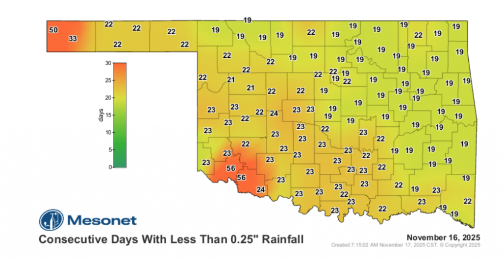
This “summer” weather has been less of a treat and more of a strain on the state, which is slipping back into drought. McManus noted the troubling lack of moisture, with parts of Oklahoma experiencing periods of 3 to 8 weeks without seeing at least a quarter-inch of rain in a single day. For some, it has been three weeks without even a tenth of an inch.
The Solution: A “Cut-Off Low”
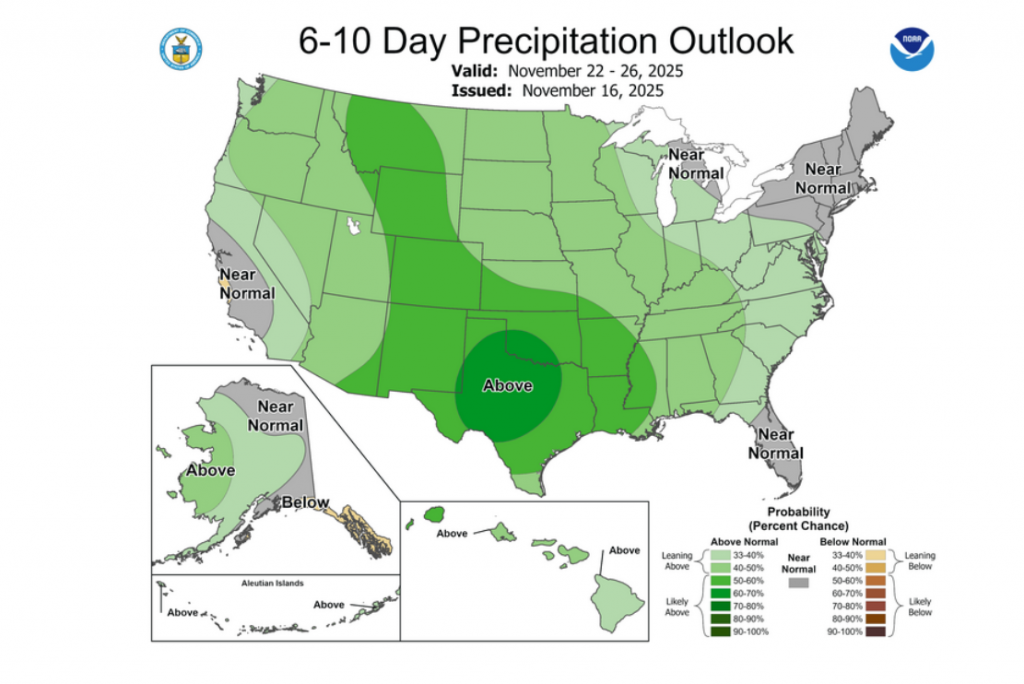
The good news, as McManus reports, is that a significant pattern change is finally on the horizon.
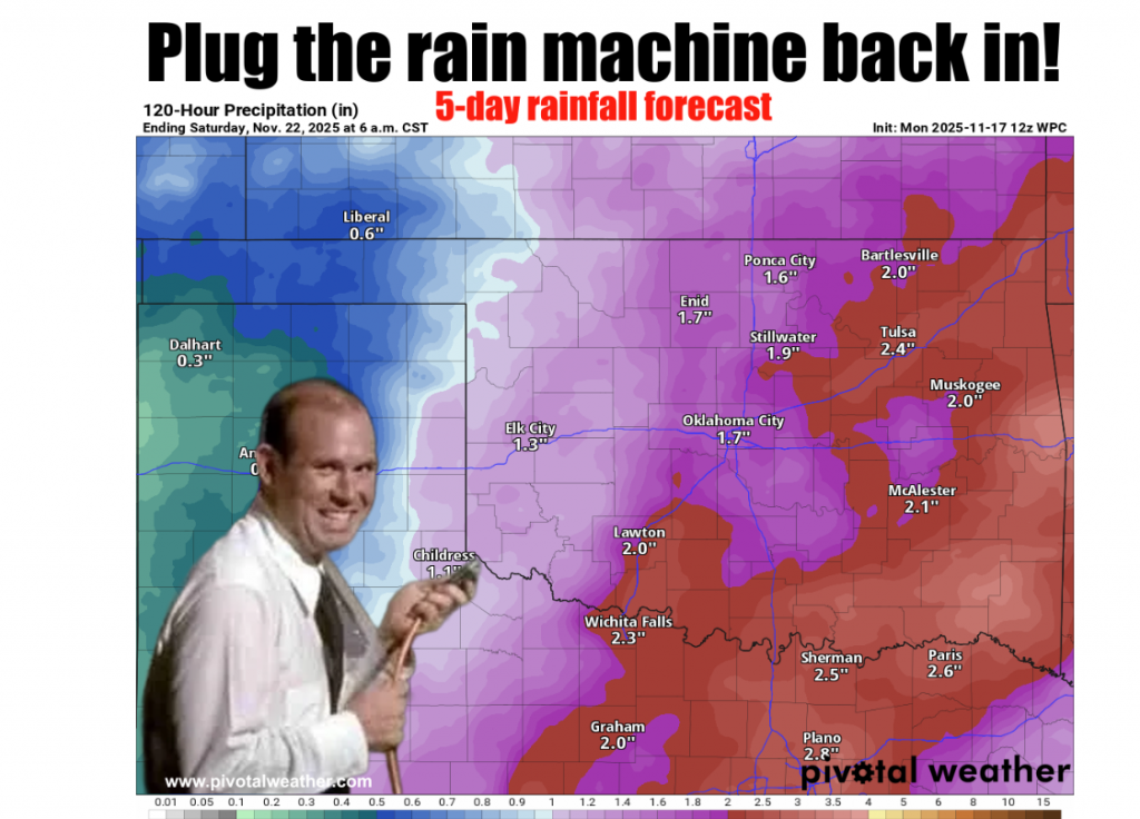
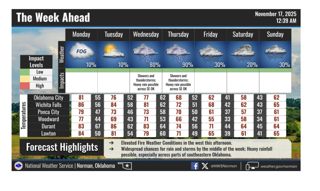
A “cut-off upper-level low pressure system”—which McManus calls “drought’s worst enemy”—is set to visit the state this week. This system is expected to end the record warmth and bring widespread chances for significant rainfall.
While the heat is forecast to persist through Monday and Tuesday, clouds and rain will usher in a more seasonal pattern by mid-week.
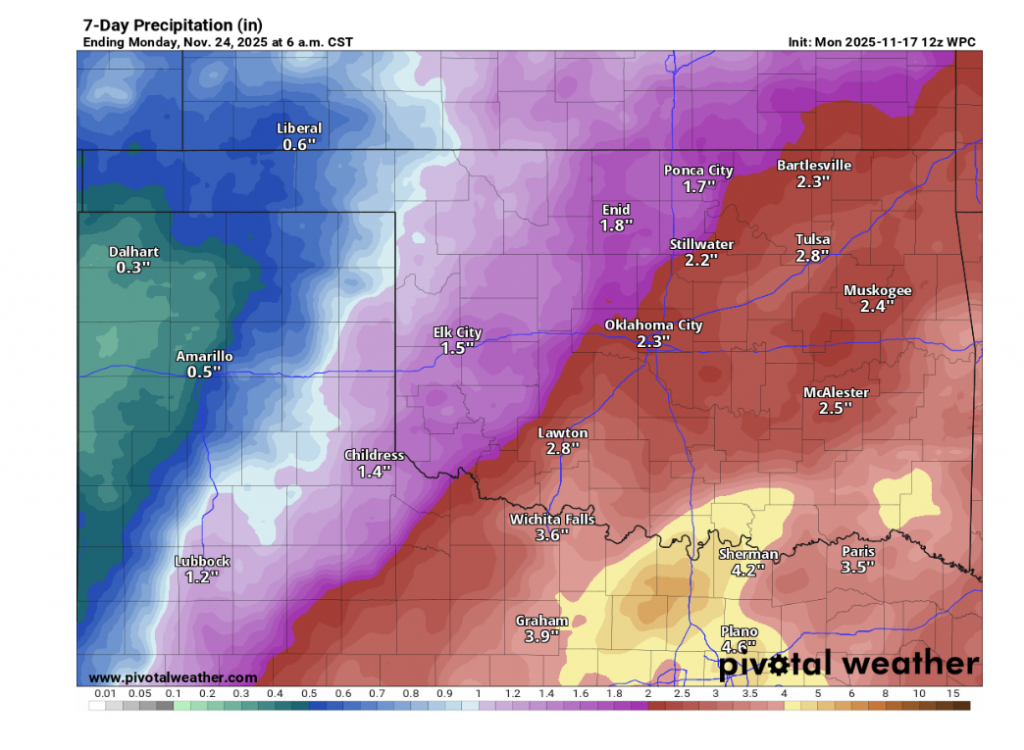
McManus cautions, however, that the forecast rainfall amounts will be anything but uniform. “Some folks are liable to get 3.6 inches and somebody a county away might get 0.6 inches,” he warned. “Just the way it works.”
This system is expected to be the first in a series, with models showing potential for more rain heading into early next week.
What About Winter?
For those tired of the weather whiplash, the Climate Prediction Center (CPC) is signaling a potential pattern change that could bring wintry weather to the state right after Thanksgiving.
McManus urges extreme caution with this long-range data, labeling it “fantasy-cast territory,” especially the “heavy snow” portion of the models.
In the short term, however, Oklahomans can expect one thing for certain: The mid-90s are done.
“At any rate,” McManus concluded, “summer’s about to be over. AGAIN!”
To read more from State Climatologist Gary McManus on his ticker, click here:


