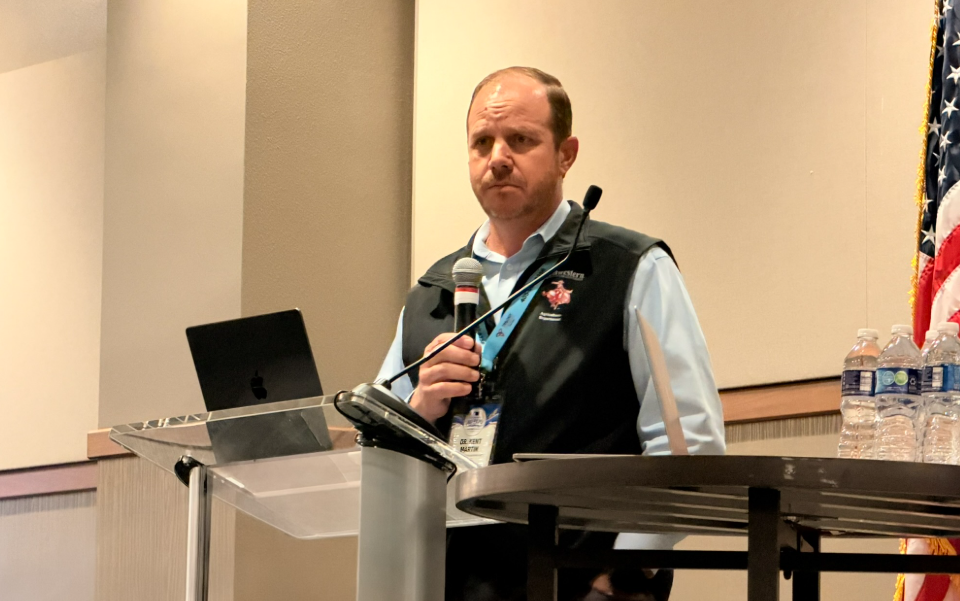
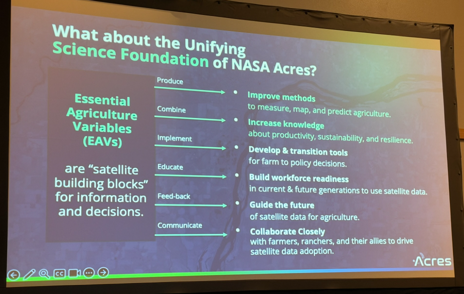
Space exploration technology has long played an unseen yet pivotal role in everyday farming operations. From the satellite navigation systems steering autonomous tractors to the weather forecasting models developed alongside NOAA, the boundary between space and the farm field continues to blur. Farm Director KC Sheperd recently sat down with Dr. Kent Martin, Professor of Agronomy at Northwestern, to discuss how NASA satellite data is being translated into practical, ground-level management tools for agricultural producers.
“NASA has been involved in agriculture for a long time,” Dr. Martin noted. “NASA of course has the satellites that drive your tractors, has the weather prediction systems, interacts with NOAA, have the satellites that look at monitoring crops and vegetation and all these kind of things. So they’ve been doing that for a long time and continue to do it, even though we haven’t really necessarily recognized that they’re the ones who are behind the scenes.”
Ground-Truthing and Producer Trust
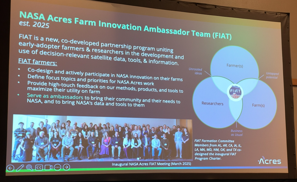
As researchers expand the application of satellite technology, developing actionable tools requires a crucial step known as “ground-truthing”. This process bridges the gap between orbital observations and the reality on the ground by collecting direct field data to train and calibrate satellites.
However, bringing academic and federal research onto private land introduces understandable producer concerns regarding data privacy and stewardship. Dr. Martin stressed that safeguarding producer data remains the foundation of this work.
“One of the big challenges is, as we develop a tool for a farmer, of course we will be capturing data that’s going to feed into that farmer’s tool, but we have to make sure 100% that data is handled very, very carefully,” Dr. Martin said. “Fully recognizing that the trust that farmers give NASA with their data is number one priority, and so making sure that all of that data is handled very, very carefully, that it’s never in the wrong hands. And we’ve done that. We’ve developed that procedure, that has been checked and approved, and so we are moving on to the next steps.”
Moving Beyond Simple Imagery
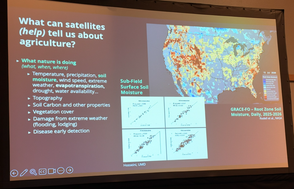
Satellite utilization in agriculture has rapidly evolved past standard, broad-scale aerial photos. Today, sensors can assess subtle ground shifts, water movement, and moisture levels both at the soil surface and deep within the root zone.
These growing capabilities allow researchers to monitor changes in bare soil and vegetative growth to define precise field boundaries, confirm planting dates, track crop development, and enhance yield estimates. Beyond routine management, satellite tracking has proven vital for emergency response, disaster documentation, and crop insurance verification.
“Anything from a flood event that occurred in Iowa with a guy on our team who needed to document that, and we were able to see it from satellite imagery where you could see corn laying on the ground and define these damaged areas and you could relate that back to a weather event—so in terms of crop insurance that became really important,” Dr. Martin explained. “All the way to other things like wildfires, where because we can look at vegetation, we can understand something about the fuel for the fire, we can integrate weather patterns, air movement in, how that might push a fire in a certain direction. We can stage first response people in certain areas to control that.”
Translating Complex Data into the Acres App
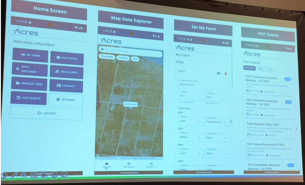
To make complex, multi-layered data accessible to producers and agronomists, researchers are packaging these capabilities into an upcoming mobile platform called the Acres app. Currently undergoing beta testing, the app is designed to serve as the user-friendly interface that turns raw satellite numbers into handheld decision-making tools.
“The app is the interface from the raw data that’s too complex and cumbersome to ever make any sense of or ever actually use, to go into a tool that’s in your pocket,” Dr. Martin said.
Initial rollouts will focus on foundational management components—such as yield prediction and nitrogen responsiveness—before expanding into specialized features like disease monitoring, insect progression tracking, and invasive species targeting for precision drone spraying.
Dr. Martin shared that producer feedback remains essential to discovering practical applications researchers might overlook. “I’m the guy in the tractor who looks at the ground and goes, ‘I wonder.’ As I drive along, I see things that, you know, I’ve seen all my life, but I never really thought about. And I think that’s what we’re asking people to do is think about the possibilities that might be there.”
Development of the Acres platform remains ongoing, with researchers expecting the initial version of the app to become functional and deploy with a targeted set of baseline tools in the first quarter of next year.