

State Climatologist Gary McManus says the Blue Norther that crashed into the state has brought down the temperatures. “Temperatures have crashed from a lovely fall/spring day yesterday all the way down to January levels,” said McManus.
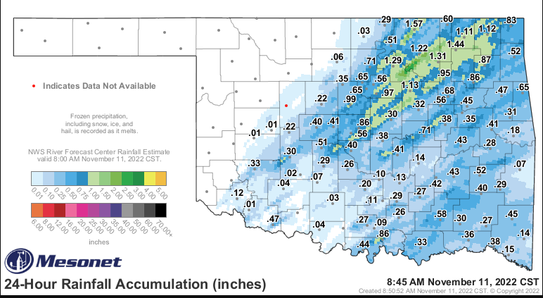
With the temperatures dropping following the cold front, McManus says so goes the moisture as well. We did see some rain across the state.
So it looks like Winter has moved in, and its going to stay for awhile. McManus says “In the next few days, Saturday and Tuesday mornings look particularly cold.” He says it is possible that we could remain in this cold pattern through Thanksgiving.
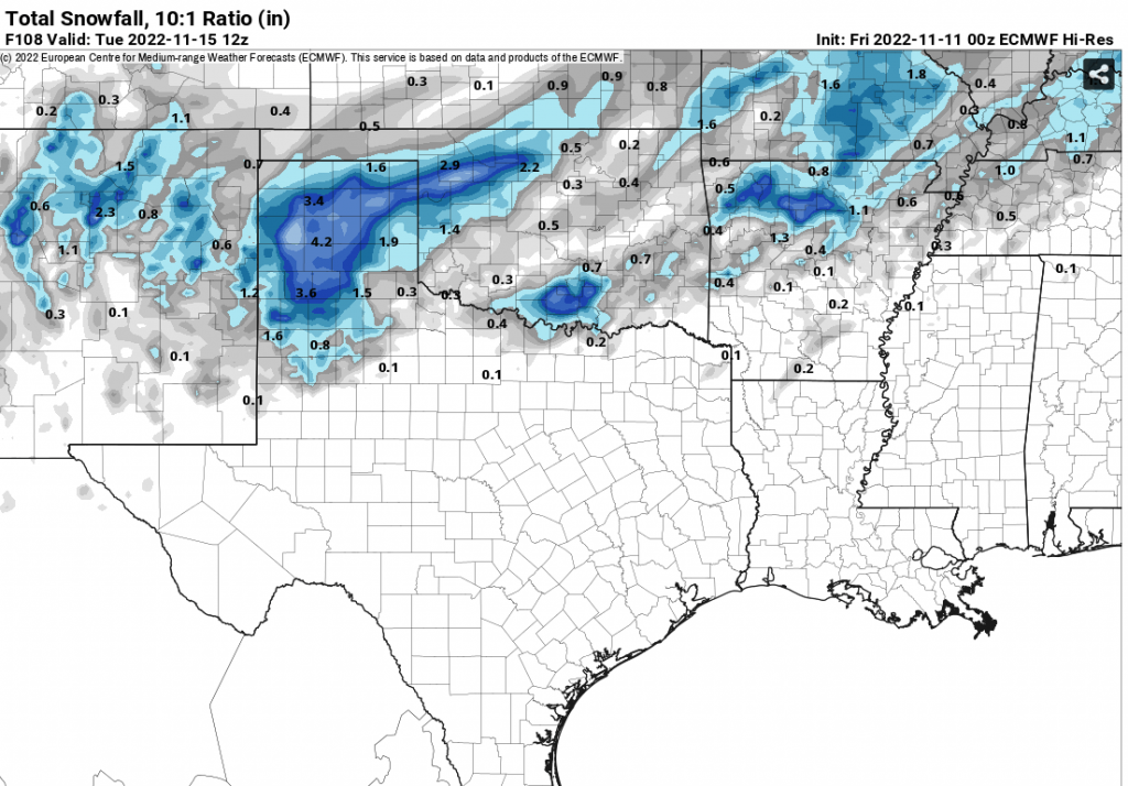
McManus says we may even see snow, “Yes, it will probably snow next Monday, maybe into early Tuesday. Unfortunately, the forecast models just don’t have a great handle on the situation just yet. The storm system that could bring us snow is still off the West Coast in the Pacific Northwest, so it’s not well-sampled yet.” McManus says Once it moves on land, the forecast models should get a better look at the storm’s track and potential. But at this point, we aren’t sure.
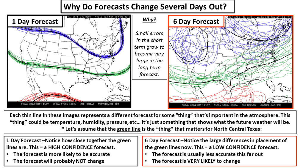
McManus says, “The trick for the models is to get the vertical profile of the atmosphere correct, IN ADVANCE, to determine what kind of precipitation might fall. You have a warm layer above the surface; you might get really cold rain, you might get freezing drizzle, you might get sleet. If you can keep that snowflake from melting as it falls, you MIGHT get snow.”
He says right now it does look like the vertical profile does favor snow, but right now surface temperatures look a little bit iffy, “That snow might fall and then get closer to the surface and melt into a chilly rain, with some snowflakes mixing in. Or, if that moisture that falls can cool the air down (through evaporation) close to the freezing level, we might see accumulating snowfall.”
McManus also offered this fun fact on his daily Mesonet Ticker for the Weather on November 11, 1911:
On that afternoon, Oklahoma City reached a record high temperature of 83 degrees.
Soon thereafter, a norther barreled through the state, dropping temperatures
50-65 degrees in the span of a few hours. By midnight, the temperature at Oklahoma City had plunged to a frigid 17 degrees, the record low for that same date.
Both records still stand, marking November 11th, 1911, as the only date in state history in which the record high and low temperatures were broken on the same day for a single location.
The Great Blue Norther of 11/11/1911 wasn’t just confined to Oklahoma. This was a massive cold frontal assault
(hint: Erie, PA also set its record high and low on Nov 12, 1911)


