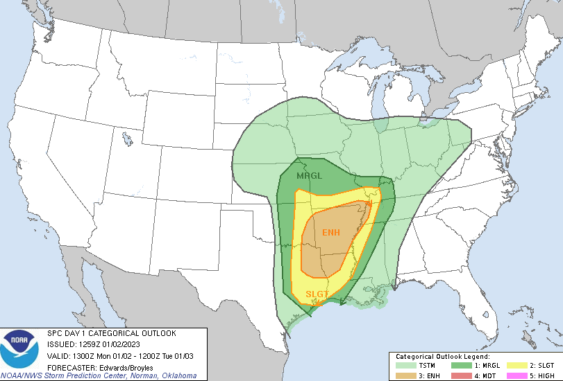
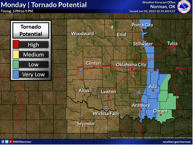
Parts of the state could see severe weather today, according to State Climatologist Gary McManus, “A warm front has brought a surge of moisture into the state, setting us up for the possibility of severe storms later today as we see yet another cold front fire through the state tonight. Kingfisher’s temperatures went up 25 degrees over the last 3 hours!”
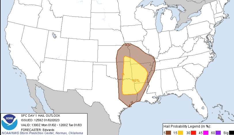
There is a risk for some pretty big storms tonight, especially to the East of I-35, and the possibility of strong tornadoes across Southeast Oklahoma. McManus reminds everyone to be weather aware.
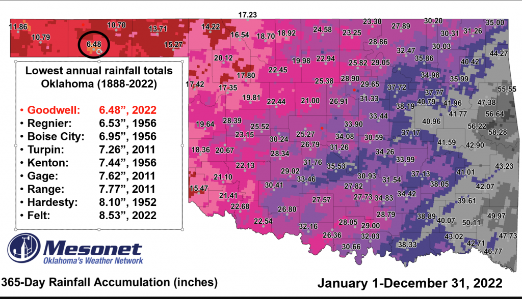
McManus says as we wrap up 2022, we did see “Extremely Extreme Extremes” throughout the state, “Our extremely extreme extremes would be normal if not for some extremely extreme happenings each year, and this year’s biggie, which makes our extremely extreme extremes extremely extreme is that 6.48 inches of precipitation measured by Goodwell, that becomes the lowest rainfall total in state history, and we’re talking back to the 1880s.”

McManus says there have been some other totals come close, “Hooker’s 6.2 inch total back in 2011. That was found to be a bit iffy due to our rain gauges under-catching a bit of snowfall in a blizzard situation. We’ve always talked about that total from then at Hooker as “one of the lowest in state history,” but sadly could not put it forth as THE lowest to the Extremes Committee.”
Other extremes this year in Oklahoma include
–The 108.4 mph wind gust from Nov. 4 at Idabel. That was associated with the EF4 monster twister than ravaged Idabel and clipped the Mesonet site.
–The 114.8 degree day at Mangum as well, which tied for the highest temperature ever recorded by the Mesonet, at least rounded to whole numbers of 115. Buffalo holds the actual lead at 115.2 degrees from July 9, 2009
–The -33.2 degrees wind chill from just a couple of weeks ago on Dec. 22. The previous extreme was -27.2 degrees from Hooker on Feb. 4, but that blast of Siberian air from the arctic circle region late in the year erased that one.
–The 84.3 degrees dewpoint at Antlers from July 20, and the 120.2 heat index from Webbers Falls on June 12.
To Read more from McManus on his mesonet ticker, click here: