

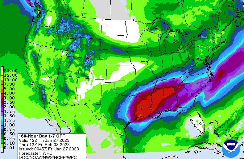
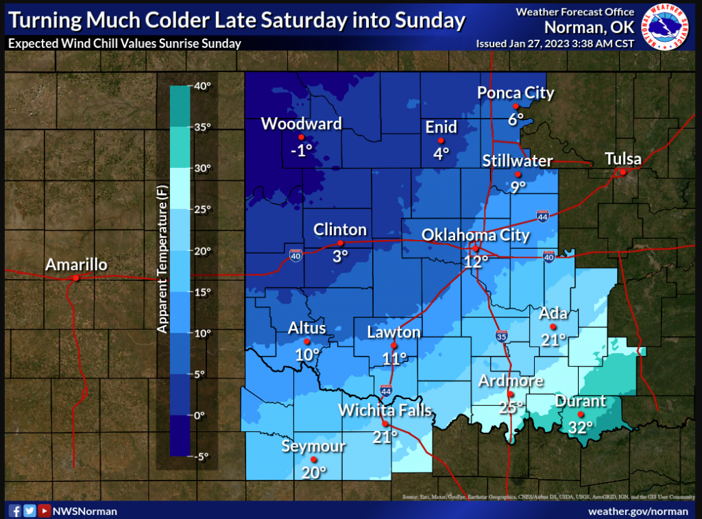
Enjoy the weekend weather as we warm up in into the 50s today and near 60 tomorrow. But then A big, arctic air blast is set to move through the State Saturday into Sunday, according to State Climatologist Gary McManus, and will give us the coldest air of the year thus far (for 2023). But McManus says that’s not all, “Then we have the big upper-level trough out West throwing out smaller systems our way before it moves to the east and passes over the Southern Plains somewhere, causing at least a couple of rounds of precipitation.”

Right now, McManus says it’s uncertain what the nature of the arctic air is, “that could mean the most dreaded form of wintry precip: freezing rain (or even freezing drizzle).” Keep in mind that with even a light glaze of ice, there could be possible travel problems, but right now, that is also unknown, “There is simply no good model consensus yet on many aspects of this storm, so the fine points are not there at this time. How deep will the cold air be, and how warm will it be in the important icing area in SE OK where heavier precip is being forecast? What is the track and strength of the main storm system as it moves over us? Remember our admonitions on how difficult it is to try and make sense of the chaos of even short-term forecasting due to lack of model consensus.”
Right now, McManus says he’s just keeping the forecast simple until it gets a bit closer, “There will be a large frigid air mass over our area and at least a couple of chances of precipitation to go along with it.”
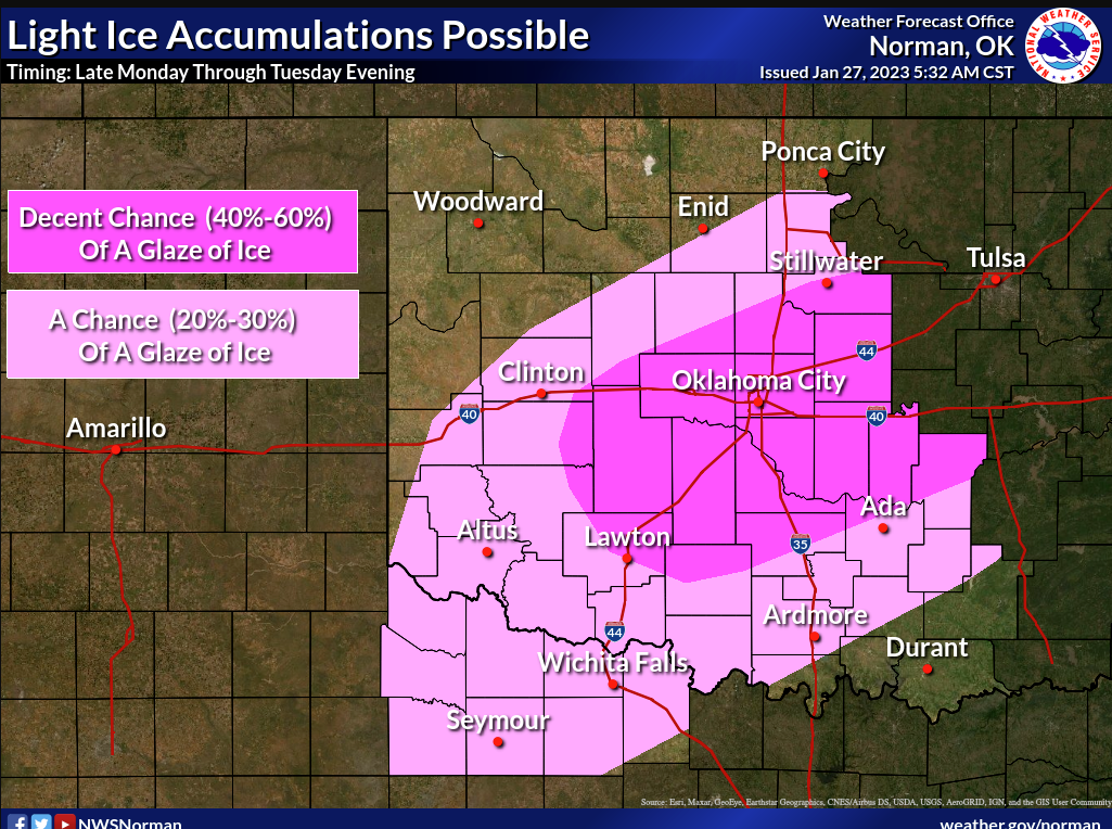
So enjoy the weekend because big changes are on the way with freezing rain, sleet, and snow moving in early next week!


