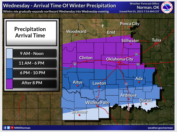
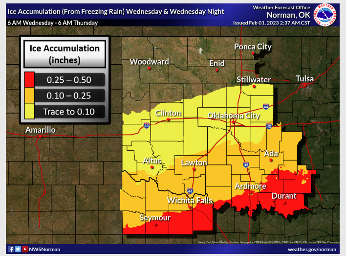
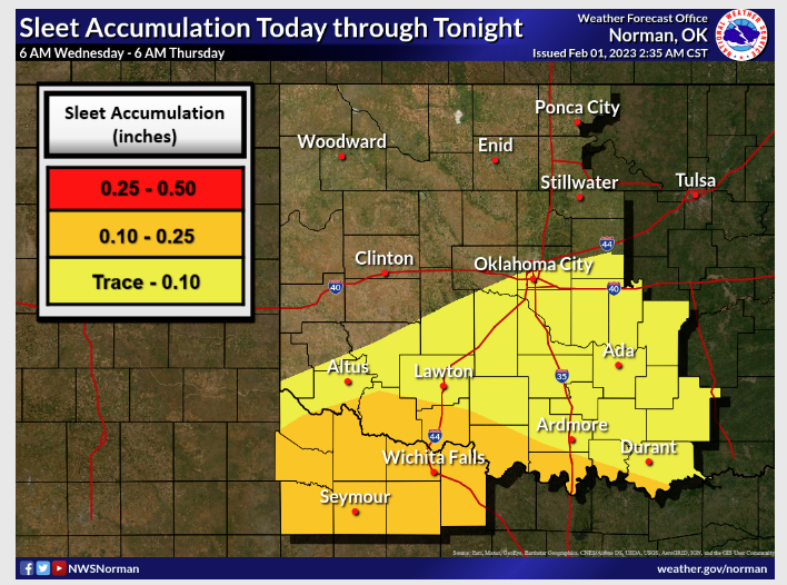
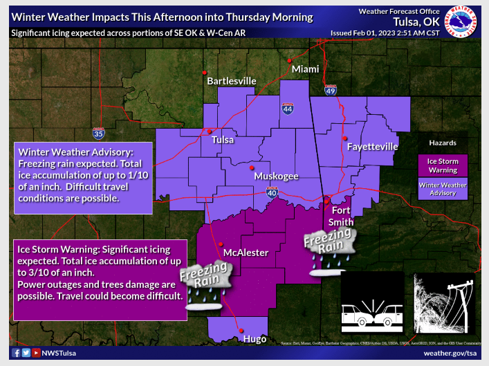
The 3rd round of Winter Weather is set to move through the state later this evening, with the possibility of sleet and freezing rain. State Climatologist Gary McManus says this latest round of Wintery mix will gradually expand northward on Wednesday into Wednesday evening. With this latest round, you can expect precipitation in the state tonight before it trudges east Thursday afternoon. Highs will climb back above freezing today but fall below this evening which could cause some travel problems. Just a small amount of ice can cause very big problems, so please be careful if you do need to get out.
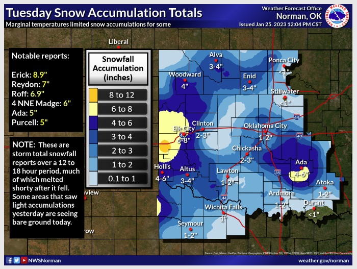
McManus says January in Oklahoma began springlike but ended with a wintery Punch, “Warm weather dominated the first three weeks of the month and was on pace to become one of the warmest Januarys on record before winter crashed the party.” We went from seeing highs in the ’60s and ’70s during January’s first three weeks to seeing Snow, sleet, and freezing rain over the month’s final ten days, “The first winter storm on Jan. 23-24 brought the type of picturesque snowfall rarely seen in Oklahoma. Temperatures hovered near freezing in the state, which helped produce
snowflakes to the size of half-dollars that fell into a near windless environment, an oddity on most days in Oklahoma. West central Oklahoma saw 6-8 inches of snow, with Erick leading the state at 8.9 inches. Locations in central
and eastern Oklahoma reported 4-6 inches, and nearly everybody saw at least some snow, albeit briefly”.
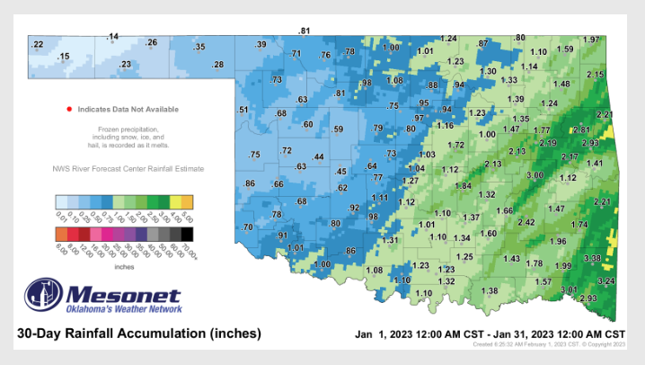
Even with the precipitation, McManus says we are still .04 inches below normal for January, as it ranked the 58th direst January since the records began back in 1895, ” Far eastern Oklahoma had the greatest totals of 3-4 inches, with a few localized areas with 4-5 inches evident on radar estimates. Much of the western half of the state ended with less than
an inch of precipitation, the Mesonet site at Eva’s 0.14 inches bringing up the rear.”
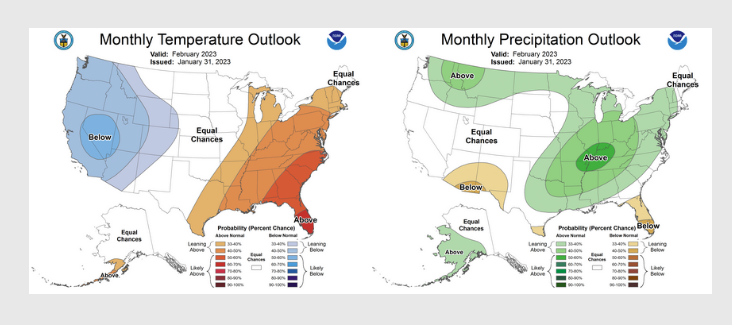
McManus says the Climate predictions center for February precipitation indicates increased odds for above normal precipitation across the easter four-fifths of the state, but especially for the eastern One-third of Oklahoma, “The temperature outlook shows increased odds of above normal temperatures for far southeastern Oklahoma. The hopeful precipitation outlook leads to CPC’s February drought forecast of improvements across the eastern one-third of the state. Drought is expected to persist across the western two-thirds, however.”
To read more from McManus’s Mesonet Ticker, click here: