There’s a lot going on today on the Oklahoma Weather map! The wind will be a constant battle again today for farmers and ranchers today. According to State Climatolgist Gary McManus we have:
— Strong low pressure system moving to our north will drag a dryline and a front
through Oklahoma.
— The dryline should surge back westward tonight but then get overtaken by cold
front overnight.
— Relative humidity values in the teens and single digits behind the dryline will
make for prime wildfire conditions thanks to much above average temperatures.
— Strong mixing behind the dryline will transport high wind speeds downwards,
so watch for winds once again gusting from 50-70 mph. Some damage is expected
in areas with higher wind speeds.
— Storms *might* fire along dryline, but strong capping inversion makes it
pretty iffy.
— Better chance of storms in far eastern Oklahoma, where all modes of severe
weather are possible, including a chance for strong (EF2-EF5) tornadoes.
— Cold front will bring in a wind shift overnight with strong northerly winds.
— Drought conditions in the High Plains create ample opportunity for blowing
dust, and we could see several waves of dust move east across the state
later today.
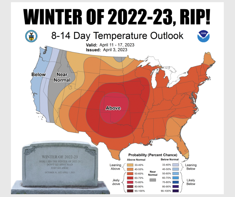
We will be getting a bit cooler over the next couple of days, “We may even see a freeze in NW OK the next couple of days, winter is probably dead for good.” Keep in mind, fire danger will be high again today with burn bans across the state.