

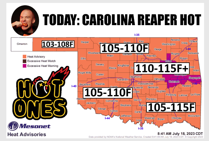
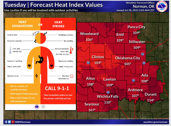
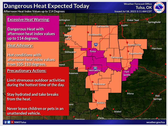
Dangerous Temps are expected across the State this week with excessive heat warnings. According to State Climatologist Gary McManus, heat index values are up to 114 degrees. With temperatures this hot, there’s a possibility of heat illnesses, so be careful and make sure you have plenty of water on hand.
The Dangerous high temps will be sticking around for the next couple of days as we are approaching the hottest part of the year for most of Oklahoma and throughout the U.S. “The hottest day of the year occurs from mid-July through
mid-August. That’s what we see for much of Oklahoma as well. You can get a better look from this image with dots on the stations representing the “normal” hottest day of the year.
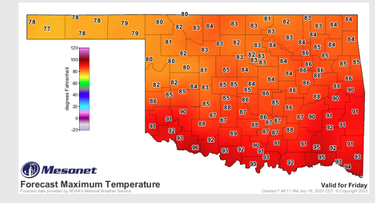
McManus says come Friday, we may see a little relief from this heat as we see highs only in the upper 80s.
Enjoy it while it lasts because McManus says next week, racks up more triple-digit numbers, ” The heating is still gaining a bit of momentum well past the solstice because the days (and the heat) are still much longer than the nights (and the cooling), so the heat continues to accumulate. And NORMALLY by this time of the year, our soil moisture is flagging due to that heat and therefore more of those suns rays are going towards heating the Earth’s surface and less is being used to evaporate soil moisture (which is a cooling process).”
McManus said the good news is right now our soil moisture looks much better than it has in the past, “The heat peaks on July 23 at 95.4F and stays elevated at that peak to around Aug. 7, then starts to decrease pretty rapidly. Again, climatological speaking. Looking at the actual weather this year, we don’t have much of a soil moisture problem right now for most of the state.”
To read more from State Climatologist Gary McManus, visit his weekly ticker here:


