

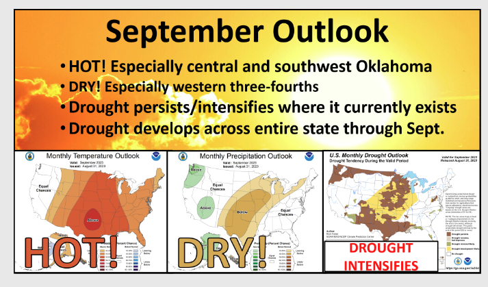
September has arrived, and with it comes Hot Dry Weather. State Climatologist Gary McManus said, “The heat and dry weather roared back with a vengeance, however, and flash drought erupted for the second consecutive summer.”
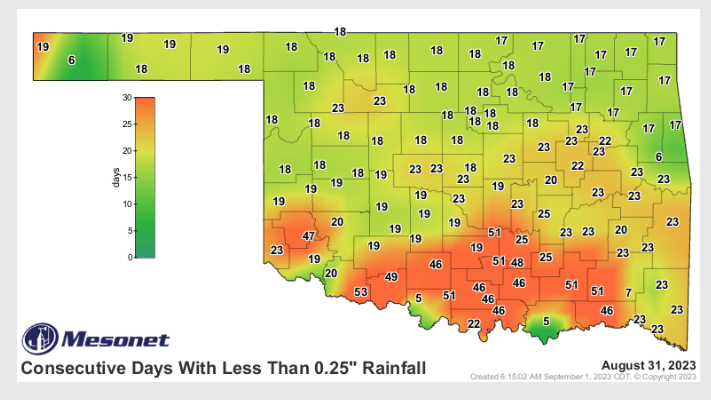
This week’s drought monitor shows how triple digit temps and very few rain showers have affected the state so far, “Only 13% of the state was in drought on Aug. 8 according to the U.S. Drought Monitor, contained entirely in small patches across far southwestern and north central Oklahoma. That amount had increased to 36% in just three weeks’ time, and the percentage of the state in at least severe drought rose from 6% to 20% over that period. The entirety of that
increase occurred in the southern half of the state where some Oklahoma Mesonet sites had gone as many as 53 days without a quarter-inch of rain in a single day. The flash drought left much of southern Oklahoma with flagging soil
moisture, dead and dormant vegetation, and critical wildfire conditions.” Said McManus.
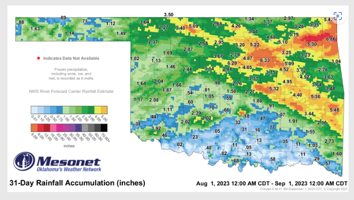
It’s been hot for awhile in Oklahoma, but thankfully we did see some good rains in July. However, McManus says that is quickly depleting, and this August is ranked as the 44th driest August since records began back in 1895. McManus says some areas did see rain across the state, but it was all hit or miss, ” The month’s rainfall was yet another tale of the haves versus have-nots in Oklahoma, with the southwestern half of the state going largely without rainfall through the month, while the northeastern half enjoyed more robust totals. Widespread 1-3 inches deficits were common across the
southwestern half, with similar surpluses to the northeast. Totals ranged from 6.86 inches at Jay to 0.02 inches at both Grandfield and Ringling. Thirty-seven of the Mesonet’s 120 sites recorded an inch or less for the month. The June-
August statewide average finished at 12.31 inches, 1.62 inches above normal, and ranked as the 29th wettest climatological summer on record. West central Oklahoma’s average of 15.82 inches ranked as their wettest summer on record, 6.35 inches above normal. The first eight months of the year were the 43rd wettest with a statewide average of 25.67 inches, 0.42 inches above normal.”
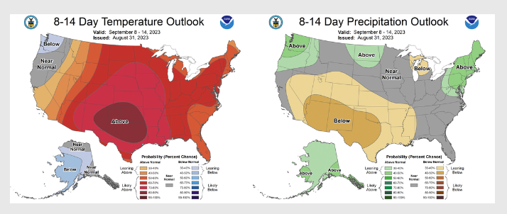
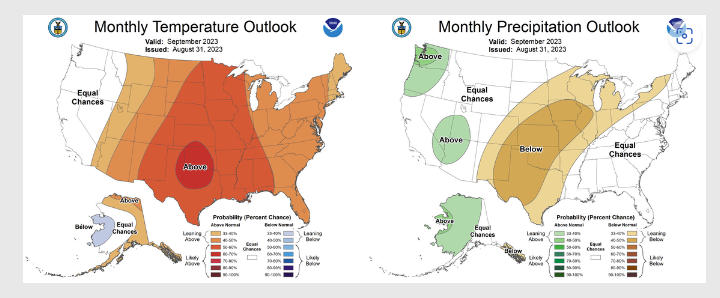
As we get into September, McManus said the outlook for big-time drought relief is not great, “The prospects for drought relief look somewhat bleak according to the Climate Prediction Center’s September outlooks, which indicate increased odds for above normal temperatures and below normal precipitation for the entire state. Those odds are particularly enhanced for both across the western three-fourths of the state, each of which could lead to further drought intensification should they occur.”
There still could be some hope for rain. As well all know, the State Fair of Oklahoma usually brings a shower or two to town, and with it being hurricane season, we could also see some moisture from tropical storms and hurricanes, but nothing too promising just yet. To see the mesonet ticker from Gary McManus, click here;


