

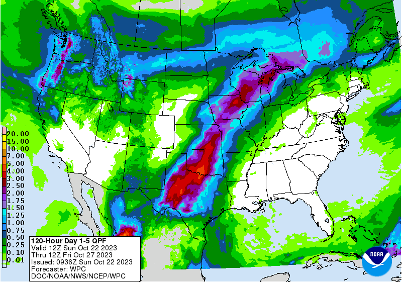
Forecasters are predicting significant rain for the first time since mid summer across a good portion of Oklahoma- including areas that have felt a flash drought rise up in recent days. State Climatologist Gary McManus said these rains- if the systems bringing it into Oklahoma hold together, “would be key to stop the flash drought in its tracks.”
Best chances of rain as seen in the latest forecasts are showing up Tuesday into Wednesday with the main body of the state with at least an inch of rain- with under an inch projected for the panhandle. The forecast map above was released on Sunday morning by the National Weather Service. According to the Weather Prediction Center of the National Weather Service- the combination of a Pacific Front with Tropical Storm Norma are pushing closer to Texas and Oklahoma- “As the frontal system continues east, increasing moisture associated with Tropical Storm Norma currently in the Pacific is forecast to bring showers and thunderstorms to the Southern Plains overnight Monday, with some locally heavy rainfall possible.”
Local Mesonet forecasts suggest best rainfall chances for Oklahoma are Tuesday and Tuesday evening- starting in the southwest and moving up into the state.


