

Well Winter has officially shown up in Oklahoma, leaving Fall in the Dust.. However, according to State Climatologist Gary McManus we will be seeing fall-like temps across the state this weekend, “A warm-up through the weekend then a minor cold front.” We will be seeing temps climb into the high 60s, and low 70s across the state starting on Friday and Saturday just in time for daylight savings time. (Don’t forget to Fall Back one hour on Sunday, November 5) Thursday we are looking at a high of 62, with a low as 42, then Saturday it warms up to 72 with a low around 54.
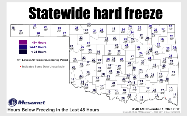
Temps have been COLD the past few days with lows in the teens and low 20’s, “Those 16s at Nowata and Vinita are the lowest temperatures ever recorded on a Nov. 1 on the Mesonet since its temperature records began in 1997, besting.
Hooker’s 17 degrees in 2019.”
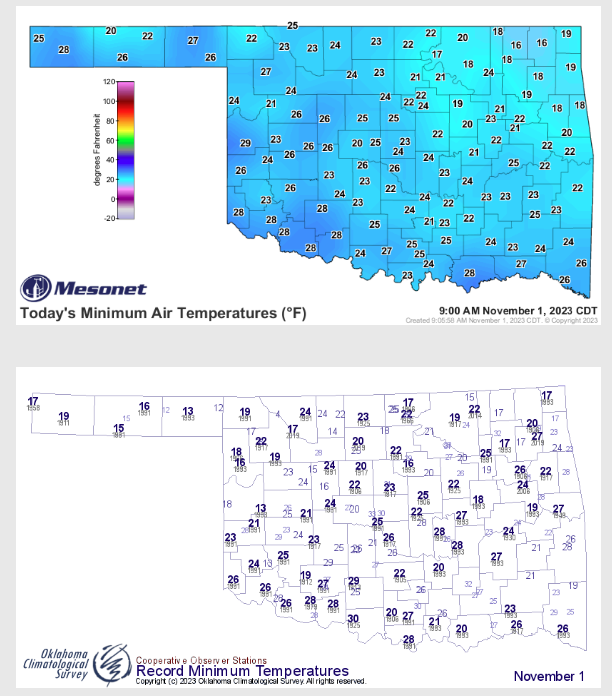
McManus says some models are showing another storm system in 10-14 days, but its still a ways out. The last rain system that made its way through the state brought good rain, “A more conventional storm system from the west that brought another round of rainfall to the state and ushered in significantly cooler weather. The last system arrived during the month’s final weekend, accompanied by a blast of Arctic air, offering Oklahoma an early taste of winter. Freezing rain, mixed with sleet and snow, created hazardous driving conditions across the Panhandle and far northwestern Oklahoma on the 28th and 29th, while the rest of the state experienced a cold rain in blustery conditions. Another surge of cold air
greeted Oklahoma’s trick-or-treaters, leading to a frigid Halloween night with wind chills in the 20s and 30s on the evening of the 31st.”

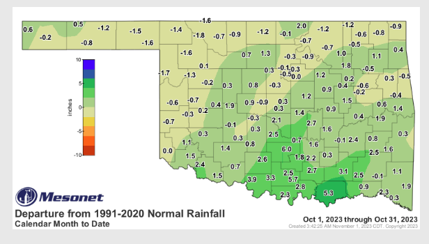
Statewide average rain fall for the month stood at 3.88 inches, and ranks as the 37th wettest October since records began back in 1895, ” The late-month storms contributed to surpluses of 3-6 inches across south central Oklahoma, making it the 15th wettest October on record for that region of the state, exceeding the normal by 2.92 inches. However, far northwestern Oklahoma and the eastern Panhandle received limited rainfall, resulting in deficits of 1 to 2 inches. Ardmore led the month with 9.74 inches of rainfall, while Beaver had the lowest total at 0.36 inches. An additional 31 sites of the Mesonet’s 119 active locations recorded at least 5 inches of rainfall, while nine sites in the far northwest and Panhandle ended the month with less than an inch. The first ten months of the year concluded with a statewide average of
32.42 inches, surpassing the normal by 0.49 inches and ranking as the 42nd wettest January through October since records began in 1895.”
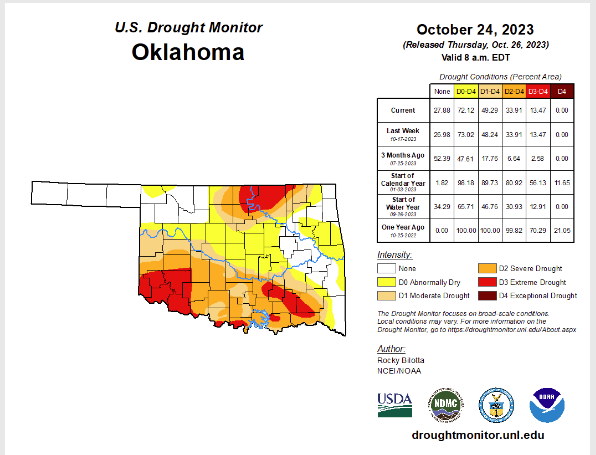
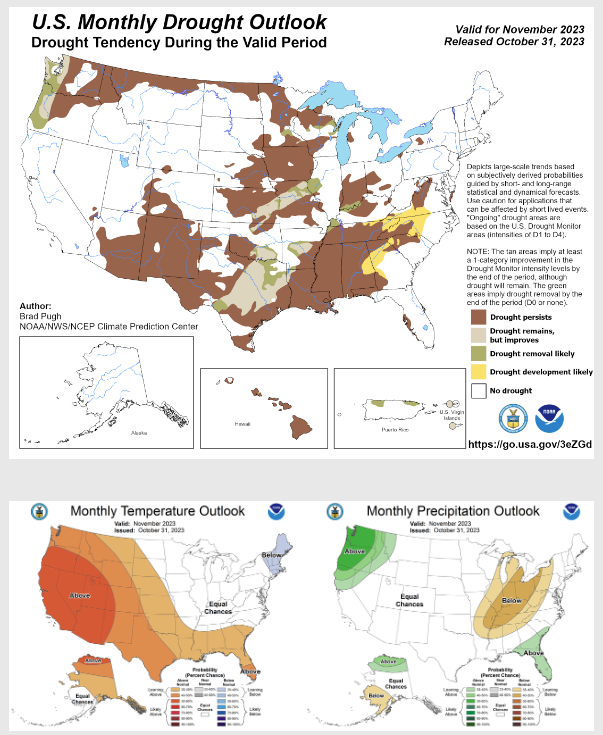
Before the remnants of Tropical Storm Norman hit the state drought coverage had surged to nearly 50% of the state according to the US Drought Monitor. McManus says the precipitation we have received will be reflexted in next week’s drought monitor, “The precipitation that fell during the final week will be reflected in the following week’s U.S. Drought Monitor report. The Climate Prediction Center’s November drought outlook reflects these changes, with expected improvements in parts of south central and north central Oklahoma. Drought is anticipated to persist through November in other parts of the state. The temperature and precipitation outlooks predict above-normal temperatures with an equal
probability of above-normal, below-normal, or near-normal moisture.”
To hear more from State Climatologist Gary McManus on his mesonet Ticker, click here:


