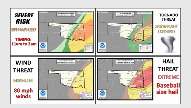
Today is one of those ‘weather aware’ days according to State Climatologist Gary McManus, “That recognition of moisture return in advance of a cold front and dryline makes your hair stand up on your head. Add highs in the upper-70s
and probably a few low-80s and you have trouble brewing in severe weather city.”
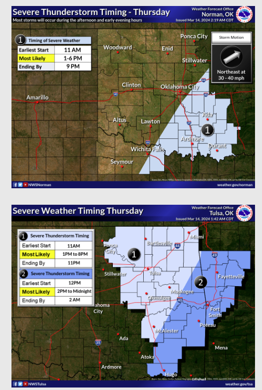
McManus said storms could start kicking off this morning and head East, “With discrete supercells possible
as they tread eastward before lining out and forming an MCS. It’s in the discrete mode that they are most dangerous.”
Not much is expected for Western Oklahoma, as they are still in a possible flash drought Mode. McManus says after this system moves through we should continue to see spring-type seasonable temps, and little chance for rain.
To Read more from State Climatologist Gary McManus on his Ticker, click here: