Oklahoma is experiencing a severe dry spell, with drought conditions intensifying across much of the state. According to State Climatologist Gary McManus, the situation is becoming increasingly dire, marked by a prolonged lack of significant rainfall.
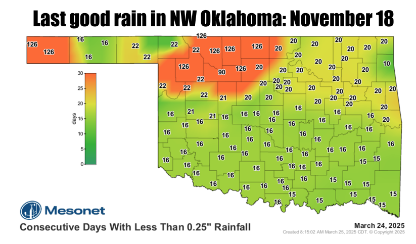
“The last time Medford received at least a quarter-inch of rain (or melted snow/ice) in a single day was back on Nov. 18 at 0.59 inches. They’ve only received 1.01 inches since,” McManus reports. This stark statistic highlights the severity of the dry period, emphasizing the minimal precipitation received in recent months.

Looking at the broader state picture, historical rainfall data reveals alarming trends. “NW OK has had their 2nd-driest last 120 days in the last 100+ years, an average of 4″ below normal,” McManus notes. This places the current dry spell within a historical context, illustrating the rarity and severity of the current conditions.
While some areas are faring slightly better, the overall picture remains concerning. “Some areas are a bit better off, but still mostly top-15 driest last 120 days on record. So a bit better, but still really bad,” McManus clarifies.
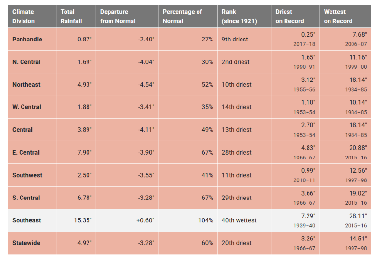
He further elaborates on regional disparities, stating, “Southeast OK and their surplus of 0.6 inches.”
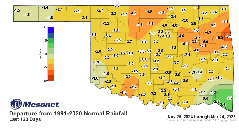
The core issue, as McManus explains, is the deviation from normal rainfall patterns. “The 120-day rainfall departure maps tell the story. So yes, drought is intensifying once again across Oklahoma, spreading rapidly in the blast furnace fire weather conditions we’ve seen over the last few weeks.”
Adding to the concern is the lack of forecasted relief. “The worst part of the story is no good rains showing up just yet across much of the driest areas. The SE third of the state comes out okay in the forecast,” McManus reveals.
However, there is a glimmer of hope. “The best part? Our normal wettest time of the year (for all but the Panhandle) is just starting, with 35-50% of our normal precip being accounted for in the April-June time frame. The Panhandle normally sees most of their precip in the summer months, tied into the Desert Southwest monsoon season,” he points out.
McManus concludes with a crucial reminder: “Remember, these maps show what we would NORMALLY expect, based on past conditions (i.e., ‘normals’). NOT getting that is how droughts increase.” This emphasizes that the current drought is a direct result of deviating from these established rainfall norms.

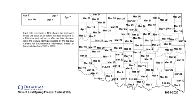
We are past the earliest spring freeze that we have seen, but knowing Oklahoma McManus says “It is Oklahoma, though, so expect a blizzard in April sometime. Not this week, though, and not next week, either. Probably. Rain? Well, you know how it goes…again, Oklahoma. Those that need it won’t get it, and those that don’t need it soon will anyway.”
To read more from McManus on his mesonet ticker, click here: