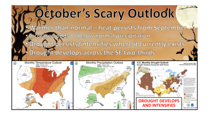
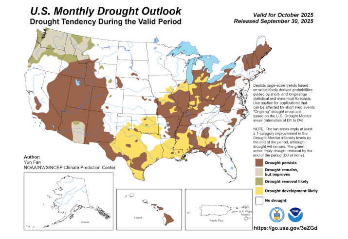
While Oklahomans enjoyed a deceptive, cool start to autumn, the state now faces an escalating drought threat. State Climatologist Gary McManus warned that the official October outlook favors conditions—above-normal temperatures and below-normal precipitation—that are prime for drought expansion.
“We definitely don’t want to see drought flourish in October, but that’s what the outlooks are saying,” McManus noted, pointing out that the forecast is heavily influenced by the dry, warm pattern expected through the first two weeks of the month.
The silver lining, McManus suggests, may be approaching slowly. “We do see a hint of a possible pattern change for next week… maybe some rain,” he said, before adding his trademark humor about persistent forecasting delays: “At this rate, we’ll finally get that big cold front sometime around Halloween!”
September’s Topsy-Turvy Performance
September 2025 proved to be a month of climatic contradictions. A delightful taste of early fall weather from late August lingered through the first week of September, bringing welcome relief. However, summer quickly “grabbed the remote control again,” replacing the 60∘F and 70∘F highs with more customary 80∘F and 90∘F readings.
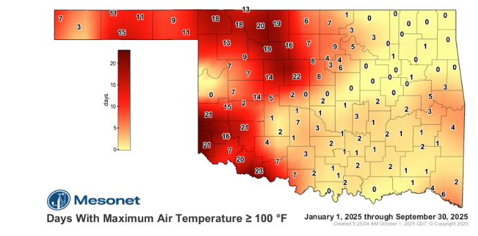
Despite this summer comeback, the month managed one notable feat: for the first time since 2008, the Oklahoma Mesonet failed to record a single 100∘F air temperature during September. The last triple-digit readings of the year occurred back on August 28. The statewide average temperature finished at 73.8∘F, a modest 0.9∘F above normal, ranking as the 56th-warmest September on record.
Rainfall Shortfalls and Emerging Deficits
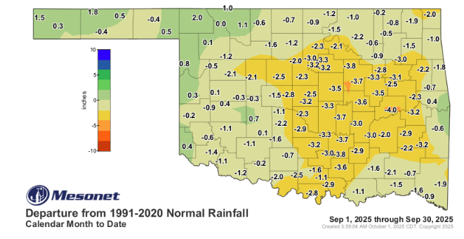
The impressive, soaking rains of August failed to materialize through much of September. Rainfall deficits of 2–4 inches became common across large swaths of the state. Central Oklahoma fared the worst, recording a deficit of 2.87 inches, marking its eighth-driest September on record.
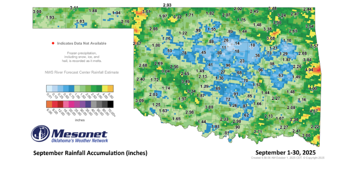
Overall, the statewide average precipitation was just 1.91 inches, a disappointing 1.41 inches below normal, ranking it as the 27th-driest September since 1895. Only three of the 120 Mesonet sites topped 4 inches, with Sallisaw leading the state at 4.94 inches, while Marena bottomed out with a paltry 0.11 inches.
Drought Creeps Ahead
These shortfalls have allowed drought to slowly creep back into the picture. While long-term moisture surpluses, fueled by abundant spring and summer rains—including April’s record-setting totals—have prevented widespread disaster, the warning signs are clear.
By the end of September, the U.S. Drought Monitor showed 3% of the state covered by drought, the highest level since May 27. More concerningly, 24% of the state was classified as “abnormally dry,” a direct precursor to full-scale drought.
The Climate Prediction Center (CPC) reinforced these concerns, forecasting that drought development is “likely” across the southeastern two-thirds of Oklahoma by the end of October.
McManus concluded his assessment and urgently: “At any rate, our ‘beautiful’ weather continues, but so does our ‘ugly’ weather. Yes, we need rain. Badly.”
To read more from State Climatologist Gary McManus on his ticker, click here: