Thu, 06 Oct 2022 09:03:56 CDT
According to state climatologist Gary McManus We now have 76% of the state in that Extreme/Exceptional (D3/D4) drought on the Drought Monitor. McManus says "This is territory not seen in the state since early February 2013. While that was year three of our horrible 2010-15 drought period, what I remember from that time was empty lakes, water emergencies, and runaway wildfires. While we're not in emergency territory yet with our lakes, they ain't good. And we are going to have a horrible wildfire season without help. We might anyway."
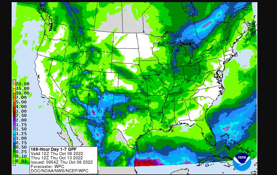
Not Many rain chances are showing up on the radar, McManus says the forecast for far Western Oklahoma and the Panhandle have the best chances over the next seven days.
Oklahoma reservoir Levels show most of the lake levels are below normal pool storage with Lake Lugert-Altus at -25ft below the normal pool elevation, Draper is -10ft, and Broken Bow -12ft.
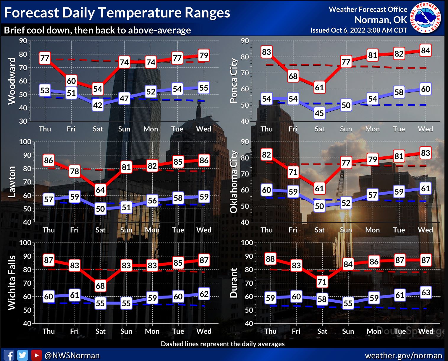
McManus says fall weather is headed this way next week though starting on Friday with the arrival of the strongest cold front we have seen thus far, "I would expect to see highs struggle to reach the 60s where it's drizzly/rainy out west, especially in NW OK…60s and 70s elsewhere. Then a longer stretch of "hey, shouldn't we be in the 70s" weather coming back with highs up into the 80s again. "