Statewide Discussion: Offset fire environment conditions have resulted in below normal activity across Oklahoma. Recent wet weather has dampened activity across much of the state although the Panhandle and northwestern counties have not faired so well with persistently dry conditions where extreme and exceptional drought indices remain firmly entrenched. Although not fully aligned, elevated fire weather over fuels predominantly separated for rainfall will lead to increasing fire danger through the weekend. An early week opportunity for rainfall across Oklahoma will be welcomed should it deliver as potential for an enhanced fire-effective weather system arrives Wednesday placing emphasis on far western Oklahoma.
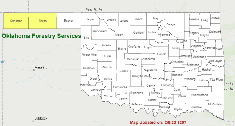
Today: Fire weather is poorly aligned overall. The highest fire danger indices will develop during a brief period this afternoon in far western Oklahoma (Ellis, Roger Mills and Beckham Counties) where temperatures will warm into the mid-40°’s with relative humidity values around 25% under clearing skies. North winds sustained around 15 mph gusting to 25 mph will support moderate rates of spread, maintaining good initial attack opportunities. Further north and west into the Panhandle wind speeds remain well below critical threshold, limiting fire spread potential. Elsewhere in Oklahoma recent rainfall, slowly clearing skies and elevated relative humidity values will limit fuel receptiveness.
Saturday: Fire danger indices increase across the Oklahoma Panhandle into northwestern Oklahoma where new fire occurrence may exhibit a bit more aggressive fire behavior although probability of initial attack success remains high given the relatively short burning period. In this area, a cold start will give way to temperatures warming into the 53°-60° range under mostly-clear skieswith relative humidity values dipping into 14-24% range driving fine-dead fuel moisture values briefly to 4%. South-southwest winds sustained 14-23 mph with higher gusts will support head fire rates of spread 142-213 ft/min with flame lengths 12-14 ft. where grazing/haying has not occurred. Otherwise, ROS around 100 ft/min and FL +/- 7 ft. should be expected. Conditions will quickly moderate following sunset.
Sunday: Drier air will overspread Oklahoma supporting increased, broader scale fire danger although the highest fire danger indices will remain in northwestern Oklahoma and areas of far western Oklahoma. In NW/far western Oklahoma, where there is 50+ days separation from wetting moisture, temperature will warm to around 60° with afternoon relative humidity values in the 20%’s. Increasing sky cover will serve to hold fine-dead fuel moisture values outside of the critical threshold with observations generally 7%. South-southwest winds 15-20 with some gusts above 25 will drive moderate rates of spread in rangeland fuels 120- 160 ft/min with flame lengths 7-11 ft
NOTE: Fuels will become more receptive in areas along and east of I-35 with limited initial attack activity expected. Given recent rainfall, firefighters are encouraged to scout potential control lines on foot prior to committing engines and equipment to avoid becoming stuck in soft ground.
Near-Term: Rainfall and mixed precipitation potential returns early next week with current forecast data supporting nearly statewide potential noting that wetting amounts currently predicted to favor central and eastern Oklahoma. Location, amount and duration of precipitation potential will be important as potential for a fire-effective
weather system approaches far western Oklahoma mid-week.
