

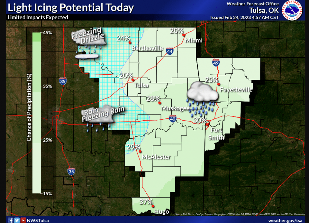
Severe Weather is forecasted for the state on Sunday. Still, State Climatologist Gary McManus says today’s weather may also present some problems: “Everybody is staring at Sunday when today might hold some unpleasant impacts as well. There is a chance for freezing mist/drizzle/rain throughout the day where the temperatures remain below freezing. It has been cold enough lately to allow some accumulation on at least bridges and overpasses.”
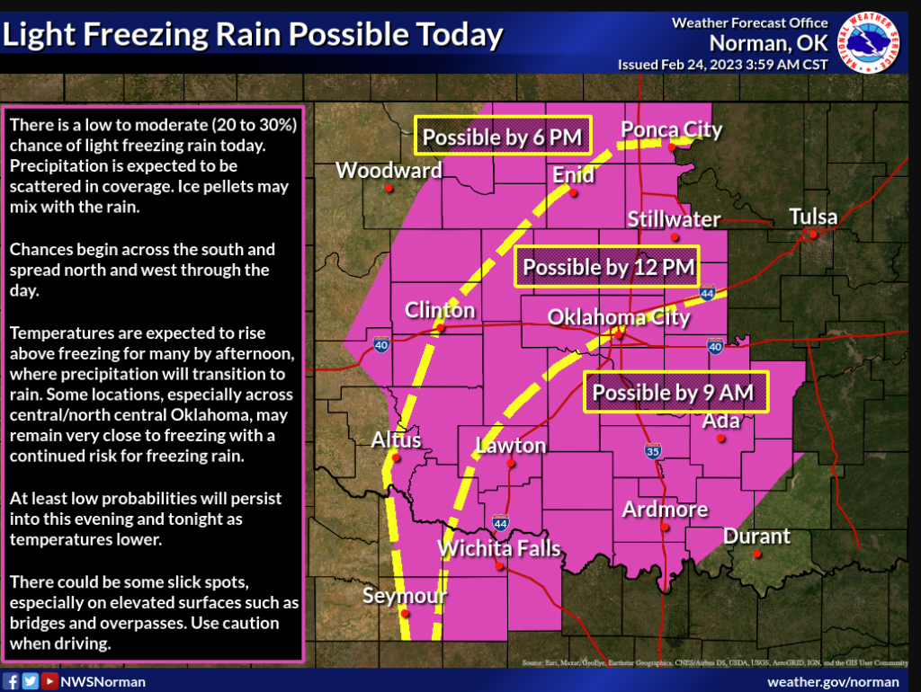
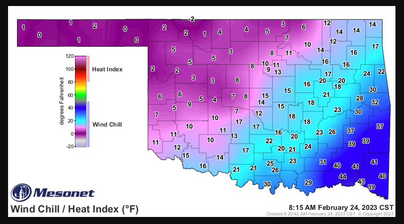
McManus says while we aren’t sure what this weather will bring, but one thing for sure is that it will continue to stay cold this weekend.
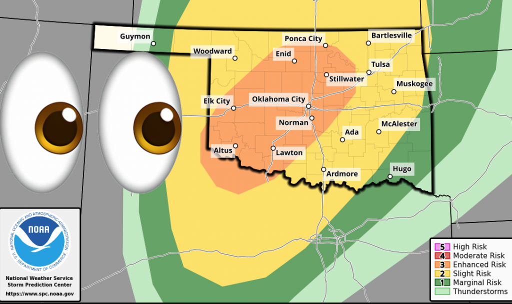
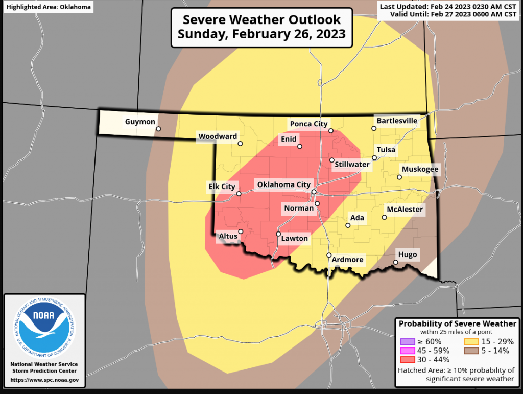
As Sunday rolls in we will see a potential for Severe Weather, “The potential for severe weather is still there, and the Storm Prediction Center across the hall from me has issued an “Enhanced” risk for that day, surrounded by “Slight” and “Marginal” risks.”
McManus says there is still uncertainty three days out but says the current SPC,
“NAM forecast soundings at 03Z on Monday have weak instability in place across the moist sector with peak SBCAPE near 500 J/kg. In addition, wind speeds increase from near 15 knots at the surface to about 70 knots at 850 mb. This strong speed shear should be favorable for supercell development. Although mid-level lapse rates will be steep enough for isolated large hail, the threat will likely remain somewhat isolated, due to a late afternoon and early evening
capping inversion. The cap is expected to weaken by mid evening. This, combined with a strengthening low-level jet, should allow for robust convective development. The most favorable area for organized severe storms will be from northwest Texas, extending northeastward into north-central Oklahoma. In addition to a threat for large hail,
wind damage will also be possible. The wind-damage threat should be maximized with the strongest of storms during the evening. The threat could linger into the overnight if a severe convective cluster can remain organized.”
With this storm system, the possible primary threats will be large hail and damaging winds, so be weather aware!
To read more from Gary McManus on his mesonet ticker, click here:


