

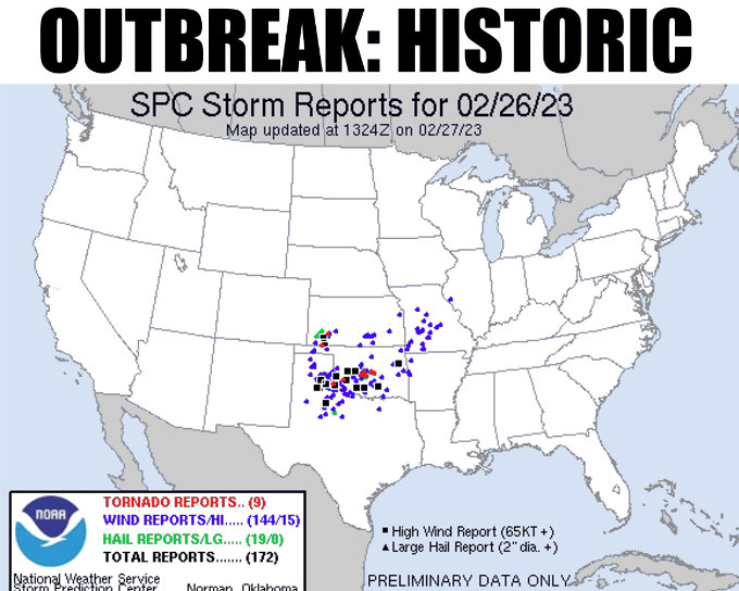
What a night across the state last night as a dozen or more tornadoes touched down. State Climatologist Gary McManus says we won’t know the extent of the damage until local weather folks from the NWS and SPC offices go out and investigate what was tornadic damage vs. straight-line wind damage.
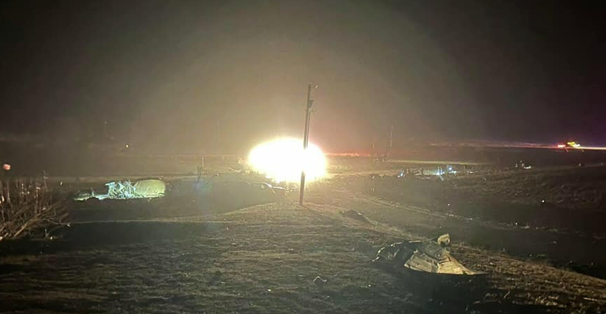
Channel 9’s David Payne showed the tornado’s on his facebook page this morning:
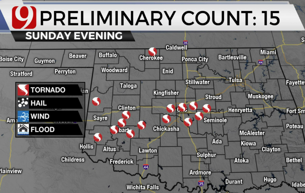
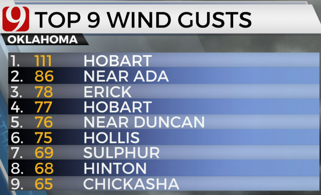
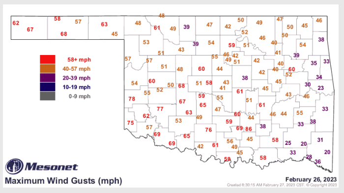
According to Payne, wind gusts got up to 111 in Hobart, 86 near Ada, and even up to 65 in Chickasha. Storm damage was reported across the state, including Shawnee, where we saw Several damaged buildings. Norman also received damage with a reported EF2 Tornado with several homes impacted.

Cheyenne in Western Oklahoma was among the hardest hit in the state, with several homes destroyed. Today schools are closed in Cheyenne. The Tornado touched down on the west side of town around the cemetery and airport area and proceeded Northeast to the Northwest corner of town and then a few miles west of Strong City. State Representative Anthony Moore, OK HD57, posted pics of damage in Cheyenne on his Facebook Page;
While February tornados are not the norm, McManus says we have seen them, “We blew away the record for tornadoes in February, the previous high which was 6 in 1975 and 2009. Now you’d be hard-pressed to find a worse single TORNADO than the one that struck Lone Grove back on Feb. 10, 2009, a killer EF4 twister that left 8 dead and 46 injured.”
February has brought several severe weather events in the past including the February 1975 Tornado with 5 of 6 twisters being F2s. McManus says we also saw softball-sized hail that day with lots of damage, “If you look back at the total number of tornadoes for 1975 and 2009, they were relatively mundane, both finishing with annual totals of 34 tornadoes. But if we end up with a dozen or more twisters yesterday–and I dare say that number could go well above a dozen–combine that with the record 5 tornadoes we had last month and we’re already looking at maybe 20+ for 2023 already.”
McManus says if this is a preview of whats to come, we are off to a rocky start, “Winds have calmed somewhat, but we had 59 severe wind gusts (at least 58 mph) during the last 24 hours recorded by the Mesonet, the tops of which was 86 mph at Fittstown at 10:25pm.”
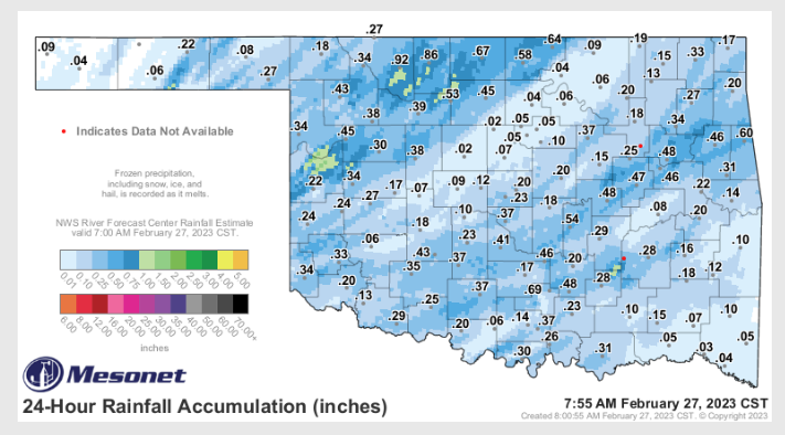
We did see some rain from the severe weather last night, and McManus says the weather appears to look much calmer for the next week or so, with the possibility of storms in SE Oklahoma on Wednesday and Thursday.
To read more from Gary McManus on his mesonet ticker, click here:


