Following a weekend of increased wildfire activity, Oklahoma fire officials are warning of high to very-high fire danger today and tomorrow. A combination of unseasonably warm temperatures, gusty winds, and dormant winter vegetation has created a volatile environment for fire spread across the state.
While some areas saw light sprinkles yesterday, meteorologists report that the precipitation had virtually no impact on the state of the fuels. With the ground dry and temperatures soaring well above normal, conditions are primed for rapid ignition and spread.
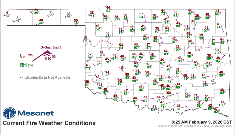
Critical Conditions: Red Flag Warning in Effect
The most severe danger is concentrated in the Oklahoma Panhandle and far northwestern Oklahoma, where a Red Flag Warning is in effect today beginning at Noon.
- Timing: The warning lasts until 6:00 PM in the Panhandle and 7:00 PM in Northwestern Oklahoma.
- The Threat: Temperatures are expected to hit 75°–80°F under clear skies. When combined with relative humidity dropping as low as 9% and southwest wind gusts reaching 35 mph, the environment is critical.
Fire analysts warn that “challenging initial attack” conditions should be expected. Because there is an above-normal load of fuel (grass and vegetation) on the ground, fires can grow quickly. In areas with heavy fuel loading, flames could reach lengths of 17–25 feet, moving at speeds up to 300 feet per minute (roughly a football field every minute).
Regional Breakdown
While the Panhandle faces the most extreme threat, elevated fire danger exists statewide.
- Western/Southwestern Oklahoma: Similar to the northwest, temperatures will hover near 81°F. Winds will pick up by mid-afternoon, gusting to 25 mph. Grass fires here could see flame lengths of 14–18 feet. Conditions are expected to subside around 8:00 PM.
- North-Central/Northeastern Oklahoma: The day starts cool, delaying fire risks until the afternoon. Winds will be strongest along the I-35 corridor. In tall-grass areas, fires could spread rapidly (80–140 ft/min) with significant flame intensity.
- South-Central/Southeastern Oklahoma: Winds are expected to be calmer here, keeping fire spread potential in the “moderate” range. However, due to the high volume of recent activity—including both wildfires and prescribed burns—residents should expect a high frequency of smoke and fire reports today.
Looking Ahead: A Shift in Weather
A cold front is expected to enter northwestern Oklahoma on Tuesday morning, slowly moving across the state throughout the day.
- Tuesday Forecast: The front will bring cooler temperatures and higher humidity to the Panhandle, relaxing the fire danger there. However, locations south of I-44 will continue to see above-normal temperatures.
- Rain Chances: Modest rain chances are forecast for Tuesday evening into Wednesday, though amounts are not expected to be significant enough to “wet” the fuels thoroughly.
- Long-Term Outlook: Fire danger indices will hold at “moderate” for Wednesday and Thursday. However, forecasters are optimistic about a second cold front arriving later in the week, which brings the potential for widespread, wetting rainfall that could significantly reduce the fire threat statewide.
To see the latest Burn Bans, click here: