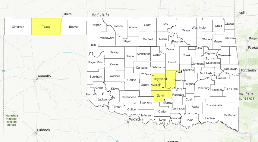
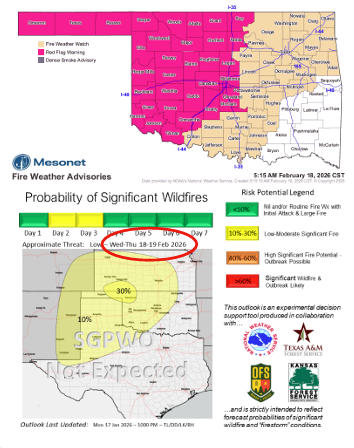
Recent observations from high-impact wildfires in northwestern Oklahoma confirm that fire behavior has met “extreme” thresholds. While a Red Flag Warning remains in place for central Oklahoma today, a Fire Weather Watch has been issued for Thursday, signaling that elevated fire danger is pushing further east into the northeastern and south-central portions of the state.
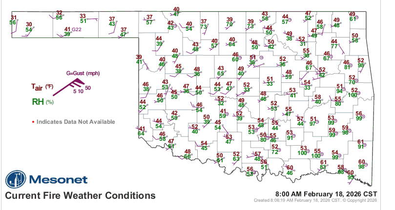
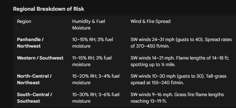
A critical factor in the current emergency is poor overnight moisture recovery. In the northwest, the air failed to regain humidity during the night, leading to a “near-continuous burning period” where fires do not settle down after sunset. Today, relative humidity is expected to drop as low as 14% in central Oklahoma and 18% in the far east.
Operational Challenges and Resource Mobilization
Suppression efforts face a unique physical challenge: ground saturation. Despite the high fire danger, recent weekend rainfall has left the soil wet in specific areas. This creates a paradox where surface fuels (grass and brush) are dry enough to burn intensely, yet the heavy equipment required to extinguish them—such as dozers and engines—may become stuck or face limited access.
To combat the growing threat, Oklahoma Forestry Services (OFS) has mobilized suppression groups consisting of engines, dozers, and overhead personnel to the following strategic hubs:
- Woodward (2 Groups)
- Guymon
- Shawnee
- Henryetta
The Thursday Transition and Long-Range Outlook
On Thursday, fire crews expect a “notable increase” in new wildfire occurrences. While the rate of spread may be slightly lower than previous days (estimated at 140–240 ft/min), a shifting wind from the southwest to the west-northwest will challenge containment lines on established fires.
As composite fuel moisture continues to degrade, resistance to control is expected to increase. Looking ahead, fire danger indices may relax slightly from Friday through Monday; however, meteorologists are already tracking signals for a return to near-critical fire weather by next Tuesday. This upcoming window suggests a high potential for significant fire activity returning to western and central Oklahoma.
County Burn Bans: Click HERE for current burn ban information.