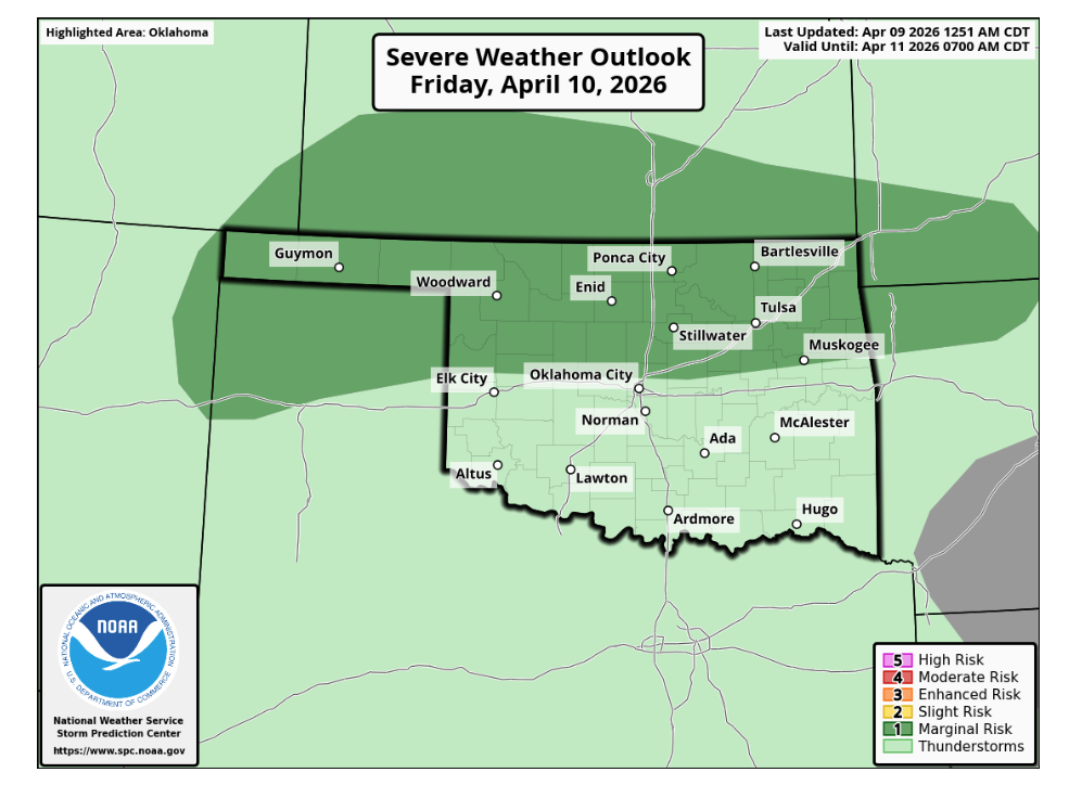
As the state enters a volatile spring pattern, the latest Oklahoma Severe Weather Outlook indicates a multi-day window for potential storms and much-needed moisture. According to State Climatologist Gary McManus, the atmospheric setup begins with marginal severe weather risks in the Panhandle and northern Oklahoma tonight, before shifting across the northern half of the state on Friday and into western Oklahoma by Saturday. While these initial rounds may bring hail and high winds, the primary benefit for many will be the potential for heavy rainfall.
Severe Potential Ramps Up
The forecast becomes increasingly complex heading into early next week. McManus notes that the Storm Prediction Center (SPC) risk maps for the four-to-eight-day period are already highlighting the region.
“The SPC risk maps for the 4-8 period are pinging our area already, which can often be a sign of significant severe weather being possible,” McManus said. He cautioned, however, that these long-range outlooks are subject to change. “The forecast can and probably WILL change as we get closer to those days, and not always for the better!”
Drought Deficits Persist
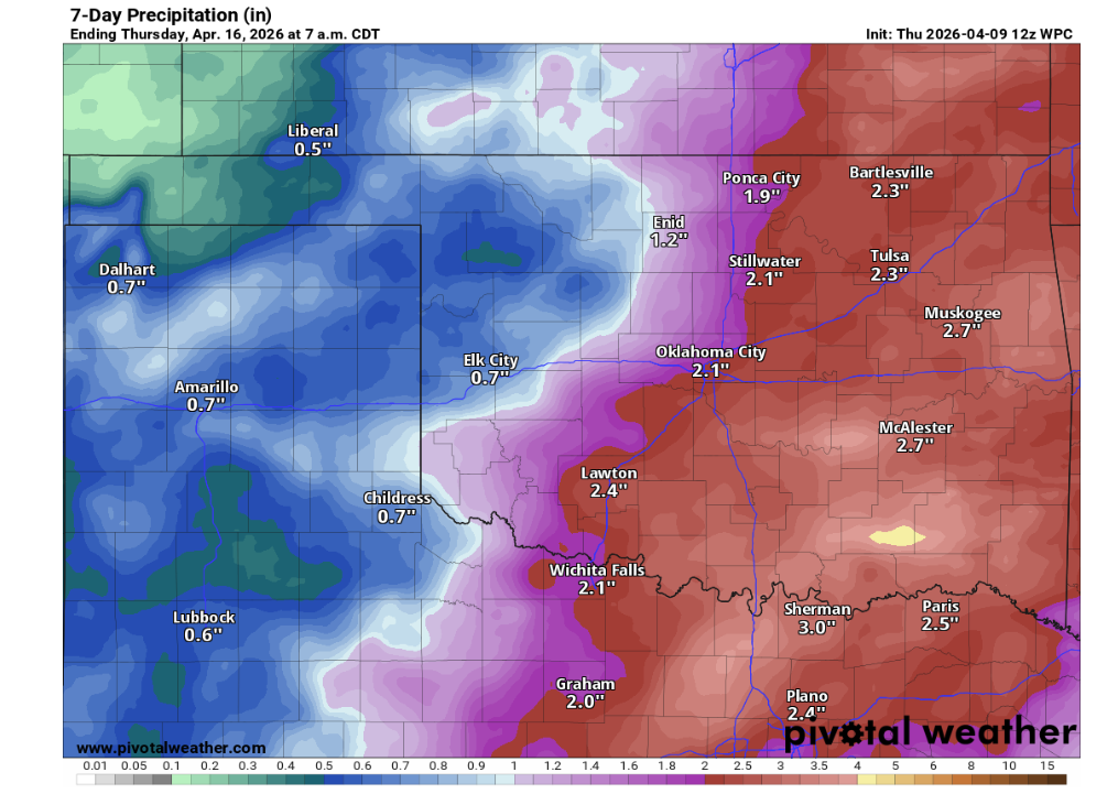
Despite recent precipitation, the state remains gripped by a significant moisture deficit. Currently, 99% of Oklahoma is still classified in drought. While last week’s rains provided a slight reprieve, McManus emphasizes that a single event cannot undo two-thirds of a year of dryness.
“You can’t end 8 months of deficits with one week’s rainfall, after all,” McManus said. “But we did knock it down a bit and left it vulnerable to another closely-timed rainfall event like we might see over the next week. We can’t keep doing the weeks between events deal.”
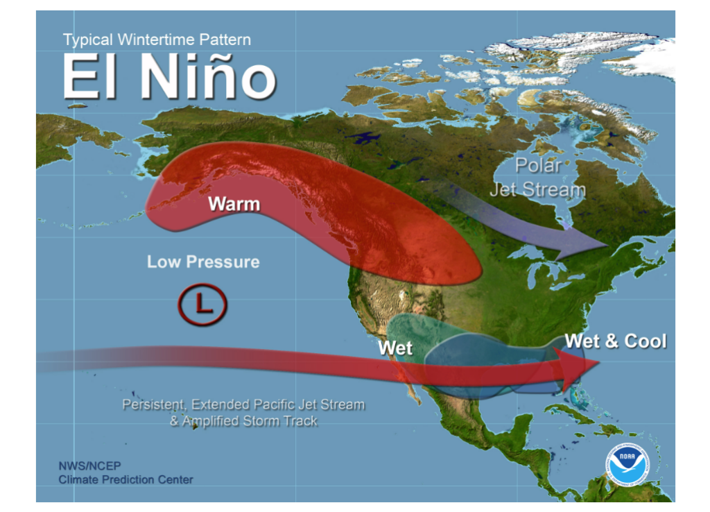
The Shift to El Niño
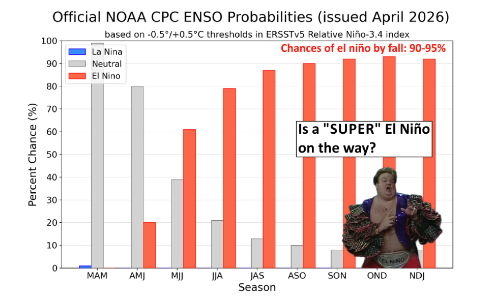
Looking beyond the immediate storm threats, the tropical Pacific is undergoing a major transition. After years of drought-fueling La Niña conditions, the Pacific has settled into an ENSO-neutral state, but a shift toward El Niño appears imminent. The Climate Prediction Center (CPC) currently estimates a 60–62% chance of El Niño developing by mid-summer 2026, with those odds climbing as the year progresses.
McManus points out that by the October-November-December (OND) period, there is a 93% chance of El Niño being present. The strength of this event remains the primary variable, with current data suggesting a 23% chance of a “very strong” event.
“Now if El Niño does take hold—and especially if it strengthens—it would have broad implications heading into late 2026 and early 2027,” McManus said. “For the southern U.S., including Oklahoma to some degree, El Niño winters often tilt the odds toward a more active storm track and wetter conditions.”
Historical Context and Future Impacts
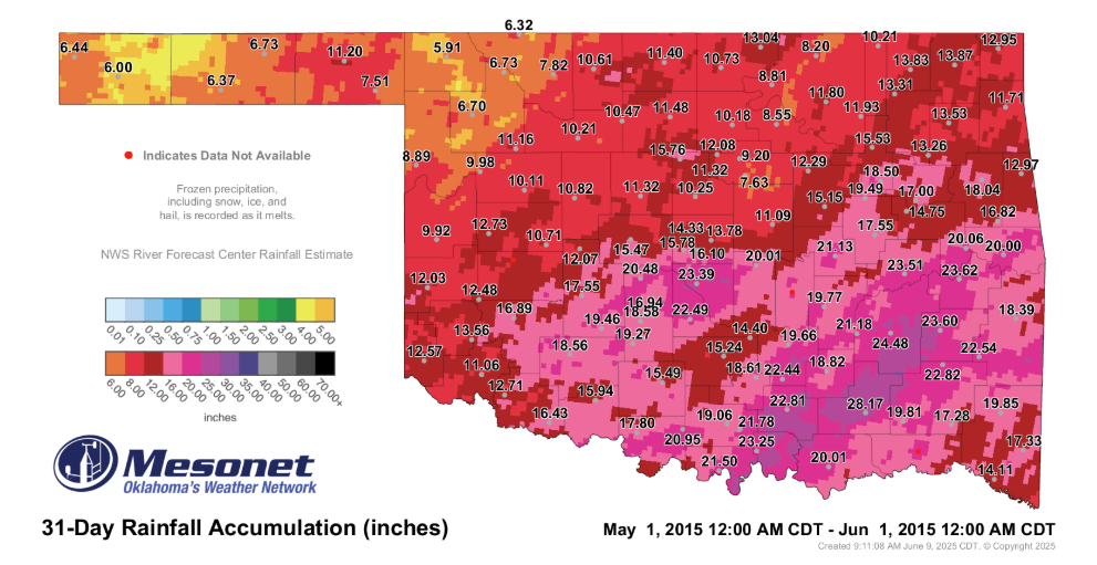
A strong El Niño has historically brought record-breaking moisture to the region. McManus referenced the “Godzilla” El Niño of 2015-16, which coincided with the wettest month and year in Oklahoma history. While ENSO patterns “load the deck” for certain weather outcomes, the exact timing of the storm track remains the deciding factor.
Farm Director KC Sheperd notes that for Oklahoma’s agricultural producers, the transition away from La Niña is a welcome development, as it traditionally signals a break from the persistent dry patterns that have plagued the state over the last two years.
“What we’re NOT looking at is La Nina, supposedly, which is the best news of all!” McManus said.
To read more from State Climatologist Gary McManus on his mesonet ticker, click here: