Elevated fire weather is expected across western Oklahoma today and Wednesday as afternoon relative humidity values dip below 20 percent and triple-digit temperatures persist. According to the latest Fire Situation Report from the Oklahoma Department of Agriculture, Food and Forestry (ODAFF) Oklahoma Forestry Services (OFS), overnight rain on Sunday and Monday brought moderate relief to northern counties, but the remainder of the state continues to face dry, hot conditions with separation from wetting rains reaching 30 to 59 days in southwestern and western areas.
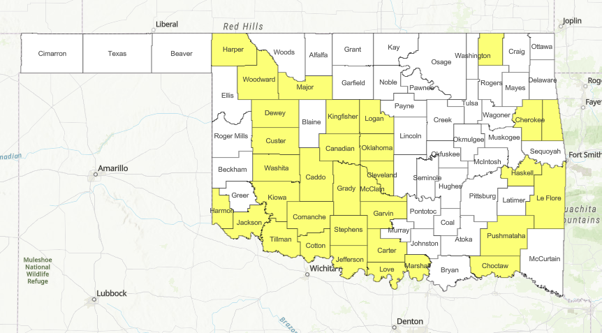
County Burn Bans Active Across the State
Due to the worsening flash drought and prolonged absence of wetting moisture, multiple county burn bans remain in effect across Oklahoma. Landowners, agricultural producers, and the public are urged to check the latest county-by-county resolutions before conducting any outdoor activities that could produce a spark. Under active burn bans, outdoor burning including campfires, bonfires, and trash burning is strictly prohibited, while specific exemptions apply to agricultural operations following certified burn plans and industrial work taking strict safety precautions.
Large and Significant Wildfire Activity
Oklahoma Forestry Services reports several large fires currently tracked across the state:
- Burnt Canyon Fire (Woodward County): 3,335 acres, 40% contained
- Snake Mountain Fire (Pushmataha County): 703 acres, 85% contained
- Wolf Gap Fire (Pushmataha County): 256 acres, 90% contained
- Pump Station Fire (Atoka County): 109 acres, 90% contained
- Springhouse Fire (Cherokee County): 173 acres, 90% contained
Initial attack activity on August 17 included one fire burning 1.6 acres in the East Central area caused by escaped debris, and two fires burning 21.0 acres in the Southeast area resulting from equipment and incendiary causes. Local fire departments reported an additional two fires burning six acres.
Regional Weather & Fire Behavior Breakdown
- Panhandle and Northwest Oklahoma: Highs will range from 100° to 104° with relative humidity between 15% and 22%, driving fine-dead fuel moisture to 3%. Southwest winds will reach sustained speeds of 10 to 16 mph with gusts up to 20 mph during peak heating hours. Where rain was missed, rangeland fuels may produce head fire rates of spread between 125 and 160 feet per minute with 10 to 14 foot flame lengths, along with potential torching and spotting in brush.
- Western and Southwest Oklahoma: Temperatures are forecast between 104° and 107° alongside 15% to 20% relative humidity. Fine-dead fuel moisture is sitting at 3% widely with localized drops to 2%. Southwest winds sustained at 9 to 15 mph will support spread rates of 125 to 160 feet per minute and flame lengths up to 14 feet. Juniper and brush fuels continue to present torching and short-range spotting challenges into the evening.
- Central Oklahoma: Highs will range from 102° to 107° with humidity levels between 19% and 27%, producing fine-dead fuel moisture around 4%. Southwest winds will hold around 10 mph along and west of Interstate 35. Grass fuels will support spread rates of 65 to 90 feet per minute with 8 to 10 foot flame lengths.
- Eastern Oklahoma: Temperatures will register from 101° to 107° with relative humidity from 24% to 31% and light, variable winds under 10 mph. Timber fuels, particularly where pine is present, will see spread rates of 15 to 30 feet per minute, with torching, spotting, and isolated short crown runs possible in pine plantations.
Statewide Outlook
Triple-digit temperatures are projected to remain a dominant factor across much of Oklahoma through the remainder of the week, particularly south of Interstate 40. While the majority of new starts continue to be captured during initial attack, large fire activity exceeding 300 acres remains most probable in areas where rugged terrain and heavy fuel loads limit access. For wildfire reporting or emergency resource mobilization, Oklahoma Forestry Services operates the Incident Resource Hotline at (800) 800-2481.