
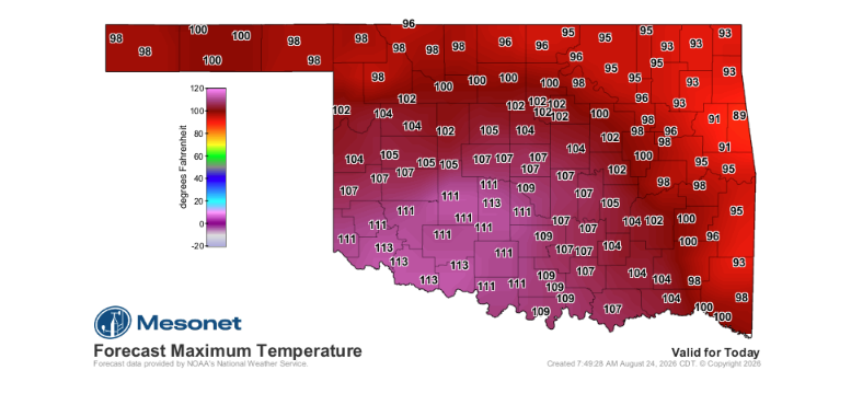
Late August is delivering some of the most intense temperatures of the season across Oklahoma, with the potential to mark the hottest day of the year so far.
According to State Climatologist Gary McManus, anyone assuming late August cannot rival the brutal conditions seen earlier in the month only needs to look at the history books. Extreme late-summer heat is far from unprecedented, with similar historical patterns seen on this date in 1922, 2011, and 2024.
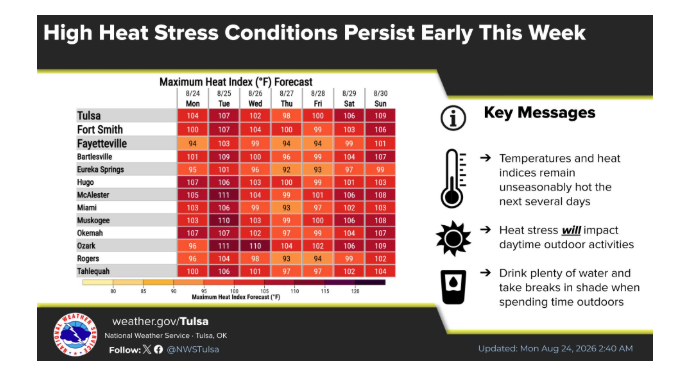
The ongoing weather pattern continues to illustrate the self-reinforcing cycle between dry conditions and soaring temperatures: drought promotes heat, which in turn deepens the drought.
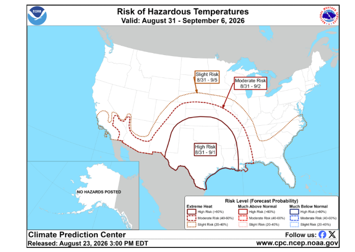
A brief reprieve is expected to bring temperatures down slightly, shifting conditions from significantly above normal to just slightly above average for a few days. However, long-range outlooks indicate that elevated heat will persist through the upcoming weekend and into the first week of September.
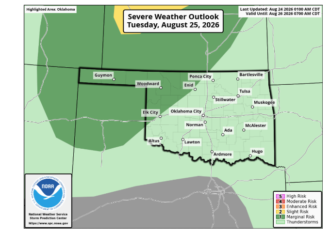
Scattered storm activity over the next few days could bring localized moisture across parts of the state. Recent storms have over-performed, though forecasters urge caution regarding strong downburst winds produced by collapsing storm systems. While these isolated events will settle dust rather than break the broader drought, they offer pockets of relief.
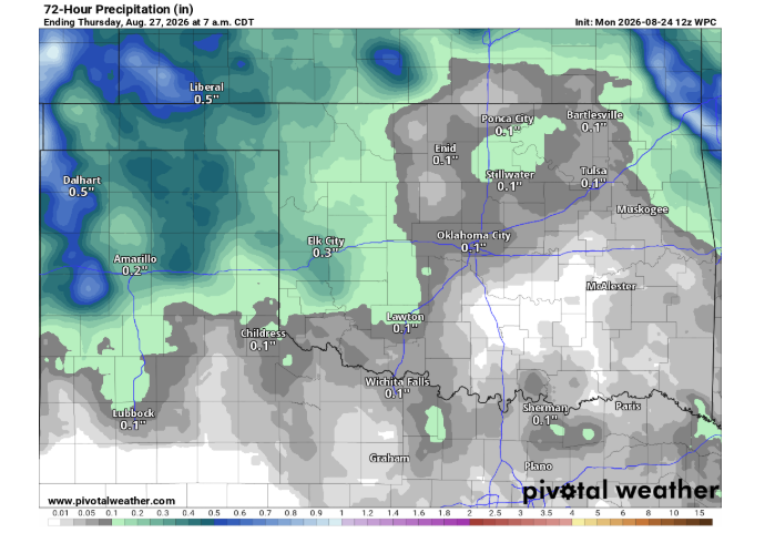
Forecast models remain subject to adjustment depending on the movement of the upper-level heat dome as it meanders westward over the coming days. For now, the focus remains on managing today’s peak heat safely.