
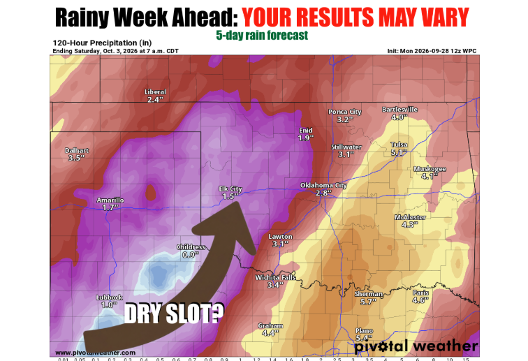
Oklahoma agricultural producers tracking fall moisture may soon see relief as a shifting weather pattern brings both significant rainfall potential and severe weather risks across the state. Oklahoma State Climatologist Gary McManus outlined the evolving scenario in his latest Mesonet Ticker, noting that atmospheric ingredients are aligning to deliver moisture, cooler conditions, and a round of midweek storms.
The unfolding setup hinges on two primary drivers: an incoming upper-level trough pushing in from the west and the remnants of Hurricane Polo tracking up from the southwest. McManus emphasized that maximizing statewide precipitation requires these two systems to synchronize just right, though the forecast remains fluid.
“So how things are setting up as of now, and this will likely shift around, transmogrify, and morph into a different setup either subtly or enormously,” McManus said.
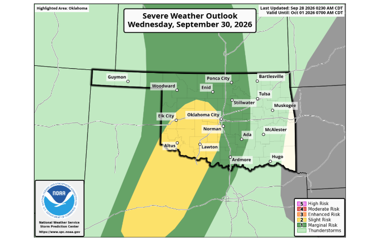
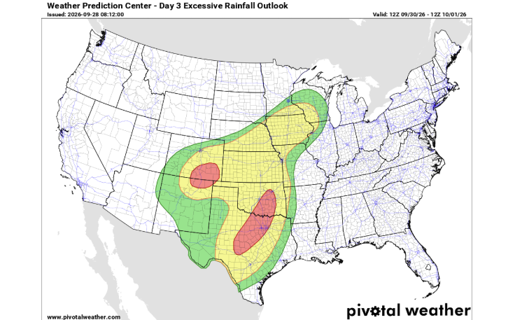
According to McManus and data shared from the National Weather Service office in Norman, the influx will draw copious amounts of moisture into the region. However, that influx also carries a dual threat for farm and ranch operations. As a dry slot scenario develops heading into Wednesday, the atmosphere will support potential severe weather development, with all severe modes on the table alongside the risk of localized flooding.
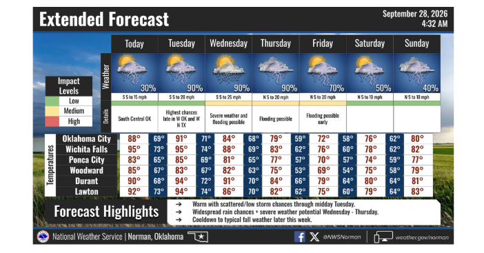
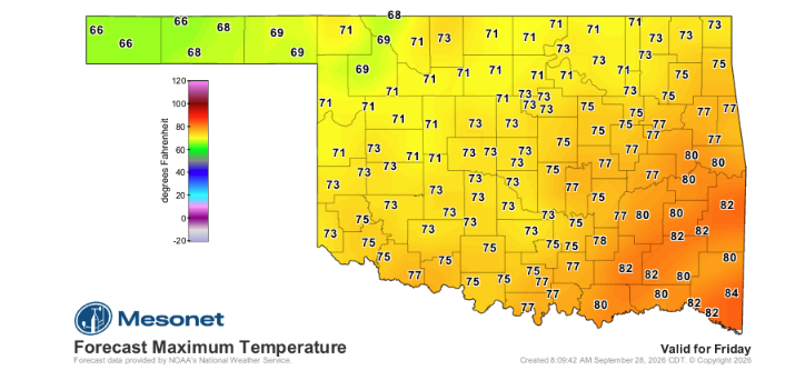
Beyond the thunderstorm and flooding hazards, the arrival of the eventual cold front, cloud cover, and rain will deliver a sharp seasonal shift for the latter half of the week. McManus noted that autumnal temperatures will take hold across Oklahoma for at least several days, bringing high temperatures down into the 60s and dropping nighttime lows into the 40s.
Producers and landowners are encouraged to monitor local forecast updates through the Norman National Weather Service and Oklahoma Mesonet as timing, rain totals, and severe parameters continue to evolve through midweek.
To read more from McManus on his mesonet ticker, click here: