
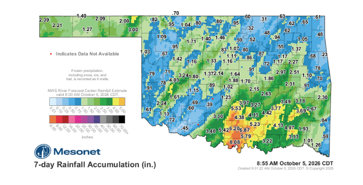
Oklahoma agricultural producers navigating early fall planting and forage management face a stark divide in soil moisture following recent localized storm systems, as rainfall totals leave sharp regional disparities across the state. While portions of south-central Oklahoma and segments of the Panhandle received heavy precipitation, broad stretches of central and western Oklahoma remain critically dry, leaving newly planted winter wheat and parched pastures vulnerable to rapid moisture loss under anticipated above-normal temperatures.
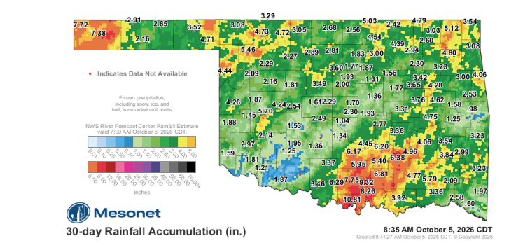
According to Oklahoma State Climatologist Gary McManus in his latest Mesonet Ticker update, recent precipitation provided substantial drought relief to isolated areas but missed significant portions of the state. McManus pointed out that Norman, for instance, recorded just 1.02 inches over the past week and a meager 1.04 inches across the trailing 30-day window—amounting to roughly 29 percent of normal rainfall for that timeframe.
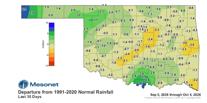
The immediate concern for Oklahoma ranchers and farmers is the lack of reinforcing moisture needed to protect against quick evaporation. McManus emphasized that while recent storms “knocked the crap out of” drought conditions in areas like south-central Oklahoma and parts of the Panhandle, warm, above-normal temperatures are set to persist without accompanying rainfall.
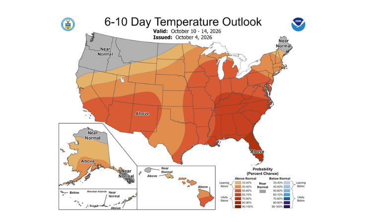
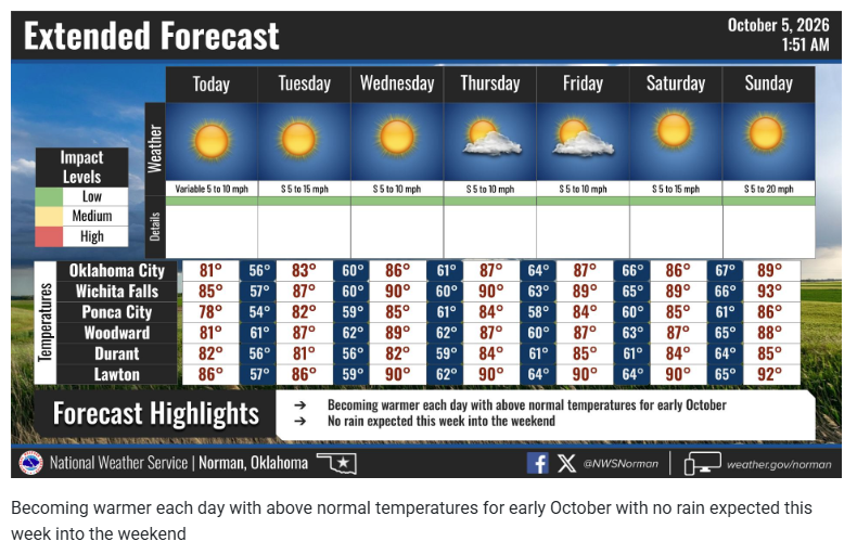
With seven- to ten-day weather outlooks projecting largely dry conditions statewide, any topsoil moisture gained in lighter-hit corridors faces rapid depletion. For wheat producers who dusted in seed or producers relying on standing forage heading into winter, cold fronts lacking accompanying storm tracks will offer little relief against ongoing moisture deficits. As McManus noted regarding the outlook, Oklahoma needs genuine rain-producing fronts rather than dry wind shifts to sustain recent gains and prevent drought conditions from rebounding.
To read more from Gary McManus on his mesonet ticker click here: