
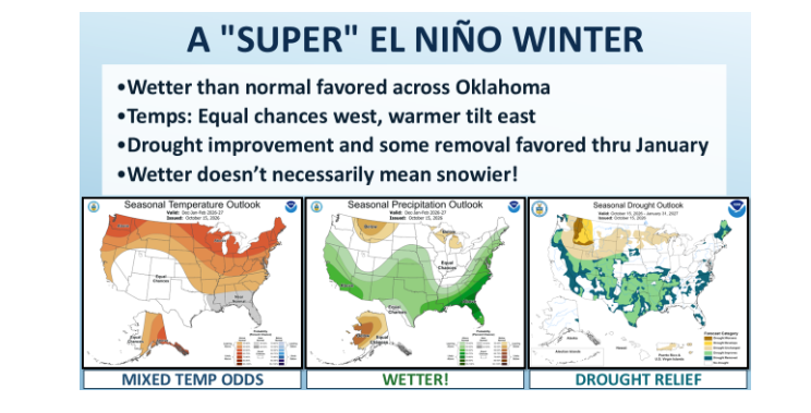
Agricultural producers across the region are tracking a massive climate driver dominating the southern tier: a powerful, historic El Niño pattern sitting across the equatorial Pacific. According to State Climatologist Gary McManus, the unusually warm ocean waters extend hundreds of feet below the surface, supplying sustained energy that will influence Southern Plains weather straight through next spring.
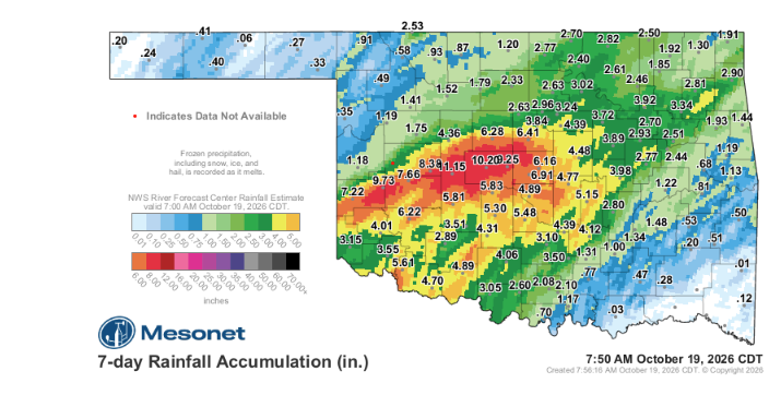
For agricultural producers, the near-term setup brings pleasant conditions following significant precipitation events. A massive rainfall event recently dropped heavy moisture across west-central and central areas, providing critical relief to soil moisture levels without requiring extra moisture support from Tropical Storm Simon, which dissipated over the Pacific.
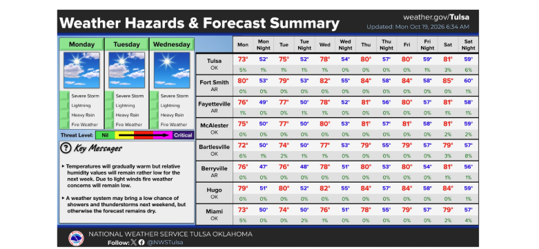
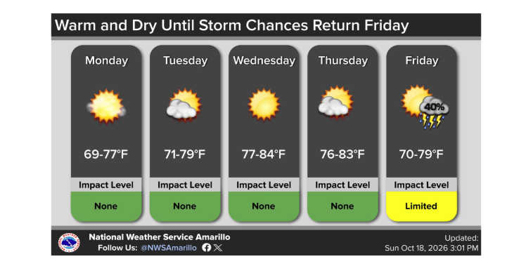
Sunny conditions with normal to above-normal temperatures will clear out the region before a mild cool front brings the next potential chance for rainfall over the weekend.
The long-term outlook offers promising news for pasture recovery and moisture reserves. The Climate Prediction Center notes that weakened trade winds and shifted tropical thunderstorm activity are strengthening and extending the Pacific jet stream farther south and east. This positioning creates a prime storm track across the southern United States, delivering frequent opportunities for widespread precipitation.
The active jet stream supports an optimistic wet forecast for December and January, opening up strong possibilities for continued drought mitigation across regional agricultural lands.
While precipitation chances remain well above average, winter temperature forecasts present a far more variable picture. Forecasters have assigned equal chances for below-normal, near-normal, or above-normal temperatures across the Southern Plains, as past strong El Niño cycles show a wide array of thermal outcomes.
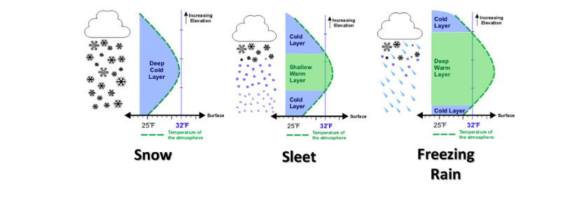
Because temperature profiles remain dynamic, winter weather threats will depend entirely on the atmospheric layering during individual systems:
- Warm air over sub-freezing surface layers will produce sleet or freezing rain.
- A fully cold atmospheric column will deliver snowfall.
- Slower Arctic air boundary movement will result in heavy, cold rains.
Producers and ranchers are advised to track weekly temperature trends as storm systems develop, ensuring winter feeding and livestock management plans account for sudden shifts between rain, ice, and snow opportunities through the upcoming season.
To see more from Gary McManus on his mesonet ticker, click here: