

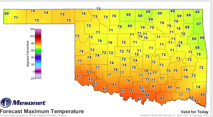
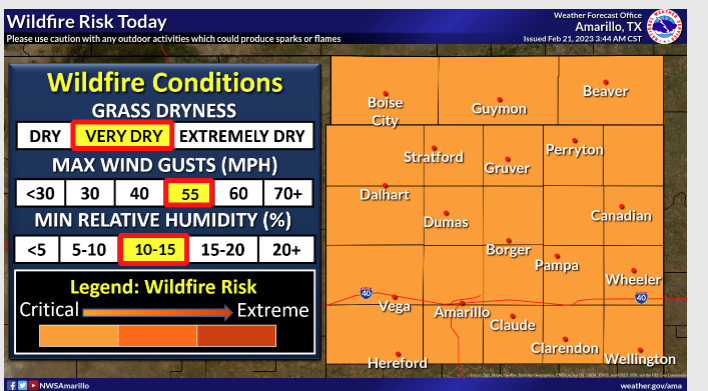
Windy weather and warm temperatures are in store for the next couple of days as a storm system moves through the state. State Climatologist Gary McManus says, “That heat is a pretty important component of today’s Red Flag Fire Warning today, and Fire Weather Watch tomorrow, and it’s customary and/or common to see these types of conditions in late winter/early spring ahead of a storm system here in the Southern Plains” The low humidity, strong winds and above normal temperatures are an unpleasant trifecta that produces perfect conditions for a spark to get quickly out of control in the dead and dormant vegetation that is so plentiful this time of year.”
This time of year is perfect for fires as The vegetation has had months to cure in the drier air of winter, and the weather is so warm. The Good news is McManus says we are expecting a few storm systems this week, “The first is expected to generate showers and storms late tonight into early tomorrow morning, sending convection marching across the state, possibly severe at times. A low tornado threat, but not zero. Wind and hail are the larger threats.”
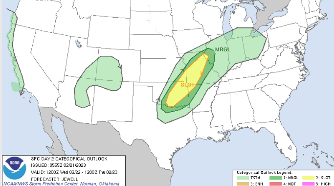
McManus says we will clear out and cool down before ramping back into spring mode throughout the weekend, but another chance of Severe Weather arrives on Sunday, “That day looks more like a classical Southern Plains severe
weather day, so go ahead and start your springtime severe weather preparations now, just in case.”
Lots of wind and fire danger are expected the next couple of days, and we have to be aware of possible dust storms, “Storms overnight tonight into tomorrow morning. Briefly cold with some low wind chills, then back to spring mode by
the weekend. Still not seeing signs of true winter returning other than the brief visit this week. No prolonged cold weather in sight.”
To read more from McManus’s Mesonet Ticker, click here:


