

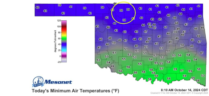
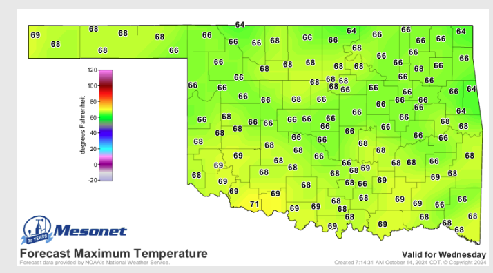
Oklahomans are definitely ready for fall, as October has brought us almost 100-degree days for the past few months. According to State Climatologist Gary McManus says, “We’re officially at the 4-way stop of seasons in Oklahoma when we can get Summer, fall, spring, and summer fighting it out to see who takes control. We had the summer this weekend with darned near 100 in SW OK, the 2nd-highest temperature ever recorded for Oct. 12, and more sun than you could handle. Now, some would say we get our first freezes (and frosts) in the fall, so it should be fall.” Cooler temps will undoubtedly be welcome, and we will see those throughout this week with Wintery morning highs in the 60s across the state. A beautiful Start to your Monday morning with highs in the 70s, light winds, and mostly sunny Skies. This morning, we saw lows in the 40s and some 30s across the state. Tomorrow, another cold front will move in, ramping up some north winds.
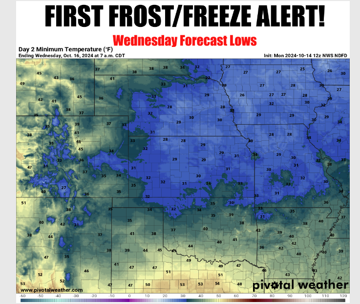
The Coldest air of the season will arrive on Wednesday morning, with a light frost and maybe even a light freeze possible. The Portions of the State in the possible Frost outlook for Wednesday Morning are the Alva-Enid-Stillwater-Tulsa area, while the “Freeze” portion would be Ponca City-Bartlesville. The rest of the state looks clear for now.
McManus says the big need right now is Rain. With Wheat planting being behind throughout the state, he says the high plains may see some moisture, ‘Right now, it’s starting to look like a High Plainsevent mostly.” We will see a slight chance of rain on Saturday and Sunday.

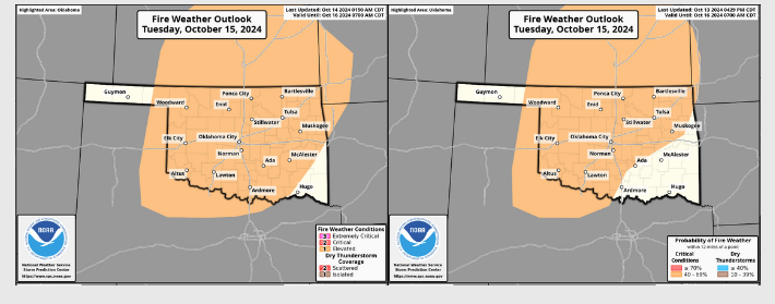
With the Cold Front, and all the drought, McManus says we will have to be on the lookout for Fire danger, “Wildfire danger will be on the increase thanks to the low humidity and gusty winds.”
McManus says that with this latest cold front, hopefully, the 100-degree days and upper 90-degree days are gone. However, don’t put it past Oklahoma to “Oklahoma” us a time or two.”
To read more from Gary McManus on his daily ticker, click here:


