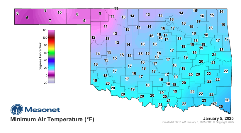
Even though it has been a warm Winter so far, Winter storms and frigid temps have arrived in the state. According to State Climatologist Gary McManus, we have tied the record for warmest year on Record. Still, we knew Winter would hit eventually, and it did, with temps dipping into the single digits across the state.
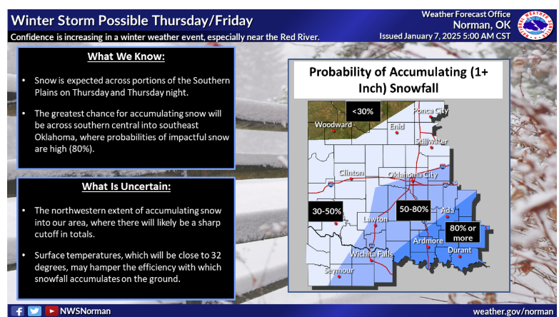
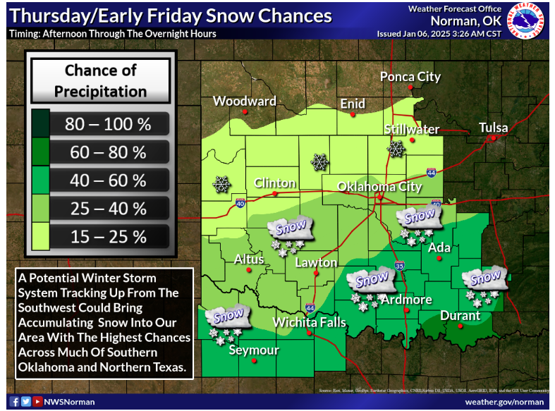
According to McManus, this week is going to stay on the cool side, “Northern Oklahoma go theirs yesterday, now the rest of the state gets to play later this week, most likely starting early Thursday into early Friday, and again most likely an I-44 to the south and east type of snowfall.” McManus said we aren’t exactly sure what this next storm might bring, but right now it looks like we will see some more snow in the state, “A winter storm watch has been issued for that area in SE OK where the 3-8 inches of snow is possible. Due to the uncertainty, it’s a watch thus far, but I’d expect to see a change to a winter storm warning if things continue on track as they are now. And we still can’t rule out things shifting north or south as we go forward. I don’t think we will see much of a spread vs. a shift, however.”

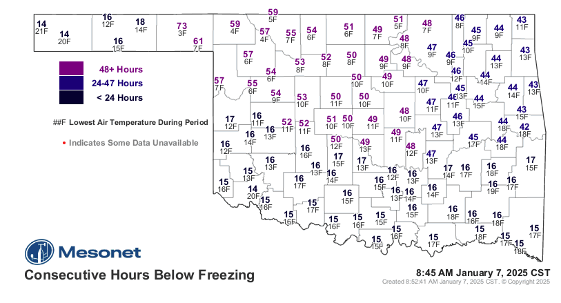
McManus says we will continue to see these temps over the next few days, so he advises to drive carefully if you do have to get around because roads could be slick and hazardous in some places.

To read more from State Climatologist Gary McManus on his weather ticker, click here: