

Oklahoma State Climatologist Gary McManus indicates a potential for severe weather this weekend, noting a familiar “tornadoey” feeling in the air.
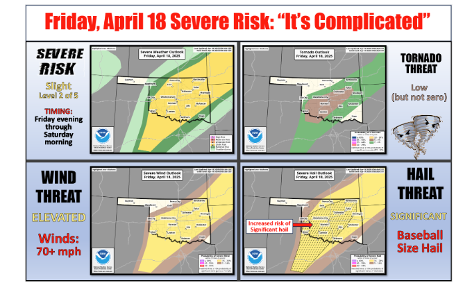
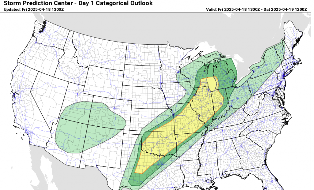
However, while the tornado threat exists, it is not the primary concern today. McManus highlights the Storm Prediction Center’s (SPC) assessment, which points to a “messy convective mode” and a cold front potentially limiting the development of widespread severe hail and wind.
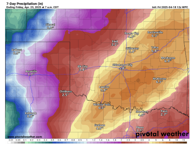
Despite this complexity, the threat of large hail is significant. Looking ahead to next week, the Weather Prediction Center’s forecast suggests substantial rainfall, with some areas potentially receiving 7-8 inches, which could lead to localized flooding.
The newest 10 day rain outlook continues to show a bunch of rain on the way with the newest data showing us getting even wetter than what the data showed yesterday.
A lot of rain will fall this weekend and storm chances will continue for much of next week and next weekend.
To Read more from McManus on his ticker, click here:


